Saint-Eutrope
| Saint-Eutrope | |
|---|---|
|
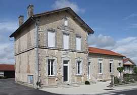
Town hall | |
 Saint-Eutrope | |
|
Location within Poitou-Charentes region 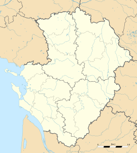 Saint-Eutrope | |
| Coordinates: 45°25′08″N 0°06′44″E / 45.4189°N 0.1122°ECoordinates: 45°25′08″N 0°06′44″E / 45.4189°N 0.1122°E | |
| Country | France |
| Region | Poitou-Charentes |
| Department | Charente |
| Arrondissement | Angoulême |
| Canton | Montmoreau-Saint-Cybard |
| Intercommunality | Montmorélien |
| Government | |
| • Mayor (2008–2014) | Claude Fortin |
| Area1 | 2.67 km2 (1.03 sq mi) |
| Population (2008)2 | 163 |
| • Density | 61/km2 (160/sq mi) |
| INSEE/Postal code | 16314 / 16190 |
| Elevation |
114–186 m (374–610 ft) (avg. 183 m or 600 ft) |
|
1 French Land Register data, which excludes lakes, ponds, glaciers > 1 km² (0.386 sq mi or 247 acres) and river estuaries. 2 Population without double counting: residents of multiple communes (e.g., students and military personnel) only counted once. | |
Saint-Eutrope is a commune in the Charente department in southwestern France.
Population
| Historical population | ||
|---|---|---|
| Year | Pop. | ±% |
| 1793 | 282 | — |
| 1800 | 228 | −19.1% |
| 1806 | 274 | +20.2% |
| 1821 | 279 | +1.8% |
| 1831 | 297 | +6.5% |
| 1841 | 292 | −1.7% |
| 1846 | 306 | +4.8% |
| 1851 | 306 | +0.0% |
| 1856 | 258 | −15.7% |
| 1861 | 262 | +1.6% |
| 1866 | 242 | −7.6% |
| 1872 | 201 | −16.9% |
| 1876 | 194 | −3.5% |
| 1881 | 196 | +1.0% |
| 1886 | 200 | +2.0% |
| 1891 | 210 | +5.0% |
| 1896 | 202 | −3.8% |
| 1901 | 195 | −3.5% |
| 1906 | 202 | +3.6% |
| 1911 | 192 | −5.0% |
| 1921 | 174 | −9.4% |
| 1926 | 187 | +7.5% |
| 1931 | 159 | −15.0% |
| 1936 | 146 | −8.2% |
| 1946 | 142 | −2.7% |
| 1954 | 173 | +21.8% |
| 1962 | 157 | −9.2% |
| 1968 | 137 | −12.7% |
| 1975 | 164 | +19.7% |
| 1982 | 164 | +0.0% |
| 1990 | 192 | +17.1% |
| 1999 | 169 | −12.0% |
| 2008 | 163 | −3.6% |
See also
References
| Wikimedia Commons has media related to Saint-Eutrope (Charente). |