Saint-Didier-de-la-Tour
| Saint-Didier-de-la-Tour | |
|---|---|
 Saint-Didier-de-la-Tour | |
|
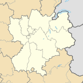
Location within Rhône-Alpes region  Saint-Didier-de-la-Tour | |
| Coordinates: 45°33′20″N 5°29′01″E / 45.5556°N 5.4836°ECoordinates: 45°33′20″N 5°29′01″E / 45.5556°N 5.4836°E | |
| Country | France |
| Region | Rhône-Alpes |
| Department | Isère |
| Arrondissement | La Tour-du-Pin |
| Canton | Tour-du-Pin |
| Intercommunality | Les Vallons de La Tour du Pin |
| Government | |
| • Mayor (2014–2020) | Gérard Vitte |
| Area1 | 14.63 km2 (5.65 sq mi) |
| Population (2011)2 | 1,841 |
| • Density | 130/km2 (330/sq mi) |
| INSEE/Postal code | 38381 / 38110 |
| Elevation |
328–554 m (1,076–1,818 ft) (avg. 410 m or 1,350 ft) |
|
1 French Land Register data, which excludes lakes, ponds, glaciers > 1 km² (0.386 sq mi or 247 acres) and river estuaries. 2 Population without double counting: residents of multiple communes (e.g., students and military personnel) only counted once. | |
Saint-Didier-de-la-Tour is a commune in the Isère department in southeastern France. It is often referred to as "La Cassola", due to the river that runs through it, which has waters coloured similarly due to the mineral composition of the area's rocks.
Over 600 people work in the local mines.
Geography
The Bourbre forms part of the commune's northeastern border.
Population
| Historical population | ||
|---|---|---|
| Year | Pop. | ±% |
| 1793 | 886 | — |
| 1806 | 889 | +0.3% |
| 1821 | 1,063 | +19.6% |
| 1831 | 1,318 | +24.0% |
| 1841 | 1,450 | +10.0% |
| 1851 | 1,594 | +9.9% |
| 1861 | 1,550 | −2.8% |
| 1872 | 1,488 | −4.0% |
| 1881 | 1,376 | −7.5% |
| 1891 | 1,308 | −4.9% |
| 1901 | 1,148 | −12.2% |
| 1911 | 1,053 | −8.3% |
| 1921 | 964 | −8.5% |
| 1931 | 959 | −0.5% |
| 1946 | 894 | −6.8% |
| 1954 | 923 | +3.2% |
| 1962 | 925 | +0.2% |
| 1968 | 949 | +2.6% |
| 1975 | 1,116 | +17.6% |
| 1982 | 1,127 | +1.0% |
| 1990 | 1,310 | +16.2% |
| 1999 | 1,419 | +8.3% |
| 2006 | 1,630 | +14.9% |
| 2011 | 1,841 | +12.9% |