Saint-Denis-du-Maine
| Saint-Denis-du-Maine | |
|---|---|
|
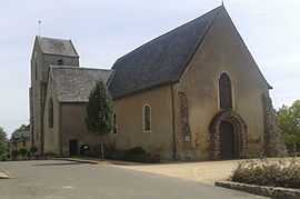
The church in Saint-Denis-du-Maine | |
 Saint-Denis-du-Maine | |
|
Location within Pays de la Loire region  Saint-Denis-du-Maine | |
| Coordinates: 47°58′03″N 0°31′34″W / 47.9675°N 0.5261°WCoordinates: 47°58′03″N 0°31′34″W / 47.9675°N 0.5261°W | |
| Country | France |
| Region | Pays de la Loire |
| Department | Mayenne |
| Arrondissement | Laval |
| Canton | Meslay-du-Maine |
| Area1 | 14.55 km2 (5.62 sq mi) |
| Population (1999)2 | 307 |
| • Density | 21/km2 (55/sq mi) |
| INSEE/Postal code | 53212 / 53170 |
| Elevation |
52–98 m (171–322 ft) (avg. 63 m or 207 ft) |
|
1 French Land Register data, which excludes lakes, ponds, glaciers > 1 km² (0.386 sq mi or 247 acres) and river estuaries. 2 Population without double counting: residents of multiple communes (e.g., students and military personnel) only counted once. | |
Saint-Denis-du-Maine is a commune in the Mayenne department in north-western France.
Geography
The Vaige forms most of the commune's eastern border.
See also
- Communes of Mayenne
References
| Wikimedia Commons has media related to Saint-Denis-du-Maine. |