Saint-Désiré
| Saint-Désiré | |
|---|---|
|
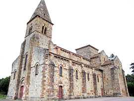
The church in Saint-Désiré | |
 Saint-Désiré | |
|
Location within Auvergne region  Saint-Désiré | |
| Coordinates: 46°29′54″N 2°25′57″E / 46.4983°N 2.4325°ECoordinates: 46°29′54″N 2°25′57″E / 46.4983°N 2.4325°E | |
| Country | France |
| Region | Auvergne |
| Department | Allier |
| Arrondissement | Montluçon |
| Canton | Huriel |
| Intercommunality | Pays d'Huriel |
| Government | |
| • Mayor (2008–2014) | Denis Coffin |
| Area1 | 41.89 km2 (16.17 sq mi) |
| Population (2008)2 | 470 |
| • Density | 11/km2 (29/sq mi) |
| INSEE/Postal code | 03225 / 03370 |
| Elevation |
193–400 m (633–1,312 ft) (avg. 328 m or 1,076 ft) |
|
1 French Land Register data, which excludes lakes, ponds, glaciers > 1 km² (0.386 sq mi or 247 acres) and river estuaries. 2 Population without double counting: residents of multiple communes (e.g., students and military personnel) only counted once. | |
Saint-Désiré is a commune in the Allier department in Auvergne in central France.
Population
| Historical population | ||
|---|---|---|
| Year | Pop. | ±% |
| 1800 | 500 | — |
| 1900 | 1,400 | +180.0% |
| 1940 | 1,000 | −28.6% |
| 1962 | 650 | −35.0% |
| 1968 | 731 | +12.5% |
| 1975 | 555 | −24.1% |
| 1982 | 498 | −10.3% |
| 1990 | 442 | −11.2% |
| 1999 | 455 | +2.9% |
| 2008 | 470 | +3.3% |
See also
References
External links
| Wikimedia Commons has media related to Saint-Désiré. |