Saint-Côme-d'Olt
| Saint-Côme-d'Olt | ||
|---|---|---|
|
A view of Saint-Côme-d'Olt from the bridge | ||
| ||
 Saint-Côme-d'Olt | ||
|
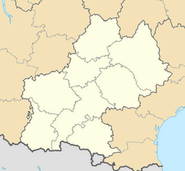
Location within Midi-Pyrénées region  Saint-Côme-d'Olt | ||
| Coordinates: 44°30′59″N 2°48′55″E / 44.5164°N 2.8153°ECoordinates: 44°30′59″N 2°48′55″E / 44.5164°N 2.8153°E | ||
| Country | France | |
| Region | Midi-Pyrénées | |
| Department | Aveyron | |
| Arrondissement | Rodez | |
| Canton | Espalion | |
| Government | ||
| • Mayor (2008–present) | Nathalie Auguy-Perie | |
| Area1 | 30.1 km2 (11.6 sq mi) | |
| Population (2008)2 | 1,387 | |
| • Density | 46/km2 (120/sq mi) | |
| INSEE/Postal code | 12216 / 12500 | |
| Elevation |
340–840 m (1,120–2,760 ft) (avg. 340 m or 1,120 ft) | |
|
1 French Land Register data, which excludes lakes, ponds, glaciers > 1 km² (0.386 sq mi or 247 acres) and river estuaries. 2 Population without double counting: residents of multiple communes (e.g., students and military personnel) only counted once. | ||
Saint-Côme-d'Olt (Occitan: Sant Còsme) is a commune in the Aveyron department in southern France.
Geography
The commune is located in the Lot valley, near the confluence with the river called Boralde of Saint-Chély-d'Aubrac.
Way of St. James
Saint-Côme-d'Olt with its twisted church spire is located on the Le Puy route (Latin: Via Podiensis, French: route du Puy) of the Way of St. James.
Pilgrims come from Saint-Chély-d'Aubrac. Their next stage is Espalion, and its church of Perse.
Population
| Historical population | ||
|---|---|---|
| Year | Pop. | ±% |
| 1962 | 949 | — |
| 1968 | 1,003 | +5.7% |
| 1975 | 1,103 | +10.0% |
| 1982 | 1,207 | +9.4% |
| 1990 | 1,198 | −0.7% |
| 1999 | 1,257 | +4.9% |
| 2008 | 1,387 | +10.3% |
Administration
| Term | Mayor | Party |
|---|---|---|
| March 2001 to March 2008 | Louis Morvan | P.S |
| March 2008 to present | Nathalie Auguy-Périé [1] | U.M.P |
See also
References
| Wikimedia Commons has media related to Saint-Côme-d'Olt. |

