Saint-Adelme, Quebec
| Saint-Adelme | |
|---|---|
| Parish municipality | |
 Location within La Matanie RCM. | |
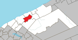
 Saint-Adelme Location in eastern Quebec. | |
| Coordinates: 48°49′N 67°19′W / 48.817°N 67.317°WCoordinates: 48°49′N 67°19′W / 48.817°N 67.317°W[1] | |
| Country |
|
| Province |
|
| Region | Bas-Saint-Laurent |
| RCM | La Matanie |
| Settled | early 20th century |
| Constituted | September 9, 1933 |
| Government[2] | |
| • Mayor | Yvan Imbeault |
| • Federal riding | Haute-Gaspésie—La Mitis—Matane—Matapédia |
| • Prov. riding | Matane-Matapédia |
| Area[2][3] | |
| • Total | 101.40 km2 (39.15 sq mi) |
| • Land | 100.46 km2 (38.79 sq mi) |
| Population (2011)[3] | |
| • Total | 485 |
| • Density | 4.8/km2 (12/sq mi) |
| • Pop 2006-2011 |
|
| • Dwellings | 321 |
| Time zone | EST (UTC−5) |
| • Summer (DST) | EDT (UTC−4) |
| Postal code(s) | G0J 2B0 |
| Area code(s) | 418 and 581 |
| Highways | No major routes |
| Website |
www |
Saint-Adelme is a parish municipality in the Canadian province of Quebec, located in La Matanie Regional County Municipality in the Bas-Saint-Laurent region.
Demographics
| |||||||||||||||||||
See also
References
- ↑ Reference number 55487 of the Commission de toponymie du Québec (French)
- ↑ 2.0 2.1 "Saint-Adelme". Répertoire des municipalités (in French). Ministère des Affaires municipales, des Régions et de l'Occupation du territoire. Retrieved 2012-01-23.
- ↑ 3.0 3.1 3.2 "Saint-Adelme census profile". 2011 Census data. Statistics Canada. Retrieved 2012-01-23.
- ↑ "2006 Community Profiles". Canada 2006 Census. Statistics Canada. March 30, 2011. Retrieved 2012-01-23.
- ↑ "2001 Community Profiles". Canada 2001 Census. Statistics Canada. February 17, 2012. Retrieved 2012-01-23.
| Wikimedia Commons has media related to Saint-Adelme. |
 |
Sainte-Félicité | | ||
| Matane | |
Saint-Jean-de-Cherbourg | ||
| ||||
| | ||||
| Saint-René-de-Matane |
| ||||||||||||||||||||||