Saint-Étienne-la-Geneste
| Saint-Étienne-la-Geneste | ||
|---|---|---|
|
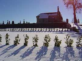
The church in Saint-Étienne-la-Geneste | ||
| ||
 Saint-Étienne-la-Geneste | ||
|
Location within Limousin region  Saint-Étienne-la-Geneste | ||
| Coordinates: 45°26′50″N 2°20′47″E / 45.4472°N 2.3464°ECoordinates: 45°26′50″N 2°20′47″E / 45.4472°N 2.3464°E | ||
| Country | France | |
| Region | Limousin | |
| Department | Corrèze | |
| Arrondissement | Ussel | |
| Canton | Neuvic | |
| Intercommunality | Gorges de la haute Dordogne | |
| Government | ||
| • Mayor (2008–2014) | Anne Escurat | |
| Area1 | 5.01 km2 (1.93 sq mi) | |
| Population (2008)2 | 80 | |
| • Density | 16/km2 (41/sq mi) | |
| INSEE/Postal code | 19200 / 19160 | |
| Elevation |
545–637 m (1,788–2,090 ft) (avg. 680 m or 2,230 ft) | |
|
1 French Land Register data, which excludes lakes, ponds, glaciers > 1 km² (0.386 sq mi or 247 acres) and river estuaries. 2 Population without double counting: residents of multiple communes (e.g., students and military personnel) only counted once. | ||
.svg.png)
Saint-Étienne-la-Geneste is a commune in the Corrèze department in central France.
Geography
The river Diège forms all of the commune's eastern boundary.
Population
| Historical population | ||
|---|---|---|
| Year | Pop. | ±% |
| 1962 | 71 | — |
| 1968 | 85 | +19.7% |
| 1975 | 58 | −31.8% |
| 1982 | 55 | −5.2% |
| 1990 | 62 | +12.7% |
| 1999 | 61 | −1.6% |
| 2008 | 80 | +31.1% |
See also
References
| Wikimedia Commons has media related to Saint-Étienne-la-Geneste. |