Saguache County Road T
Approach to Crestone at the east end of Road T. The square topped mountain is Kit Carson Mountain, the peak on the right is Crestone Peak.
Saguache County Road T is a county road in Saguache County, Colorado in the San Luis Valley of Colorado. It is "T" in a series of alphabetically named east-west roads which begin at State Highway 112, the south boundary of Saguache County, which would be Road A, if it were not a state highway. Road T is a through road across the valley, crossing U.S. Highway 285 at Swede's Corners about 6 miles south of Saguache, Colorado but is paved only from Moffat, Colorado east 12.5 miles to Crestone, Colorado.[1] The eastern portion of Road T forms the north boundary of the Baca National Wildlife Refuge.
Notes
Gallery
-
Road T east from Moffat
-

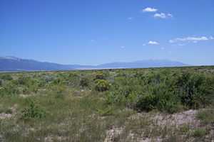
View of rangeland on the Baca National Wildlife Refuge