Sabanalarga, Atlántico
| Sabanalarga | |||
|---|---|---|---|
| Municipality and town | |||
| |||
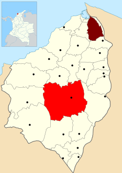 Location of the municipality and town of Sabanalarga, Atlántico in the Atlántico Department of Colombia | |||
 Sabanalarga Location in Colombia | |||
| Coordinates: 10°37′52″N 74°55′16″W / 10.63111°N 74.92111°W | |||
| Country |
| ||
| Department | Atlántico Department | ||
| Founded | 1620 | ||
| Incorporated | 1833 | ||
| Government | |||
| • Mayor | Roberto Carlos León Peña | ||
| Area | |||
| • Total | 399 km2 (154 sq mi) | ||
| Elevation | 87 m (285 ft) | ||
| Population (2012)[1] | |||
| • Total | 79,884 | ||
| • Density | 200/km2 (520/sq mi) | ||
| Demonym | Sabanalarguero | ||
| Time zone | Colombia Standard Time (UTC-5) | ||
| Area code(s) | 57 + 3 | ||
| Website | Official website (Spanish) | ||
.svg.png)
.png)
Sabanalarga (Spanish pronunciation: [saβanaˈlaɾɣa], Spanish for Large Plains) is a municipality in the Atlántico Department, Colombia. Founded in 1620 by Lucas Dionisio Tesillo y Diego and Marceliano de Jesús Almanza. Became a municipality in 1680.
Geography
Sabanalarga is located in the middle of the Atlántico Department, Sabanalarga is surrounded to the North by the municipalities of Usiacurí, Baranoa and Polonuevo; to the East by the municipality of Ponedera; to the South by the municipalities of Candelaria and Manatí; to the Southwest with the municipality of Repelón and to the West with the municipalities of Luruaco and Piojó.
References
- ↑ "World Gazetteer". Archived from the original on 2013-02-17.
External links
- (Spanish) Sabanalarga official website
- (Spanish) Gobernacion del Atlantico - Sabanalarga
| ||||||||
Coordinates: 6°51′N 75°49′W / 6.850°N 75.817°W