São Nicolau, Rio Grande do Sul
| Map | |
|---|---|
 | |
| Statistics | |
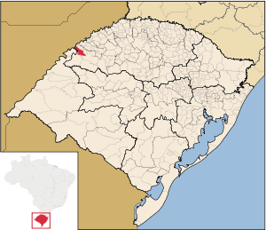
| State: | Rio Grande do Sul |
| Meso-region: | Northwestern Rio Grande do Sul (Noroeste Rio-Grandense) |
| Micro-Region: | Santo Ângelo |
| Founded: | November 23, 1965 |
| Location: | 28.0328/28° 1' 58" S lat. 56.68/56° 16' 1" W long. |
| Area: | 1,714.239 km²--> |
| Population (2003): - Total - Change - Density | 6,146 - - |
| Elevation: | - m |
| Postal code: | 97870-xxx |
São Nicolau (Portuguese meaning Saint Nicholas) is a municipality of the state of Rio Grande do Sul, Brazil. Its area is 485.3 km² and its population was 6,146 in 2003. It is located 562 km west of the state capital of Porto Alegre, northeast of Alegrete.
The municipality contains the Uruguay River, which forms a border with Argentina.
Bounding municipalities
External links
- http://www.citybrazil.com.br/rs/saonicolau/ (Portuguese)
- Map and Aerial photos:
- Coordinates: 28°1′59″S 55°16′1″W / 28.03306°S 55.26694°W
- Street maps: Street map from Mapquest, MapPoint or Google
- Satellite images and Aerial photos: Google
