Ryongnim County
| Ryongnim County 룡림군 | |
|---|---|
| County | |
| Korean transcription(s) | |
| • Hanja | 龍林郡 |
| • Hangul | South Korean: 용림군 |
| • McCune-Reischauer | Ryongnim kun |
| • Revised Romanization | South Korean: Yongnim-gun |
 | |
| Country | North Korea |
| Province | Chagang Province |
| Administrative divisions | 1 ŭp, 12 ri |
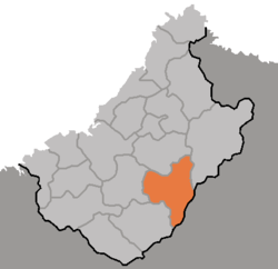
Ryongnim County is a kun, or county, in southeastern Chagang Province, North Korea. It borders Rangnim, Changjin, Chonchon, Tongsin, Taehung, and Songgan counties. The county is mainly alpine territory. It contains many mountain peaks, such as Wagalbong (2,260m), Ch'ŏnŭimulsan (2,032m), Rangnimsan (2,186m), Milpuldŏksan (1,577m), Ungŏsusan (2,020m), Tomabong (1,525m), Paktalsan (1,817m), Taedasan (1,463m), and Sonamsan (1,178m).
In the standard dialect of South Korea, Ryongnim loses its initial 'r' both in pronunciation and spelling.
See also
External links
- (Korean) In Korean language online encyclopedias:
| ||||||||||||||||