Rydalmere, New South Wales
| Rydalmere Sydney, New South Wales | |||||||||||||
|---|---|---|---|---|---|---|---|---|---|---|---|---|---|
|
The Family Inn, Victoria Road | |||||||||||||
| Population | 6,216 (2011 census)[1] | ||||||||||||
| • Density | 3,035.3/km2 (7,861.4/sq mi) | ||||||||||||
| Established | 1856 | ||||||||||||
| Postcode(s) | 2116 | ||||||||||||
| Area | 2.0479 km2 (0.8 sq mi) | ||||||||||||
| Location | 21 km (13 mi) north-west of Sydney CBD | ||||||||||||
| LGA(s) | City of Parramatta | ||||||||||||
| County | Cumberland | ||||||||||||
| State electorate(s) | Parramatta | ||||||||||||
| Federal Division(s) | Parramatta | ||||||||||||
| |||||||||||||

Rydalmere is a suburb of Sydney, in the state of New South Wales, Australia. Rydalmere is approximately 21 kilometres north-west of the Sydney central business district in the local government area of the City of Parramatta.
History
Rydalmere was named in 1866 by land speculator Thomas O'Neill when he subdivided Hannibal Macarthur's old Vineyard Estate. 'Rydal' comes from Rydal, Cumbria, in the Lake District of England where O'Neill was born, while 'mere' means a lake. The earliest grant in the area was to Phillip Schaeffer who settled in 1791.
Aboriginal culture
The Darug is the clan name for the indigenous people of the area. The Darug fashioned tools and spears for hunting native animals and collected wild berries and flora as a valuable source of vitamins. The Darug had a close relationship with the river, from which they caught fish, eels, and other food. Their stable bark canoes often carried a small fire in the middle — built on a mound of soil to allow them to cook their catch fresh. 'Firebrand farming' was also practised in the region.
European settlement
Soon after Governor Phillip's arrival with the First Fleet (of convicts from England) in 1788, Parramatta was developed as a farming settlement to feed the new English colony. This led to the immediate and tragic displacement of local Aborigines from the land they had lived off for thousands of years.
Local Aboriginal groups led a resistance against the new settlers. The most prominent warrior was Pemulwuy. Once when he tried to spear a soldier in retaliation, he was shot in the head and body. Despite being held in chains in the hospital where he was sent to recover, he managed to escape. In retaliation, the British ordered that any groups of Darug Aborigines be attacked, and a reward was placed on Pemulwuy's head. In 1802 he was shot and killed, and his head was cut off and sent to England. The conflict continued on and off until 1805 when the first recorded act of reconciliation occurred between Indigenous people and the British settlers.
The introduction of foreign diseases was the most debilitating trend — and many of the Barramatagal clan disappeared in the Small Pox epidemic during early European settlement. However against the odds others survived and their descendants live in the region to this day. In the early 19th century, more positive developments occurred and the region became a meeting place for tribes from surrounding regions. An annual feast was held by Governor Macquarie to encourage Aboriginal people to leave their children at a local school, but this focus later shifted to Blacktown area.[2]
Transport

Rydalmere railway station is located on the Carlingford line of the Sydney Trains network. The next station to the south is Camellia and to the north is Dundas.
Rydalmere ferry wharf is on Parramatta River and has services run by the Sydney Ferries network. The next wharf west is at Parramatta and east is Meadowbank. The ferry primarily services tourists on weekends and city workers during the week. RiverCat catamaran type ferries work the Parramatta River route due to shallow waters, particularly during low tides.
There are five Sydney bus routes that service the area— the 520/M52 travels to and from Parramatta Station to City and Circular Quay. The 523 travels via Spurway and Bartlett Streets in Ermington and on to West Ryde. The 524 services the industrial area of Rydalmere stopping along South Street and then on to the south side of Ermington and Melrose Park. The 525 is a Parramatta Station to Burwood service. All routes travel along Victoria Road at some point and stop at Rydalmere Station. In the 2001 census, for people travelling to work using just one method of transportation from Rydalmere, 54% travelled in a car as the driver, 6% took the train, 5% walked, 4% travelled in a car as passenger, 4% took the bus. Commuting to work via ferry, truck, motorbike, bicycle accounted for only 1% each of the Rydalmere population.
Commercial areas
Rydalmere currently consists of residential and commercial developments. The western side of Rydalmere is commercial consisting primarily of light manufacturing industry and service industries. The eastern side is mainly residential.
Housing
The residential part of Rydalmere is divided by Victoria Road. The northern side has generally higher property prices and less Department of Housing and this is reflected in the more conservative voting pattern.
- Property Prices, 12 months to 1/March/2006.
- Houses Average: $461,000.
- Houses Median: $448,000.
- Median change over last 12 months: -6%.
- Units Average for postcode: $377,000.
- Based on sales reported to Australian Property Monitors


Landmarks
- Holy Name of Mary Roman Catholic Church
- Female Orphan School
- Waterpipe and Pedestrian Bridge over Parramatta River
- Big Flagpole at Berlei factory on South Street
- The Family Inn
- Rydalmere Bowling Club
- Subiaco Creek
- Vineyard Creek
Schools
- Rydalmere Public School
- University of Western Sydney "Parramatta" Campus
- St Marys Catholic School
Parks
- Crowgey Street Reserve
- Eric Primrose Reserve
- John Carver Reserve
- Rydalmere Park
- Rydalmere section of Parramatta to Putney cycleway
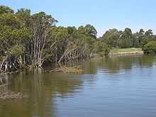
- Rydalmere section of Parramatta River
- Schaeffer Park (mostly closed due to bunnings construction 2012)
Organisations
- Rydalmere Bowling Club
- Rydalmere Cricket Club
- Rotary Club of Rydalmere
- Rydalmere Branch of Australian Labor Party
- 1st Rydalmere Scout Group
- Part of the suburb of Rydalmere lies in the Anglican parish of Dundas/Telopea.[3]
Sport and recreation
- The Rydalmere Cricket Club's team, 'The Mighty Wrens',[4] plays in the Northern Districts Cricket Association (NDCA [5] competition.The Rydalmere and Dundas United Cricket Clubs are a partnership that involves the Rydalmere Cricket Club being responsible for senior cricket teams and Dundas United Cricket Club responsible for developing and fostering junior cricket in the greater Parramatta area.
- Parramatta City FC Blues is the soccer (football) team whose home ground is Eric Primrose Reserve in Rydalmere.
Population
At the 2011 census, Rydalmere recorded a population of 6,216. Of these:[1]
- The age distribution was quite similar to the country in general. The median age was 37 years, identical to the national median. Children aged 0–14 years made up 21.2% of the population (national average is 19.3%) and people aged 65 years and over made up only 12.0% of the population (national average is 14.0%).
- Just over half (58.5%) were born in Australia; the next most common countries of birth were China 9.4%, Korea 4.5%, Hong Kong 2.2%, England 2.0% and Philippines 1.7%. The breakdown of languages spoken at home is similar: 53.2% spoke English, and other languages spoken at home included Mandarin 7.7%, Cantonese 7.2%, Korean 6.0%, Arabic 2.8% and Spanish 1.4%.
- The average household weekly income was $1,287, which is very similar to the national average of $1,234.
- Only 17.4% of employed people travelled to work on public transport, and 65.7% by car (either as driver or as passenger).
Politics
In the Australian Parliament, Rydalmere falls within the Division of Parramatta, currently represented by Julie Owens,[6] a member of the Australian Labor Party. Owens was elected at the 2004 federal election.
In the New South Wales Parliament, Rydalmere falls within the Parramatta electorate, currently represented by Geoff Lee,[7] a member of the Liberal Party. Lee was elected to NSW Parliament at the 2011 state election.
Rydalmere falls within the Elizabeth Macarthur Ward of the City of Parramatta local government area.[8]
References
- ↑ 1.0 1.1 Australian Bureau of Statistics (31 October 2012). "Rydalmere(NSW)". 2011 Census QuickStats. Retrieved 13 April 2014.
- ↑ The Book of Sydney Suburbs, Compiled by Frances Pollon, Angus & Robertson Publishers, 1990, Published in Australia ISBN 0-207-14495-8, page 233
- ↑ "Dundas Telopea Anglican Church".
- ↑ "Home". Cricket NSW. 2011-06-14. Retrieved 2011-08-02.
- ↑ "Home". Cricket NSW. 2011-06-14. Retrieved 2011-08-02.
- ↑ Dept of House of Representatives Web Manager (27 July 2011). "Parliament of Australia: House of Representatives". Aph.gov.au. Retrieved 2 August 2011.
- ↑ "Dr (Geoff) Geoffrey Lee, BAppSc(Hort), MBA, DBA MP". Members of the NSW Legislative Assembly. Parliament of New South Wales. 28 April 2011. Retrieved 30 April 2011.
- ↑ "PCC | Parramatta City Council". Parracity.nsw.gov.au. 26 July 2011. Retrieved 2 August 2011.
External links
| Wikimedia Commons has media related to Rydalmere, New South Wales. |
Coordinates: 33°48′40″S 151°02′08″E / 33.81111°S 151.03565°E
| ||||||||||||||||||||||||||||||||||||||