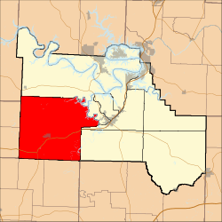
Russell Township, Camden County, Missouri
| Russell Township | |
|---|---|
| Township | |
 | |
| Coordinates: 37°59′30″N 092°56′57″W / 37.99167°N 92.94917°WCoordinates: 37°59′30″N 092°56′57″W / 37.99167°N 92.94917°W | |
| Country | United States |
| State | Missouri |
| County | Camden |
| Area | |
| • Total | 142.83 sq mi (369.92 km2) |
| • Land | 141.21 sq mi (365.73 km2) |
| • Water | 1.62 sq mi (4.19 km2) 1.13% |
| Elevation[1] | 1,099 ft (335 m) |
| Population (2000) | |
| • Total | 2,495 |
| • Density | 17.7/sq mi (6.8/km2) |
| FIPS code | 29-63668[2] |
| GNIS feature ID | 0766393 |
Russell Township is one of eleven townships in Camden County, Missouri, USA. As of the 2000 census, its population was 2,495.
Geography
Russell Township covers an area of 142.83 square miles (369.9 km2) and contains one incorporated settlement, Macks Creek. It contains nine cemeteries: Creach, Edwards, Green, Hurst, Mills, Raggs, Stanton, Warren and Wiley Gott.
The streams of A B Creek, Broadus Branch, Brush Creek, Brush Creek, Jacks Creek, Kolb Branch, Little Brush Creek, Little Niangua River, Long Branch, Macks Creek, Pennel Branch, Phillips Branch, Watson Branch and Woodall Branch run through this township.
Public Areas
Public Areas include:
- Cedar Camp which contains rental cabins, a park, a campground, and a Little Niangua canoe access.
- Bannister Ford which contains a bridge where Route CC crosses the Little Niangua River and a canoe access.
References
- ↑ "US Board on Geographic Names". United States Geological Survey. 2007-10-25. Retrieved 2008-01-31.
- ↑ "American FactFinder". United States Census Bureau. Retrieved 2008-01-31.
External links
| |||||||||||||||||||||||||||||||||
