Rushville, Indiana
| City of Rushville | |
|---|---|
| City | |
|
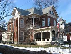
The John K. Gowdy House in Rushville | |
 Location in the state of Indiana | |
| Coordinates: 39°36′52″N 85°26′55″W / 39.61444°N 85.44861°WCoordinates: 39°36′52″N 85°26′55″W / 39.61444°N 85.44861°W | |
| Country | United States |
| State | Indiana |
| County | Rush |
| Township | Rushville |
| Government | |
| • Mayor R | Mike Pavey (R) |
| Area | |
| • Total | 3.09 sq mi (8.0 km2) |
| • Land | 3.09 sq mi (8.0 km2) |
| • Water | 0.00 sq mi (0.0 km2) 0% |
| Elevation | 958 ft (292 m) |
| Population (2010) | |
| • Total | 6,341 |
| • Density | 2,668.8/sq mi (1,028.7/km2) |
| Time zone | EST (UTC-5) |
| • Summer (DST) | EDT (UTC-4) |
| ZIP code | 46173 |
| Area code(s) | 765 |
| FIPS code | 18-66438[1] |
| GNIS feature ID | 0442410[2] |
| Website | http://www.cityofrushville.in.gov/ |
Rushville is a city in Rushville Township, Rush County, Indiana, United States. The population was 6,341 at the 2010 census. The city is the county seat of Rush County.[3] It was the campaign headquarters for Wendell Willkie's 1940 presidential campaign against Franklin D. Roosevelt. Willkie is buried in the city's East Hill Cemetery. It, like the county, was named in honor of Dr. Benjamin Rush, who signed the Declaration of Independence.[4]
Geography
Rushville is located at 39°36′52″N 85°26′55″W / 39.61444°N 85.44861°W (39.614482, -85.448657),[5] along the Flatrock River.[6]
According to the 2010 census, the city has a total area of 3.09 square miles (8.0 km2), all land.[7]
Demographics
As of the census[1] of 2000, there were 5,995 people, 2,434 households, and 1,552 families residing in the city. The population density was 2,668.8 people per square mile (1,028.7/km²). There were 2,597 housing units at an average density of 1,156.1 per square mile (445.6/km²). The racial makeup of the city was 96.45% White, 1.58% African American, 0.20% Native American, 0.85% Asian, 0.05% Pacific Islander, 0.13% from other races, and 0.73% from two or more races. Hispanic or Latino of any race were 0.40% of the population.
There were 2,434 households out of which 31.2% had children under the age of 18 living with them, 46.9% were married couples living together, 12.7% had a female householder with no husband present, and 36.2% were non-families. 31.6% of all households were made up of individuals and 15.2% had someone living alone who was 65 years of age or older. The average household size was 2.39 and the average family size was 2.99.
In the city the population was spread out with 25.2% under the age of 18, 8.6% from 18 to 24, 28.6% from 25 to 44, 20.2% from 45 to 64, and 17.5% who were 65 years of age or older. The median age was 37 years. For every 100 females there were 89.0 males. For every 100 females age 18 and over, there were 85.0 males.

The median income for a household in the city was $30,233, and the median income for a family was $36,646. Males had a median income of $30,127 versus $22,440 for females. The per capita income for the city was $17,072. About 8.1% of families and 11.0% of the population were below the poverty line, including 12.3% of those under age 18 and 12.0% of those age 65 or over.
Notable people
- Leonidas Sexton, 19th Century politician, was from Rushville.
- Wendell Willkie claimed residence in and ran his unsuccessful 1940 presidential campaign from Rushville. He remains the only native of Indiana to be nominated as the presidential candidate for a national party. He is buried in the East Hill Cemetery. His wife, Edith Wilk, was a native of Rushville.
- Frazier Thomas was born in Rushville on June 13, 1918 and died in Chicago, Illinois on April 3, 1985. He was a television personality best known for having hosted the long-running children's television program Garfield Goose and Friends on WGN-TV. In a long career that spanned from before World War II until his death, he also hosted Family Classics and took over as circus manager on Bozo's Circus after the retirement of ringmaster Ned Locke, both shows also on WGN-TV.
- Tony Stewart, NASCAR driver, former IRL champion, is also referred to as the "Rushville Rocket." Stewart grew up in Columbus, Indiana but started his racing career while living in Rushville. There is a small drive next to Rushville Consolidated High School named Tony Stewart Drive in his honor.
- Philip Willkie, Indiana politician and businessman
- Janet Gray Hayes, Mayor of San Jose, California
- Carmelita Geraghty, silent film actress
- Knowles Shaw, author, composer
- Samuel Bigger, 7th Governor of Indiana
- Joe Hogsett, former Secretary of State of Indiana, current U.S. Attorney for the Southern District of Indiana
- Joe Cotton, World War II bomber pilot and NASA test pilot
References
- ↑ 1.0 1.1 "American FactFinder". United States Census Bureau. Retrieved 2008-01-31.
- ↑ "US Board on Geographic Names". United States Geological Survey. 2007-10-25. Retrieved 2008-01-31.
- ↑ "Find a County". National Association of Counties. Retrieved 2011-06-07.
- ↑ De Witt Clinton Goodrich & Charles Richard Tuttle (1875). An Illustrated History of the State of Indiana. Indiana: R. S. Peale & co. p. 572.
- ↑ "US Gazetteer files: 2010, 2000, and 1990". United States Census Bureau. 2011-02-12. Retrieved 2011-04-23.
- ↑ DeLorme (1998). Indiana Atlas & Gazetteer. Yarmouth, Maine: DeLorme. ISBN 0-89933-211-0
- ↑ "Places: Indiana". 2010 Census Gazetteer Files. United States Census Bureau. Retrieved 2012-04-21.
External links
- City of Rushville website
- "Wendell Willkie, Presidential Contender" from C-SPAN's The Contenders, broadcast from Rushville
| |||||||||||||||||||||||||||||||||