Rupandehi District
| Rupandehī Jillā रुपन्देही जिल्ला | |
|---|---|
| District | |
|
Lumbini Temple (Birthplace of Gautama Buddha) | |
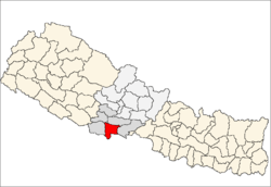 Location of Rupandehi | |
| Country | Nepal |
| Region | Western (Pashchimanchal) |
| Zone | Lumbini |
| Headquarters | Siddharthanagar |
| Area | |
| • Total | 1,360 km2 (530 sq mi) |
| Population (2011) | |
| • Total | 880,196[1] |
| Time zone | NPT (UTC+5:45) |
| Main language(s) | Nepali |

Rupandehi District(Nepali: रुपन्देही जिल्ला![]() Listen , a part of Lumbini Zone, is one of the seventy-five districts of Nepal and covers an area of 1,360 km². The district headquarters is Siddharthanagar . In 2001 this district had a population of 708,419.
Listen , a part of Lumbini Zone, is one of the seventy-five districts of Nepal and covers an area of 1,360 km². The district headquarters is Siddharthanagar . In 2001 this district had a population of 708,419.
History
Gautama Buddha was born in this area.
Geography
The district lies on the southern Nepal. On the East it shares border with Nawalparasi District, on West with Kapilvastu District, on North with Palpa District and on South with India.
The elevation of the district lies between 100m to 1229m from sea level. The total area of the district is 1,360 km² with 16.1% in Churia Range and rest in the Terai region.
Settlement areas
There are 69 Village Development committees and 2 municipalities. The district is divided into 5 election areas.

|
|
|
Major Rivers
Rupandehi has many rivers all of which flow from Northern mountains towards south into India.
|
|
|
|
Major Lakes
- Gaidahawa lake (Bishnupur)
- Gajedi lake (Gajedi)
- Nanda vauju lake (Chilhaiya)
- Sukaiiya lake
Climate
| Climate Zone[2] | Elevation Range | % of Area |
|---|---|---|
| Lower Tropical | below 300 meters (1,000 ft) | 89.3% |
| Upper Tropical | 300 to 1,000 meters 1,000 to 3,300 ft. |
10.5% |
| Subtropical | 1,000 to 2,000 meters 3,300 to 6,600 ft. |
0.2% |
Place of attraction
- Lumbini
- Manimukunda sen Park
- Chanchala Mai Temple
- Bol bum
- Siddha Baba Temple
- Gitgadi
Major economic centers
|
|
|
|
Non-profit organisations
- NAMUNA Integrated Development Council (NAMUNA)
- Samriddhi Foundation
- Ma Bhagawiti Anurag Jagarn Samooh
- Astha Samuha (www.asthasamuha.org.np)
References
- ↑ "National Population Census 2011". National Planning Commission Secretariat, Central Bureau of Statistics (CBS), Government of Nepal. September 2011.
- ↑ The Map of Potential Vegetation of Nepal - a forestry/agroecological/biodiversity classification system (PDF), . Forest & Landscape Development and Environment Series 2-2005 and CFC-TIS Document Series No.110., 2005, ISBN 87-7803-210-9, retrieved Nov 22, 2013
- Shaha, Rishikesh (1992). Ancient and Medieval Nepal. Manohar Publications, New Delhi. ISBN 978-81-85425-69-6.
- Shreshta, S.H (2005). Nepal in Maps. Kathmandu: Educational Publishing House. p. 129.
- Shreshta, Vinod Prasad (2007). A Concise Geography of Nepal. Kathmandu: Mandal Publications. p. 126. ISBN 978-99946-55-04-5.
- Woodhatch, Tom (1999). Nepal handbook. The Royal Palace (Footprint Travel Guides). p. 194. ISBN 978-1-900949-44-6. Retrieved 2009-12-17.
| ||||||||||||||||||||||||

Coordinates: 27°30′N 83°27′E / 27.500°N 83.450°E