Rundu
| Rundu | ||
|---|---|---|
| Town | ||
|
Eugene Kakururu Street | ||
| ||
| Nickname(s): Ru-town | ||
| Motto: Unitiy & Development | ||
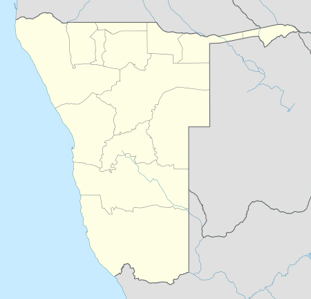 Rundu Location in Namibia | ||
| Coordinates: 17°55′S 19°46′E / 17.917°S 19.767°ECoordinates: 17°55′S 19°46′E / 17.917°S 19.767°E | ||
| Country |
| |
| Region | Kavango-East Region | |
| Constituency | Rundu Urban constituency | |
| Government | ||
| • Mayor | Hilkka Wayera Levi (SWAPO) | |
| Elevation | 1,095 m (3,593 ft) | |
| Population (2011)[1] | ||
| • Total | 63,431 | |
| Time zone | South African Standard Time (UTC+1) | |
| Area code(s) | 066 | |
| Website | http://www.runducity.iway.na/ | |


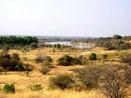
Rundu is the capital of the Kavango-East Region, northern Namibia, on the border with Angola on the banks of the Kavango River about 1000 m above sea level. The place normally receives an annual average rainfall of 565 millimetres (22.2 in), although in the 2010/2011 rainy season 757 millimetres (29.8 in) were measured.[2]
Rundu is growing rapidly. The 2001 census counted 36,964 inhabitants;[3] and for the 2011 census it has climbed to 63,430.
History
In 1936 it became seat of the local governor and replaced Nkurenkuru as capital of the Kavango district. The town has since grown into a multilingual city of the Kavango region and only recently its official status was changed to that of a town.[4]
Geography
Localities
The oldest houses in Rundu are located in the Katutura area. These houses are mainly 2 bedroom homes with large backyards even though they are situated next to the central business district. On the west is Tutungeni, which means "let's build". This area was previously occupied by executives of the white-dominated businessplace, but now it is open for any willing buyer in need of a quiet neighbourhood. On the East is Safari. There are the middle-priced houses and were built in the 1970s.
These three main localities dominated Rundu residential life until the turn of the millennium in 2000, when new housing projects by O'B Davids Properties built a new residential area named Millennium Park. After which two others have been built by the NHE, Queens and Kings Parks respectively.
Climate
| Rundu | ||||||||||||||||||||||||||||||||||||||||||||||||||||||||||||
|---|---|---|---|---|---|---|---|---|---|---|---|---|---|---|---|---|---|---|---|---|---|---|---|---|---|---|---|---|---|---|---|---|---|---|---|---|---|---|---|---|---|---|---|---|---|---|---|---|---|---|---|---|---|---|---|---|---|---|---|---|
| Climate chart (explanation) | ||||||||||||||||||||||||||||||||||||||||||||||||||||||||||||
| ||||||||||||||||||||||||||||||||||||||||||||||||||||||||||||
| ||||||||||||||||||||||||||||||||||||||||||||||||||||||||||||
Rundu has a humid subtropical climate (Cwa, according to the Köppen climate classification), with hot summers and relatively mild winters (with warm days and chilly to cool nights). It borders on a semi-arid climate (BSh). The average annual precipitation is 571 mm (22 in).
Culture
Rundu is home to many woodcarvers [5] and features a woodcarver's market near the open market. Several local restaurants serve traditional food, including mahangu, ground nuts, stewed meats, and fish from the Okavango River. One such restaurant is Kalimba Home Restaurant [6]
Informal housing
Outside the formal suburbs shanty towns symbolise the rapid urbanisation of the town and high unemployment rates. Kehemu also known by the locals as Cali, Sauyemwa (SA) and Ndama are the most informal areas while a fourth, Donkerhoek (Dark Corner) is rapidly becoming formal since the start of the Build Together Campaign in 1992.
Infrastructure
Rundu Airport, mostly used for tourism and cargo, is 5 km southwest of the town.[7]
The Rundu State Hospital is situated in the center of the town, off Markus Siwarongo street. It's the largest hospital in Kavango.
Schools
There are five tertiary Institutions in Rundu, namely the Rundu College of Education, the Institute of Open Learning (IOL), the Rundu Vocational Training Centre, the Namibia College of Open Learning (NAMCOL) and Triumphant College. The University of Namibia and Polytechnic of Namibia both maintain centres that provide support for students who are studying on distance. There are six secondary schools in the town: Rundu Secondary School, Dr. Alpo Mbamba Secondary School, Dr. Romanus Kampungu Secondary School, Elias Neromba Senior Secondary School, Noordgrens, and Kamunoko Secondary School.
Rundu Open Market
Rundu Open Market is the most well-known and biggest open market in the town. It was founded in 1996 through cooperation between the government of Namibia and the government of Luxembourg.[8][9][10]
Town twinning
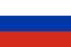 Cheboksary, Chuvash Republic, Russia
 Nieuwegein, Netherlands
References
- ↑ "Table 4.2.2 Urban population by Census years (2001 and 2011)". Namibia 2011 - Population and Housing Census Main Report. Namibia Statistics Agency. p. 39. Retrieved 10 September 2013.
- ↑ Menges, Werner (26 May 2011). "Rainy season was one for the record books". The Namibian.
- ↑ Republic of Namibia 2001 Population and Housing Census (Basic Analysis with Highlights ed.). Windhoek: Central Bureau of Statistics, National Planning Commission. July 2003. p. 21. ISBN 0-86976-614-7.
- ↑ Heussen, Sven (7 July 2010). "Revisionsurteil verweigert. Generalbuchprüfer rügt Dorfrat von Rundu – Chaos in der Verwaltung" [Internal audit refused. Auditor-General admonishes Rundu Village Council – Administration in chaos]. Allgemeine Zeitung (in German).
- ↑ Namibia: Woodcarvers of the Kavango by Fifi Rhodes. AllAfrica. 12 April 2012.
- ↑ Boabab Guides by Javier Leandro Sobradillo. 21 May 2010.
- ↑ Namibia Airports Company Rundu
- ↑ RunduOpenMarkets.org/
- ↑ Namibia (Other Places Travel Guide) by Jeremiah Allen
- ↑ Kavango Women Keep Pots Boiling New Era, 16 February 2005
| Wikimedia Commons has media related to Rundu. |