Ruckersville, Virginia
| Ruckersville, Virginia | |
|---|---|
| Census-designated place (CDP) | |
| Coordinates: 38°13′59″N 78°22′09″W / 38.23306°N 78.36917°W | |
| Country | United States |
| State | Virginia |
| Founded | 1732 |
| Elevation | 594 ft (181 m) |
| Population (2010) | |
| • Total | 1,141 |
| Time zone | EST (UTC-5) |
| • Summer (DST) | EDT (UTC-4) |
| ZIP codes | 22968 |
| Area code(s) | 434 |
| FIPS code | 51-14968[1] |
| GNIS feature ID | 1498463[2] |
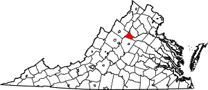
Ruckersville is a census-designated place (CDP) in Greene County, Virginia, United States, located in a rural area on the outskirts of Charlottesville. The population as of the 2010 Census was 1,141.[3] The community lies amidst hills, mountain views, trees, and farmland. It is located at the intersection of two major highways, north-south U.S. Route 29 and east-west U.S. Route 33. It was founded by the same family that established Ruckersville, Georgia.[4]
Media
Ruckersville has one media outlet, ESPN 840, a sports talk radio station. Although the station's tower location is in Earlysville, and the mailing address is Quinque, the station still considers itself a Ruckersville station.
Demographics
As of the census[1] of 2000, there were 8,536 people, and 3,067 households residing in the 22968 ZIP code. The Male Population was 4,235. The median age of all residents was 34. Median Real Estate Taxes were $802 while median gross rent was $640. The median home value was $111,400.
Ruckersville Parkway
In 2005, a pair of veterans of the local political scene proposed a road that would connect Ruckersville to Charlottesville, a sort of unofficial, mid-speed bypass of the crowded streets of Charlottesville. However, objections from residents and planners quashed the proposal, which had been dubbed the "Ruckersville Parkway."[5]
Notable residents
- NASCAR autoracer Philip Morris was born in Ruckersville.
References
- ↑ 1.0 1.1 "American FactFinder". United States Census Bureau. Retrieved 2008-01-31.
- ↑ "US Board on Geographic Names". United States Geological Survey. 2007-10-25. Retrieved 2008-01-31.
- ↑ Virginia Trend Report 2: State and Complete Places (Sub-state 2010 Census Data). Missouri Census Data Center. Accessed 2011-06-08.
- ↑ http://books.google.com/books?id=EEYUAAAAYAAJ&pg=PA439&lpg=PA439&dq=Rucker+house+Ruckersville+georgia&source=bl&ots=1McEOfky01&sig=zntbLfR5B8_1Cvoll94spUNLA1E&hl=en&sa=X&ei=qOugUsLvPIbakQeVroDQCQ&ved=0CGAQ6AEwCA#v=onepage&q=Rucker%20house%20Ruckersville%20georgia&f=false A Standard History of Georgia and Georgians, Volume 1 By Lucian Lamar Knight pages 440,441
- ↑ Provence, Lisa (2007-11-08). "DOA? Who killed the Ruckersville Parkway?". The Hook (newspaper) (Charlottesville). Retrieved 2008-02-27.
| |||||||||||||||||||||
Coordinates: 38°13′59″N 78°22′09″W / 38.23306°N 78.36917°W
