Royal Tweed Bridge
| Royal Tweed Bridge | |
|---|---|
|
Royal Tweed Bridge | |
| Coordinates | 55°46′05″N 2°00′32″W / 55.768°N 2.009°WCoordinates: 55°46′05″N 2°00′32″W / 55.768°N 2.009°W |
| Carries | Road traffic |
| Crosses | River Tweed |
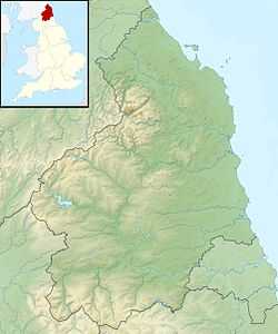
| Locale | Northumberland, England |
| Characteristics | |
| Material | Reinforced concrete |
| Total length | 430 metres (1,410 ft) |
| Number of spans | 4 |
| History | |
| Constructed by | L G Mouchel & Partners |
| Construction begin | 1925 |
| Construction end | 1928 |
| Statistics | |
| Daily traffic | Dual carriageway |
| Toll | No |
 Royal Tweed Bridge | |
The Royal Tweed Bridge is a 1920s road bridge in Berwick-upon-Tweed, Northumberland, England crossing the River Tweed. It was intended to divert traffic from the 17th century Old Bridge, and until the 1980s it formed part of the A1 road, the main route from London to Edinburgh. However, the construction of a new bridge to the west of Berwick as part of bypass has since reduced the Royal Tweed Bridge's importance.
Construction took place between 1925 and 1928. It was undertaken by L G Mouchel & Partners, who still operate today (as Mouchel Parkman). The design is of reinforced concrete and consists of four unequal arches. The bridge altogether spans a distance just short of 430 metres. However, the spans of the arches themselves (50.1, 74.4, 95.5 and 108.50 metres) vary remarkably, so much so that the longest, northern arch for a while held the record for Great Britain's largest concrete arch.
Up until the 2000s, when the road and pavement layout was altered and new lights added, both side of the bridge was used for parking with a smaller pavement in use. This caused a large weight on the deck of the bridge and forced the Berwick Borough Council to adapt a new layout to ease pressure on the bridge.
External links
- Information from the SINE project, University of Newcastle upon Tyne.
- Royal Tweed Bridge at Structurae
- Tweed bridges
- Map sources for Royal Tweed Bridge
| ||||||||||||||||||||||||||
