Royal Australian Survey Corps
| Royal Australian Survey Corps | |
|---|---|
 | |
| Active | 1 July 1915 – 1 July 1996 |
| Country |
|
| Branch | Australian Army |
| Type | Corps |
| Role | Military Survey |
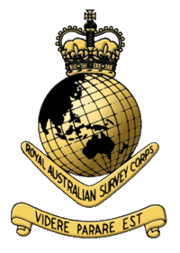
| Motto | Videre Parare Est (to see is to prepare) – the crest and motto of the Royal Australian Survey Corps (RA Svy) as it existed at cessation in 1996. It replaced the original badge of the Australian Survey Corps approved in 1915. The crest was approved in 1949 with the King's crown and modified in 1953 with the Queen's crown. The motto was approved in 1965.[1] |
| March | Wandering the Kings Highway (adopted 1965) |
| Anniversaries | Corps Birthday 1 July. Centenary 2015. |
| Engagements | Royal Australian Survey Corps was not awarded Battle honours. |
| Commanders | |
| Ceremonial chief | Colonel-in-Chief Her Royal Highness The Princess of Wales 1 July 1988 – 1 July 1996 |
The Royal Australian Survey Corps (RA Svy) was a Corps of the Australian Army, formed on 1 July 1915 and disbanded on 1 July 1996. The role of the Royal Australian Survey Corps was to provide the maps, aeronautical charts, hydrographical charts and geodetic and control survey data required for land combat operations. Functional responsibilities associated with this role were: theatre wide geodetic survey for – artillery, naval gunfire and close air support – mapping and charting – navigation systems – command and control, communications, intelligence, reconnaissance and surveillance systems; map production and printing for new maps and charts, plans, overprints, battle maps, air photo mosaics and photomaps, rapid map and chart revision; map holding and map distribution; production, maintenance and distribution of digital topographic information and products.
The operational doctrine was that the combat force deployed into the area of operations with topographic products adequate for planning, force insertion and initial conduct of tactical operations, that new products and broad area updates of the topographic base would be provided by the support area and communication zone survey forces, and that the combat support survey force in the area of operations would update the topographic base, add tactical operational and intelligence information and provide the value-added products required by the combat force.[2]
The Historical Collection of the Survey Corps is maintained by the Australian Army Museum of Military Engineering at the School of Military Engineering, Steele Barracks, Moorebank, Sydney, New South Wales. Survey Corps Associations of ex-members, family and friends are located in Adelaide, Bendigo, Brisbane, Canberra, Perth and Sydney.
History
| Corps of the Australian Army |
|---|
| Combat |
| Combat Support |
| Combat Service Support |
|
| Training Corps |
| Former Corps |
Origins
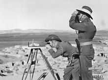
Australia's first surveyor, Lieutenant August Alt, was an Army officer of the 8th (The King's) Regiment of Foot, which arrived in Australia with the First Fleet in January 1788.[3] Eighteen years before him, Lieutenant James Cook, Royal Navy, used his knowledge and skills of topographic survey by plane-table for his surveys and charting of the east coast. This graphical method of topographic survey, first used before 1600, was the mainstay of the Australian Survey Corps for the first 20 years and used in the two world wars and occasionally much later. Cook had learned surveying in Canada from Royal Engineer Samuel Holland who then (1758) was the first Surveyor-General of British North America.[4]
For 113 years of colonisation after the arrival of the First Fleet, much of the mapping of Australia, mainly for exploration, settlement and development, was supervised and conducted by naval and military officers. These officers included the well known explorers and surveyors: Captain Matthew Flinders, Royal Navy; Lieutenant William Dawes (Royal Marines officer), (New South Wales); Lieutenant Philip Parker King, Royal Navy (mainly Tasmania, Western Australia and Northern Territory), Lieutenant John Oxley, Royal Navy, (New South Wales); Lieutenant Colonel Sir Thomas Mitchell (New South Wales, Victoria and Queensland); Captain Charles Sturt (New South Wales and South Australia); Lieutenant John Septimus Roe, Royal Navy, (Western Australia)and Colonel William Light (South Australia). After 100 years of settlement some topographic maps had been produced for both public and private use but only a few maps were of any real military utility. The colonial part-time Defence Forces prepared small-area training manoeuvre maps and some colonies had produced small systematic topographic surveys for defence of the main ports of trade and commerce in the 1880s and 1890s. That is not to say that the need for topographic mapping was not a government and public concern but there were only minor attempts to allocate appropriate public resources.[5]
After Federation in 1901, the Defence Act 1903 made provision for military mapping. Most recently a royal commission into the way the British Army had conducted itself in South Africa (Boer War) found that the troops had to fight without adequate topographic information. Indeed accurate maps of the Boer republics did not exist. The Times' history of the Boer War 1899–1902 included: 'The chief deduction to be made in the matter is that no efforts during a war will compensate for the lack of a proper topographical survey made in peace time. Maps are a necessity to a modern army, and the expense of making them is very small compared with the cost of a campaign.' [6]
The Defence Department and the Government considered a number of options to address the important and urgent need for a military survey, finally deciding in late 1907 to raise the Australian Intelligence Corps (AIC) manned by part-time Citizen Military Force (CMF) officers who were trained in surveying or draughting and whose duties included the preparation of the military survey maps. The deficiencies and limitations of this arrangement were soon obvious, and after advice from a senior British Army Royal Engineer Survey Officer, it led to the establishment in April 1910 of the Survey Section, Royal Australian Engineers (RAE) (Permanent Forces), allotted for duty under direction of the AIC. The Section was commanded by an Australian officer and staffed by Australian Warrant Officers and NCOs and four non-commissioned officer (NCO) topographers on an initial two year loan from the British Army Royal Engineers. On 16 April 1910, Warrant Officer John J Raisbeck was the first Australian appointed to the Survey Section. He was a survey draughtsman from the Department of Mines, Bendigo. He was also a Second-Lieutenant in the CMF 9th Light Horse Regiment and relinquished his commission to enlist in the Permanent Military Forces. He was granted the Honorary rank Second-Lieutenant and was retired with the rank Lieutenant-Colonel 33 years later at age 63 years having served in France in World War I and in World War II. Fitzgerald said that JJ Raisbeck was the 'pioneer of military mapping in Australia'.[1]
The first officer appointed to the position Lieutenant Survey Section RAE (Permanent) was Lieutenant William Lawrence Whitham, a licensed surveyor from South Australia. He assumed his appointment on 1 July 1910 at which time there were seven members of the Section. All men were professional surveyors and draftsman. CMF officers of the AIC in the Military District Headquarters supervised the work of the Section. In 1912 the Queensland, New South Wales, Victoria and South Australia State Governments each agreed to loan a Lands Department Survey Officer to the Survey Section RAE for two years to supervise the work of the Section in each State. Each Survey Officer was a militia officer in the AIC. The Section was divided into two sub-sections and employed in New South Wales, Victoria, South Australia and Western Australia producing scale one-mile-to-one-inch military maps ('1 mile' map) mainly of areas around cities and key infrastructure. By mid-1913 the Section had completed topographic field sheets by plane-tabling for eight maps around Newcastle, Melbourne and Canberra. The initial method of using parish plans to position the topographic detail was soon found to be inadequate and a geodetic subsection was established in 1914 to provide surveys by geodetic triangulation as spatial frameworks for the field sheets produced by the topographers. The triangulation work started at Werribee just north of Melbourne and proceeded west along the coast to Warrnambool. This work included the 1860 Geodetic Survey of Victoria where appropriate – much of which was produced by Royal Engineer officers. The AIC was disbanded in 1914 but the work of the Survey Section continued under the supervision and control of the Intelligence Section of the General Staff under the general direction of the Chief of the General Staff (CGS).[2][7][8][9][10]
First World War
The outbreak of World War I did not, at first, seriously affect the work of the members of the Section as the highest priority and urgent work of the Permanent Forces was military survey for defence of the major cities and ports in Australia. Indeed, the Section gained an increase in personnel and equipment.[11] At that stage it was understood that the British Army would provide the maps required for the Australian Imperial Force (AIF) war fighting. On 3 July 1915, Military Order 396 of 1915 promulgated that His Excellency the Governor-General has been pleased to approve of: 'A Corps to be called the Australian Survey Corps being raised as a unit of the Permanent Military Forces. All officers, warrant officers, non-commissioned officers and men now serving in the Survey Section of the Royal Australian Engineers being transferred to the Australian Survey Corps with their present ranks and seniority.’[2] The effective date of the foundation of the Corps was 1 July 1915 – on that day there were two officers and seventeen warrant officers and NCOs of the Corps (at that stage there were no sappers in the Corps). The Australian Survey Corps was placed fourth in the Order of Precedence of Corps after the Royal Australian Engineers.
Raising the Australian Survey Corps had nothing to do with supporting the AIF then at Gallipoli, but provided for the key tasks of military survey of the high defence priority areas of Australia without direction or control of Intelligence Staff or the Royal Australian Engineers. The first Officer Commanding Australian Survey Corps was Honorary Captain Cecil Verdon Quinlan who had been appointed Lieutenant Survey Section RAE in March 1913 after Lieutenant Whitham resigned. Quinlan later gave credit to the creation of the Australian Survey Corps to the then General Staff Director of Military Operations - Major Brudenell White (later General Sir, Chief of the General Staff).[11]
Survey Corps members started to enlist in the AIF in November 1915, with three Warrant Officer draughtsman working with the Headquarters of the Egyptian Expeditionary Force by late 1916. Then in late 1917, General Headquarters in France/Belgium requested survey personnel for topographic surveys in that theatre and a volunteer Australian Survey Corps AIF draft of four officers and seven NCOs arrived in France early in 1918. Military Survey in Australia then came to a virtual standstill when the AIF members departed for the Middle East and the Western Front where some of them joined the Australian Corps Topographic Section in France/Belgium and others served with General Headquarters Royal Engineer Survey Companies employed amongst other things on evaluating the suitability of the French triangulation networks for the purposes of military survey and mapping.
In early 1918 fourteen Corps members were serving with the AIF and eight were in Australia working on the military survey. One Survey Corps member (Warrant Officer Alan Stewart Murray) and one Topographic Section Engineer were awarded the Distinguished Conduct Medal for mapping under enemy fire, one Topographic Section Engineer was awarded the Meritorious Service Medal and the Engineer Officer Commanding the 1st ANZAC Topographic Section in 1917 and the Australian Corps Topographic Section in 1918 were awarded the Belgian Croix De Guerre. Warrant Officer Murray's citation for his work in Sinai/Palestine read "for conspicuous gallantry and dedication to duty. For a prolonged period this Warrant Officer was engaged on surveying the area between the lines repeatedly working under machine gun fire and sniping. In order not to attract attention he usually worked alone with his plane table and instruments. Owing to his energy and coolness he has mapped a piece of country accurately and his work has been most valuable."[2][8][12]
Between the World Wars
When the AIF members returned to Australia in 1919 they were discharged and most were re-appointed to the Survey Section RAE (Permanent). Military reorganisation after World War I, and the general reduction in military capability, saw the numbers reduced to fourteen all ranks. In 1920 the Corps was suspended and all members were transferred to the Survey Section, RAE (Permanent). Mapping continued, mainly the '1 mile' maps, albeit at a reduced rate consistent with the allocated resources, with priority given to areas around Brisbane, Sydney and Melbourne. By 1929 the Section had produced fifty-four '1 mile' maps including five revised maps. Technical developments provided for improved efficiencies. These included use of single photographs and strips of air photographs to supplement ground surveys by plane-table for topographic detail. The first military map produced with a significant component of aerial photography flown by the Royal Australian Air Force was the 1930 Albury '1 mile' map. These developments highlighted inconsistencies in State triangulation systems and once again demonstrated the need for a national geodetic system which had been identified by colonial survey officers in the 1890s.
In 1932, the Australian Survey Corps was once again formed and all fourteen Survey Section RAE (Permanent) members were transferred to the Corps. Recruiting recommenced and in 1935 the Corps establishment was raised to twenty-five all ranks. Increments allowed for a Survey (Topographic) Section to be based in each of three states, New South Wales, Victoria and Queensland, a Survey (Geodetic) Section and the Survey (Draughting) Section in Melbourne. Then in 1938, with war clouds once again on the horizon, a three-year Long Range Mapping Programme was approved, with additional funding bringing the total to ninety-seven all ranks. These extra resources would provide for a total of about thirty-five new '1 mile' maps each year. However, at the outbreak of World War II there were only fifty members in the Australian Survey Corps. Most of the men were professionally qualified, and the Corps was very knowledgeable of emerging technical developments which would improve efficiencies in map production. That there were no militia units of the Corps was due mainly to the fact that little progress in the mapping programme was achieved with part-time effort. The Corps was well equipped for the range of field survey and office mapping tasks with the exception of printing presses. Maps were printed by the Victorian State Government Printer. At this stage, just before World War II, the total coverage of military '1 mile' maps was eighty maps or about 36,000 square miles (93,000 km2) or only about 40% of the identified military mapping requirement at that stage.[13][14]
Sections (all Permanent Forces) from World War I to pre-World War II were:
- Survey Section, RAE
- No 1 Survey (Draughting) Section (Melbourne)
- No 1 Survey (Topographic) Section (QLD and South Australia)
- No 2 Survey (Topographic) Section (VIC)
- No 3 Survey (Topographic) Section (NSW)
- No 4 Survey (Geodetic) Section
Second World War
In July 1939 'Instructions for War – Survey' were issued.[1] This outlined the military survey organisation required to undertake an Emergency Mapping Programme to complete the outstanding Long Range Mapping Programme and the nucleus for expansion to war establishment. The Emergency Mapping Programme was initially for strategic mapping at scale four-miles-to-one-inch covering a coastal strip 200 miles (300 km) inland from Townsville to Port Augusta and 100 miles (200 km) inland from Albany to Geraldton and key strategic areas in Tasmania and around Darwin. Map production was from existing State Lands Departments information and conducted jointly between State and Commonwealth agencies and Survey Corps units. The programme expanded to include more of Australia, New Guinea, New Britain and New Ireland and although many maps were of a preliminary standard only, providing general coverage critical at the time.
Initially, the Australian Survey Corps continued its mapping for the defence of Australia, proceeded with basic survey triangulation and provided training cadre for new field and training units. Command Field Survey Units RAE (Militia) were established in Queensland, New South Wales and Victoria to accelerate the mapping effort. Survey staff officers were appointed to Command Headquarters to advise on survey needs and to liaise with State agencies. In April 1940 the 2/1 Corps Field Survey Company RAE was raised as part of the 2nd Australian Imperial Force for service overseas and a Survey staff was appointed to the formation (Corps) headquarters. In late 1940 significant expansion of the Australian Survey Corps was approved by Cabinet to include a Survey Directorate on Army Headquarters (AHQ) and higher formation headquarters, an AHQ Survey Company, an AHQ Cartographic Company, regional command field survey companies, a Survey Section 7th Military District (Darwin) and a Corps Survey Mobile Reproduction Section. Four militia Field Survey Companies were established in the regional commands (1 Coy – Queensland, 2 Coy – New South Wales, 3 Coy – Victoria, 4 Coy – Western Australia) absorbing the Australian Survey Corps Sections in those districts and the Field Survey Units RAE (M).
In early 1941, 2/1 Corps Field Survey Company RAE, sailed with the 2nd Australian Imperial Force, to provide survey and mapping to the Australian Corps in the Middle East theatre including Greece, Egypt, Cyrenaica and the border zones of Palestine, Syria, Trans-Jordan and Turkey. In response to the Japanese advance in the Pacific the 2/1 Corps Field Survey Company returned to Australia in early 1942 and over the next four years fifteen Australian Survey Corps units with various roles (including two Army level Topographical Survey Companies) provided survey and mapping support to military operations in the South West Pacific Area theatre of the war including Northern Territory, Papua, New Guinea, New Britain, New Ireland, Bougainville, Dutch New Guinea, Borneo and the States of Australia in particular northern Australia. Women of the Australian Women's Army Service served in Survey units and formation headquarter sections in Australia and in New Guinea.[1][2]
Acknowledgement of the value of survey support organic to the combat forces increased as the war progressed, with Survey Sections of 5th Field Survey Company assigned to both 7th Australian Infantry Division and 9th Australian Infantry Division for the large scale amphibious landings at Labuan and Balikpapan in Borneo. Later, the General Staff of Headquarters 1 Australian Corps said "...never in this war have Australian troops been so well provided with accurate maps, sketches and photo reproductions..." [1]
The Corps produced more than 1440 new maps of the theatres of war, printing more than 3 million copies of the maps. The highly valued efforts of the Corps did not go unnoticed by senior commanders. Lieutenant-General Edmund Herring, General Officer Commanding New Guinea Force, and Lieutenant-General John Northcott, Chief of the General Staff, wrote letters of appreciation of the work of the Corps to the Director of Survey, Advanced Land Headquarters. General Douglas MacArthur, Commander-in-Chief, South West Pacific Area wrote a letter of high commendation of Corps work to General Thomas Blamey, Commander, Allied land Forces, South West Pacific Area. At Morotai, the Mobile Lithographic Section was given the privilege of preparing the Instrument of Surrender signed by Commander, Second Japanese Army and countersigned by General Blamey, Commander-in-Chief, Australian Military Forces. The unit then printed thousands of copies of the surrender document for souvenirs. At the end of the war more than half of the Corps strength of 1700 were on active service outside Australia.[1]
The achievements of the Corps during World War II were its greatest contributions to the nation than at any other time during its existence. This was duly recognised in 1948 when King George VI granted the title 'Royal' to the Australian Survey Corps.[1]
Sixteen members of the Australian Survey Corps, or soldiers serving with Corps units, died during the war and are commemorated on the Australian War Memorial Roll of Honour. Four members of the Corps were formally recognised with awards and nineteen members were mentioned-in-despatches.[15]
Australian Survey Corps units in World War II were:[1]
- 2nd/1st Army Topographical Survey Company, formerly 2nd/1st Corps Field Survey Company RAE – Middle East, New Guinea, Hollandia and Morotai
- No 6 Army Topographical Survey Company, formerly No 2 Army Topographical Survey Company – Victoria, Northern Territory, Western Australia, Queensland, New Guinea, New Britain
- Land Headquarters Cartographic Company, formerly Army Headquarters Cartographic Company – Melbourne and Bendigo Victoria
- No 2 Field Survey Company – New South Wales, Queensland, Dutch New Guinea, New Guinea, New Britain, Bougainville
- No 3 Field Survey Company – Victoria, New Guinea, Queensland
- No 4 Field Survey Company – Western Australia
- No 5 Field Survey Company, formerly 1 Field Survey Company which absorbed the Northern Command Field Survey Unit (M) – Queensland, Dutch New Guinea, Labuan and Balikpapan in Borneo
- No 7 Field Survey Section, formerly 7th Military District Survey Section, Northern Territory Force Field Survey Section and 1 Australian Field Survey Section – Northern Territory
- No 8 Field Survey Section, formerly New Guinea Field Survey Section and No 2 Field Survey Section – New Guinea
- No 1 Mobile Lithographic Section, formerly 2 Army Survey Mobile Reproduction Section – Melbourne, Brisbane and Morotai
- No 11 Field Survey Depot – Bendigo
- No 12 Field Survey Depot – Queensland and Morotai
- No 13 Field Survey Depot – Sydney, New Guinea
- Field Survey Training Depot – Victoria
In addition there were Survey Directorates and Survey Staff on formation headquarters:[1]
- General Headquarters South-West Pacific Area
- Advanced Land Headquarters – Melbourne, Brisbane, Hollandia and Morotai
- Headquarters 1st Australian Army
- Headquarters 1st Australian Corps – Morotai
- Headquarters 2nd Australian Corps
- Headquarters New Guinea Force
- Headquarters Northern Territory Force
- Headquarters of Queensland, Victoria, South Australia and Tasmania Lines of Communication areas
- Headquarters Kanga Force in New Guinea
- Headquarters Merauke Force in Dutch New Guinea
At the end of World War II, which by the nature of the total war demanded the best collective capability that the nation could assemble, the Australian Survey Corps was the best organised, best manned and best equipped geodetic and topographic survey and mapping organisation in Australia. The Director of Survey expected that the organisation would play a major role in the future survey and mapping of Australia.[1]
Post Second World War
Surveying and Mapping (Australia)
After World War II the Corps reverted to its peace time role of the military survey of Australia retaining a capability in the Permanent Force Interim Army in 1946, and the Australian Regular Army from 1947 with a desired Corps strength of 460 all ranks, although a strength of 400 was not reached until the early 1960s. By 1950 the all ranks numbers were down to 210 as civilian employment opportunities significantly improved. The Australian Survey Corps structure and size was both the force-in-being and the base for expansion in war. In the early post-war years the Corps continued mainly with the '1 mile' map military survey programme and contributed to nation building projects for water conservation and settlement in the Burdekin River basin in Queensland, investigative surveys for the Snowy River Diversion Scheme in New South Wales and Victoria, surveys for water flows between the Murrumbidgee and Murray Rivers near Urana, New South Wales, production of maps for the 1947 Australian Census and survey and mapping projects for the Woomera Rocket Range in South Australia and Western Australia and the atomic test range at Maralinga in South Australia. Corps units were established in each of the regional military districts, except Tasmania and Northern Territory, and a survey school was established in Victoria. Army agreed that when not required for direct support to military operations and training, these units would be available to work in the Defence priority areas in the Government approved national survey and topographic mapping programmes.[2][16]
A Cabinet endorsed national topographic map series (initially '4 mile' map then soon after scale 1:250,000 map) programme commenced from 1954 and by 1968 the Royal Australian Survey Corps had completed its commitment of more than half the 540 maps. The Corps then embarked on the Defence priority part of the national programme of scale 1:100,000 topographic maps for defence and national development. It completed its commitment of 862 of these maps in 1982. The Corps' geodetic surveys provided the framework for the mapping programmes and were integrated with other Commonwealth and State Government surveys to create the national geodetic datum and mapping grid.
Whilst the Corps had produced maps at scale 1:50,000 and larger of areas of high Defence priority since its formation, it was not until 1983 that Defence endorsed a program for more than 2600 scale 1:50,000 maps in Defence priority areas in Northern Australia, its territories and the main land communication routes. By 1996 the Corps had produced more than 1900 of these maps. There were many other surveys, maps and information produced by the Corps for units of each of the Armed Services. These included: printing hydrographic charts for the Royal Australian Navy; joint and single service training area special surveys, maps and models including live fire requirements; vital asset protection maps; safeguarding maps for ammunition depots; digital terrain data and models for command and control, communications, intelligence, surveillance, reconnaissance, simulation, weapons and geographic information systems; photomaps using air and satellite photography; air navigation charts for the Royal Australian Air Force of Australia and a large area of its region.[17]
Units and command staff post-World War II were:
- Army Headquarters Directorate of Survey – Army
- Headquarters Field Force Command – Senior Staff Officer and Survey Section
- Army Survey Regiment based at Bendigo, Victoria, formerly AHQ Survey Regiment and Southern Command Field Survey Section and AHQ Cartographic Unit
- 1st Topographic Survey Squadron, now part of the Royal Australian Engineers, based at Enoggera Barracks in Brisbane, formed from 1st Field Survey Squadron (formerly Northern Command Field Survey Section and Northern Command Field Survey Unit – Queensland, Territory Papua and New Guinea) and 1st Division Survey Section
- 2nd Field Survey Squadron based at Sydney, NSW, formerly Eastern Command Field Survey Section and Eastern Command Field Survey Unit – New South Wales, Indonesia, Papua New Guinea, nations of South West Pacific
- 4th Field Survey Squadron including a Reserve component, based at Keswick Barracks, Adelaide, SA, formerly Central Command Field Survey Section and Central Command Field Survey Unit – South Australia, Northern Territory, Papua and New Guinea, Solomon Islands and Vanuatu
- 5th Field Survey Squadron including a Reserve component, based Perth, formerly Western Command Field Survey Section and Western Command Field Survey Unit – Western Australia, Indonesia
- New Guinea Field Survey Unit
- 8th Field Survey Squadron raised and disbanded in Papua New Guinea based at Popondetta, Wewak, Port Moresby
- 1st Topographical Survey Company (CMF) based in Sydney, NSW
- 2nd Topographical Survey Company (CMF) based in Melbourne, VIC
- 1st Topographical Survey Troop – raised and based in Sydney NSW
- 1st Topographic Survey Troop – Detachment thereof later re designated A Sect in Vietnam, B Sect based in Sydney, NSW
- 9th Topographic Survey Troop (CMF) based in Sydney, NSW
- 7th Military Geographic Information Section based at Darwin, NT
- Army Map Depot, formerly AHQ Field Survey Depot and Army Field Survey Depot – Victoria
- School of Military Survey that was initially based at Balcombe, Victoria and subsequently at Bonegilla, Victoria. It was superseded by the Geomatic Engineering Wing of the School of Military Engineering based at Steele Barracks in Moorebank, New South Wales
- Joint Intelligence Organisation Printing Section
Direct Support to Australian Military Operations (other than Survey)
RA Svy was involved in the planning and execution phases of nearly all Australian Defence Force operations after World War II. Corps units, officers and soldiers were deployed on operations and conflicts of various types including:[2]
- 1946 – staff posted to British Commonwealth Occupation Force, Japan
- 1955–1960 – Malayan Campaign, officers posted to Force Headquarters
- 1965 – 1st Topographical Survey Troop raised in Sydney NSW based at Randwick
- 1966–1971 Detachment 1st Topographical Survey Troop deployed with the 1st Australian Task Force in Vietnam, in 1967 re-designated A Section 1st Topographical Survey Troop
- 1975 – Cyclone Tracey – rapid response production of orthophotomaps and a senior Corps officer seconded as Staff Officer to the Army General commanding the emergency operations
- 1987 – Operation Morris Dance – rapid response mapping of Fiji
- 1988 – Operation Sailcloth – rapid response mapping of Vanuatu
- 1990/1991 – Operations Desert Shield and Desert Storm, Corps officers posted in United States and United Kingdom mapping agencies and units on operations
- 1992 - support to ADF elements of UN peacekeeping force in Western Sahara
- 1993 - support to ADF elements of UN peacekeeping force in Somalia
- 1993 – Corps soldiers posted to UN Transitional Authority in Cambodia
- 1995 – Corps officers posted to UN Protection Force Headquarters in Bosnia-Herzegovina
International cooperation
Commencing in 1954, the Corps was again involved in mapping the New Guinea area, initially in cooperation with the United States Army Map Service for two years, and again as solely an Australian force in the 1960s. There was a continuous Survey Corps presence in Papua New Guinea from 1969 to 1995. During this period the Corps completed the national/defence mapping programme of scale 1:100,000 topographic maps covering the entire country, the derived 1:250,000 Joint Operations Graphic – Ground and Air charts, large scale military city orthophotomaps and participated in beach surveys of most of the coastline.[18] This mapping programme was based on high altitude air photography acquired by the Royal Australian Air Force on Operation Skai Piksa, supported by the Survey Corps to ensure that the photography met the high technical standards for the subsequent mapping processes.
Under the Defence Cooperation Programme, the Corps completed many projects with nations in Australia’s area of strategic interest. These projects included ground surveys, definition of geodetic datums, air photography, assistance with definition of Exclusive Economic Zones, mapping and training of officers and technicians. Projects commenced in 1969 in Indonesia and expanded to include Solomon Islands, Fiji, Tonga, Kiribati, Nauru, Tuvalu, Vanuatu and Western Samoa. Technical Advisers were posted to national survey and mapping organisations in Fiji, Indonesia, Malaysia, Papua New Guinea, Solomon Islands and Vanuatu.[2]
Two members of the Australian Defence Force died on military survey operations outside Australia in the 1970s and are commemorated on the Australian War Memorial Roll of Honour.
Associations with other Armies commenced in World War I and for more than 50 years the Corps participated in mapping, charting and geodesy projects for standardisation and interoperability with major allies including Canada, New Zealand, United Kingdom and United States. The Corps participated in cooperative and collaborative geodetic satellite programs with the United States including the first observations of GPS satellites in Australia during the development phase of the system from 1981 to 1994.[16] The Corps managed bi-lateral Defence and Army map exchange arrangements with major allies and regional nations. Personnel exchange programs included Canada, United Kingdom and United States.
Integration with the Royal Australian Engineers
The Survey Corps was subject to many Government and Defence reviews since the 1950s, with seven from the early 1980s. Review outcomes led to many reorganisations. In the late 1980s and early 1990s efficiency reviews led to an Army direction that the non-core strategic mapping functions of the Corps were to be tested as part of the Defence Commercial Support Program. The outcome of this review was that the majority of Corps staff positions would be removed and that the work would be performed by Defence civilians in a new Defence agency. The Chief of the General Staff (CGS) decided that the remaining combat force and training force functions of the Corps would be retained and enhanced and that the Corps and its people would once again be integrated with the Corps of Royal Australian Engineers.
At the integration parade of the two Corps on 1 July 1996, 81 years after the formation of the Australian Survey Corps, the CGS said that "Since 1915 the Survey Corps has not just been a major contributor to the tactical success of the Australian Army in two World Wars and other conflicts, it has played an outstanding role in the building of this nation – the Commonwealth of Australia – and the building of other nations such as Papua New Guinea".[19] The Army-appointed author of the official Corps history, Chris Coulthard Clark – not a Corps member but a much published author and highly regarded military historian – concluded that "Australians as a whole might still be blissfully unaware and hence unappreciative of the debt of gratitude owed to the generations of surveyors who have helped make possible the enviable standard of living generally enjoyed today across the country. Should that situation ever change, and the story receive the wider recognition that it deserves, then the part within that tale occupied by military mapmakers is worthy of special acclaim by a grateful nation."[2]
On 9 July 2007, the Governor-General of the Commonwealth of Australia unveiled a plaque at the Australian War Memorial to Royal Australian Survey Corps units which served in war. In his address he praised the efforts of all personnel of the Corps over its 81 years of service to the nation in both war and peace.[19]
Corps Appointments and Its People
Her Majesty Queen Elizabeth II approved the appointment, on 1 July 1988, of Her Royal Highness the Princess of Wales as Colonel-in-Chief of the Royal Australian Survey Corps.[2]
Colonels Commandant (honorary appointment), Royal Australian Survey Corps:[2]
- Brigadier D. Macdonald (Retd), AM (August 1967 – January 1973)
- Brigadier F.D. Buckland (Retd), OBE (January 1973 – January 1976)
- Colonel J.L. Stedman (Retd) (September 1978 – February 1983)
- Lieutenant-Colonel T.C. Sargent (Retd) (February 1983 – February 1989)
- Colonel N.R.J. Hillier (Retd) (February 1989 – January 1993)
- Colonel D.G. Swiney (Retd), MBE (January 1993 – January 1996)
Officers Commanding, Survey Section RAE:[2]
- Lieutenant W.L. Whitham (July 1910 – September 1912)
- Captain C.V. Quinlan (March 1913 – June 1915)
Officers Commanding, Australian Survey Corps:[2]
- Captain C.V. Quinlan (July 1915 – January 1916)
- Captain J. Lynch (January 1916 – May 1934)
- Major T.A. Vance (March 1936 – December 1940)
Directors of Military Survey (or Survey – Army):[2]
- Lieutenant-Colonel T.A. Vance (January 1941 – June 1942)
- Colonel L. Fitzgerald, OBE (June 1942 – January 1960)
- Colonel D. Macdonald (January 1960 – March 1967)
- Colonel F.D. Buckland, OBE (March 1967 – August 1972)
- Colonel J.K. Nolan (August 1972 – June 1975)
- Colonel J.L. Stedman (July 1975 – February 1978)
- Colonel N.R.J. Hillier (March 1978 – July 1983)
- Colonel A.W. Laing (July 1983 – November 1988)
- Colonel D.G. Swiney, MBE (November 1988 – January 1991)
- Colonel S.W. Lemon (January 1991 – June 1996)
The high reputation and esteem in which the Corps was held within the Australian Defence Force, the surveying and mapping profession and amongst Australia's military allies and friends was based on its achievements largely possible only by the quality of its people. This was greatly enhanced by the camaraderie and espirit-de-corps of the members of the Corps, knowing the high military value and high quality of the work that they produced. After World War II eight Corps officers were later appointed Surveyors-General or Directors of Survey/Mapping/Lands in the States or Commonwealth organisations. Many personnel went on to leadership positions in professional institutions. The first five members of the Institution of Surveyors, Australia, recognised for outstanding service to the profession and awarded a special gold medial, had all been officers of the Survey Corps.[2]
From the 1960s, most Corps officers were tertiary educated with many at the post-graduate level in either mapping or computer disciplines and military command and staff training. This was the key to understanding the potential, application and implementation of emerging technologies and techniques across all aspects of Corps capability. Corps soldier training was both broad within a trade, across Corps trades and specific to specialised equipment with military training for various levels of leadership. Officers and soldiers posted outside Corps positions were highly regarded. Until the 1970s the Corps sponsored and trained soldiers in trades other than the mapping related trades essential to its operations. These included drivers, storemen and clerks. After some rationalisation the Corps retained career and training responsibility for all mapping related trades, and also photographers (non-public relations), illustrators and projectionists who were posted mainly to training institutions and headquarters.
More than 6,300 people served in the Survey Section (RAE), Australian Survey Corps units and Royal Australian Survey Corps units from 1910 to 1996, including more than 580 women from 1942 to 1996.[10]
The Corps participated in the national service scheme in the 1950s, training and maintaining two Citizen Military Force topographic survey companies in Sydney and Melbourne from 1951 to 1957, mainly for national servicemen to complete their obligations. National servicemen then served with the Survey Corps in Vietnam from 1966 to 1971.
The Army Audio Visual Unit was the only Corps unit not to have a mapping related role.
Equipment, Technology and Techniques
RA Svy had the enviable military, international and national reputation of leading innovation, development and implementation of many generations of state of the art technology and techniques across all areas of surveying, mapping and printing, striving to improve efficiencies. Significant examples of these include:[7][9][16]
- 1910–1915: established the standard for the Australian Military Map Series, based on United Kingdom Ordnance Survey maps; maps produced from field survey sheets using plane-tabling and parish plans for scale and orientation, final map compilation by ink fair drawing and lithographic draughting for colour separation for printing
- 1914: commenced geodetic triangulation (angles by theodolite, azimuth by astronomy and scale by baselines measured with metal tapes) as the basis for topographic mapping
- 1923–1927: used No 1 Squadron, Royal Australian Air Force air photography to complement topographic survey by plane-tabling
- 1930: graphical methods of perspective rectification of air photography to produce the Albury, New South Wales, '1 mile' map, identified the disparity between the Victoria and New South Wales state survey triangulation networks
- 1933: adopted Sydney Observatory as the geodetic datum for the eastern states, the Clarke 1858 spheroid of reference and a British modified map grid based on the Transverse Mercator map projection with Australian zones
- 1934: first baseline measurement by the method of temperature coefficient of electrical resistance of invar measuring tapes near Millicent, South Australia (development by Professor Grant of University of Adelaide was acknowledged as world class science and development)
- 1934: commencement of a geodetic survey triangulation program to connect Queensland, New South Wales, Victoria and South Australia into one coherent network
- 1936: adopted the 'Arundel' method of slotted templates for overlapping strip air photography for mapping, first map Sale, Victoria '1 mile'
- World War II: many innovative adaptions of equipment and processes for surveying, aerial photography for topographic compilation, cartography, photo-lithography, various printing methods and battlefield terrain modelling in base and field mobile situations to provide rapid response military survey/mapping support under adverse conditions of extreme heat, cold, high humidity, dust and rain in desert and jungle environments
- 1952: topographic mapping by multi-projector (Multiplex anaglyph) stereoplotting from overlapping air photography
- 1953: large format cartographic camera
- 1956: changed to metric (also known as decimal) scale mapping, largely as part of standardisation with allies in the South East Asia Treaty Organisation and adoption of an improved Australian spheroid of reference for mapping, first map Mildura 1:50,000. The '1 mile' map was discontinued in 1959.
- 1956: cartographic scribing of map detail replaced fair drawing with ink, first map Mildura 1:50,000
- 1957: helicopter transport of survey parties revolutionised transport in remote areas
- 1957: electromagnetic distance measurement (EDM) systems improved geodetic survey efficiencies for rapid network extension and densification from triangulation to EDM and theodolite traverse
- 1960: adoption of the '165 Spheroid' in Australia
- early 1960s: manual hill-shading, analytic stereocomparitor for air photography, block aerotriangulation by digital computer, presensitised lithographic printing plates, radar airborne profile recorder (Canadian Applied Research Ltd, Mark V, Airborne Profiler Recorder), vehicle mounted ground elevation meter, airborne electromagnetic distance measurement system (MRC2) for geodetic surveys over long distances by trilateration to replace traverse requiring survey station intervisibility, optical/mechanical photogrammetric plotters for topography compilation from air photography
- 1966: the Corps' Australian and Territory of Papua New Guinea surveys were integrated with other Commonwealth and State agency surveys into a national geodetic network which was published as the Australian Geodetic Datum 1966 and Australian National Spheroid with map coordinates on the Australian Map Grid (Transverse Mercator) projection. This was used for surveying and mapping until 1994.
- 1970: digital coordinatograph plotter for grids, graticules and base compilation sheets with air photography triangulated model control
- 1971: super wide angle air survey cameras (WILD RC10)
- 1972: second generation airborne electromagnetic distance measurement system (MRB3)
- 1972–1973: orthophotomap production
- 1974: portable Doppler satellite (US Navy Navigation Satellites) receivers (AN/PRR-14) and computing system to replace geodetic astronomy for absolute positioning and airborne electromagnetic distance measurement equipment, airborne laser terrain profile recorder (WREMAPS II) to replace heighting by barometry
- 1975: computer assisted cartography and mapping system (AUTOMAP 1), first map published 1978 (Yampi Training Area, 1:50,000)
- 1978: new cartographic specifications (SYMBAS Symbolisation All Scales) for map and air chart production by digital cartographic methods
- 1982: 'Bundle' analytic adjustment to augment 'polynomial strip' adjustment of large area block air photography
- 1984: second generation computer assisted cartography and mapping system (AUTOMAP 2) as a precursor to collection of digital geographic information and creation of geographic information systems in support of military operations
- 1986–1988: portable Global Positioning System (GPS) geodetic receivers (TI4100) and helicopter and vehicle mounted Inertial Positioning System (FILS3) to replace AN/PRR-14 satellite receivers
- 1988–1992: adopted the World Geodetic System 1984 (WGS84 – used by GPS) as the reference framework and spheroid for all military geospatial products of Australia and the rest of the world. In 1994 the Australian Government adopted the Geodetic Datum Australia 1994 which for practical purposes is coincident with the World Geodetic System 1984 (WGS84). The associated map grids remain based on the Transverse Mercator projection.
- 1990–1992: participation with military allies, Canada, United Kingdom and United States, in research and development of digital geospatial product standards to produce the Digital Chart of the World (DCW) and associated standards which became the baseline for international exchange of digital geospatial information
- 1993–1995: high capacity large format process print press for rapid response map printing and print on demand
Gallery – Corps Badges and Unit Colour Patches
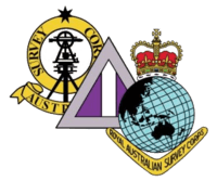
On the left is the coloured badge of the Australian Survey Corps 1915–1948. In the middle is the colour patch of Survey Corps units in the 2nd AIF (World War II) – it is based on the colour patch of the World War I 1st ANZAC and Australian Corps Topographic Sections: the triangle shape shows that Survey units were generally assigned at higher formation (Corps) level; the colour purple is the Engineer colour and the central vertical white stripe completed the Survey patch; the grey background was that of the 2nd AIF – this patch (minus the AIF grey background) was the basis of Survey unit colour patches when Army reintroduced unit colour patches in 1987. On the right is the coloured badge of the Royal Australian Survey Corps.[1]
See also
References
- ↑ 1.0 1.1 1.2 1.3 1.4 1.5 1.6 1.7 1.8 1.9 1.10 Fitzgerald, Lawrence, Brigadier (Retd) RA Svy, 1980, Lebanon to Labuan, ISBN 0959497900
- ↑ 2.0 2.1 2.2 2.3 2.4 2.5 2.6 2.7 2.8 2.9 2.10 2.11 2.12 2.13 2.14 Coulthard-Clark, CD, 2000, Australia's Military Mapmakers – The Royal Australian Survey Corps 1915–96, Oxford University Press, ISBN 0-19-551343-6
- ↑ Reilly, SE, Soldiers and Surveyors, 1983; The Australian Surveyor, March 1983, Vol 31, No 5, p 315
- ↑ Mundle, Rob Cook From Sailor to Legend Harper Collins Publishers, 2013
- ↑ Lines, John D Australia on Paper – The Story of Australian Mapping, Fortune Publications, 1992, ISBN 0 646 09769 5
- ↑ Amery, The Times History of the War in South Africa 1899–1902, vol 6, p350
- ↑ 7.0 7.1 Sargent, Clem, Lieutenant-Colonel RA Svy, 1990, The Royal Australian Survey Corps 1915–1990
- ↑ 8.0 8.1 Royal Australian Survey Corps Association Bulletin 1965 to 1989
- ↑ 9.0 9.1 School of Military Survey,1985, The Chronology of RA Svy Corps, Edition 2
- ↑ 10.0 10.1 Jensen, Peter, Lieutenant-Colonel RA Svy/RAE, A Nominal Roll of the Royal Australian Survey Corps 1910–1996, 5th draft, April 2014
- ↑ 11.0 11.1 Quinlan, Cecil Verdon, Major, Survey Section RAE 1913–15, Australian Map Makers, The Australian Surveyor, Sept 1, 1943
- ↑ National Archives of Australia, World War I personnel service records
- ↑ Raisbeck, JJ Captain, Australian Survey Corps, A Short History of the Military Survey of Australia, 1907–1936, The Australian Surveyor, Sept 1, 1937
- ↑ Vance, TA Major, Mapping a Continent, The Australian Surveyor, Sept 2, 1940
- ↑ Australian Government Gazette, 6 March 1947
- ↑ 16.0 16.1 16.2 Jensen, Peter A, Lieutenant-Colonel RA Svy/RAE, Post-World War II Topographic Mapping by the Royal Australian Survey Corps paper presented at the Mapping Sciences Institute of Australia Conference 2011 – 100 years of National Topographic Mapping, Feb 2011
- ↑ The Royal Australian Survey Corps - Products Catalogue 1993, DEF/MISC/6307, 1993
- ↑ Laing, A.W. Colonel (Retd) RA Svy, The End of an Era - A short history of the Royal Australian Survey Corps' involvement in mapping, charting and geodesy in Papua New Guinea in the period 1942-1995 unpublished 1995
- ↑ 19.0 19.1 Address by His Excellency Major General Michael Jeffery AC CVO MC Governor-General of the Commonwealth of Australia on the occasion of the unveiling of a memorial plaque commemorating the Royal Australian Survey Corps units which served in war, at the Australian War Memorial 9 July 2007
Further reading
- Coulthard-Clark, Christopher David (2000). Australia's Military Map-Makers: The Royal Australian Survey Corps 1915–96. South Melbourne: Oxford University Press. ISBN 0-19-551343-6.
- Fitzgerald, Lawrence, Brigadier (Retd) (1980). Lebanon to Labuan. Melbourne: JG Holmes Pty Ltd. ISBN 0959497900.
| ||||||||||||||||||||||