Roxburgh Dam
| Roxburgh Dam | |
|---|---|
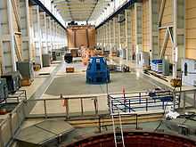
 Roxburgh Dam machine hall | |
 | |
| Location | Central Otago, New Zealand |
| Coordinates | 45°28′33″S 169°19′21″E / 45.475811°S 169.322555°ECoordinates: 45°28′33″S 169°19′21″E / 45.475811°S 169.322555°E |
| Dam and spillways | |
| Type of dam | Concrete gravity dam |
| Impounds | Clutha River / Mata-Au |
| Height | 76 m (249 ft) |
| Length | 358 m (1,175 ft) |
| Width (crest) | 10.7 m (35 ft) |
| Width (base) | 61 m (200 ft) |
| Reservoir | |
| Creates | Lake Roxburgh |
| Surface area | 6 km2 (2.3 sq mi) |
| Power station | |
| Commission date | 1956 - 1962 |
| Turbines | 8 |
| Installed capacity | 320 MW (430,000 hp) |
| Annual generation | 1,650 GWh (5,900 TJ) |
The Roxburgh Dam is the earliest of the large hydroelectric projects in the southern South Island of New Zealand. It lies across the Clutha River / Mata-Au, some 160 kilometres (99 mi) from Dunedin, some 9 kilometres (5.6 mi) to the north of the town of Roxburgh. The settlement of Lake Roxburgh Village close to the western edge of the dam.
Construction
The dam was constructed by a joint venture company between Holland, Hannen & Cubitts of the UK and S A Conrad Zschokke of Switzerland between 1949 and 1953.[1] Because of a lack of performance the initial contract was closed in 1953 and a new contract in which the original two companies were joined by Downer, a New Zealand construction company completed the main construction of the Station in 1957. The power station was commissioned over the period 1956-1962.
Roxburgh power station
The generating capacity was doubled in 1961-62. Today the eight-unit power station has a capacity of 320 megawatts (430,000 hp) operated by Contact Energy.[2]
Lake Roxburgh
Lake Roxburgh, the lake formed behind the dam, extends for nearly 30 kilometres (19 mi) towards the town of Alexandra.
Gallery
-

Spillway
-
Outdoor view, cleary showing the eight penstocks
See also
References
Further reading
- Martin, John E, ed. (1991). People, Power and Power Stations: Electric Power Generation in New Zealand 1880 - 1990. Wellington: Bridget Williams Books Ltd and Electricity Corporation of New Zealand. pp. 316 pages. ISBN 0-908912-16-1.
- Reilly, Helen (2008). Connecting the Country: New Zealand’s National Grid 1886 - 2007. Wellington: Steele Roberts. pp. 376 pages. ISBN 978-1-877448-40-9.
- Sheridan, Marion (1995). Dam Dwellers – End of an Era. Twizel: Sheridan Press. pp. 392 pages. ISBN 0-473-03402-6.
| ||||||||||||||||||||||||||||||||||
