Rougemont-le-Château
| Rougemont-le-Château | ||
|---|---|---|
|
Village overview | ||
| ||
 Rougemont-le-Château | ||
|
Location within Franche-Comté region  Rougemont-le-Château | ||
| Coordinates: 47°44′08″N 6°58′02″E / 47.7356°N 6.9672°ECoordinates: 47°44′08″N 6°58′02″E / 47.7356°N 6.9672°E | ||
| Country | France | |
| Region | Franche-Comté | |
| Department | Territoire de Belfort | |
| Arrondissement | Belfort | |
| Canton | Rougemont-le-Château | |
| Intercommunality | Pays sous Vosgien | |
| Government | ||
| • Mayor (2014–2020) | Didier Vallverdu | |
| Area1 | 16.64 km2 (6.42 sq mi) | |
| Population (20098)2 | 1,396 | |
| • Density | 84/km2 (220/sq mi) | |
| INSEE/Postal code | 90089 / 90110 | |
| Elevation | 422–1,031 m (1,385–3,383 ft) | |
|
1 French Land Register data, which excludes lakes, ponds, glaciers > 1 km² (0.386 sq mi or 247 acres) and river estuaries. 2 Population without double counting: residents of multiple communes (e.g., students and military personnel) only counted once. | ||
.svg.png)
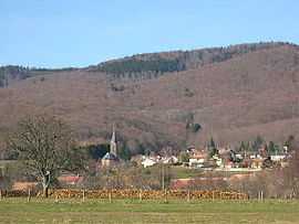
Rougemont-le-Château is a commune in the Territoire de Belfort département in Franche-Comté in northeastern France.
Sights and monuments
- Château de Rougemont, ruined 12th century castle
- Chapelle Sainte-Catherine, near the castle ruins
See also
| Wikimedia Commons has media related to Rougemont-le-Château . |