Rossett
| Rossett | |
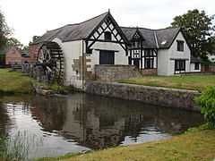 16th century mill in Rossett |
|
 Rossett |
|
| Population | 3,336 (2001 Census)[1] |
|---|---|
| OS grid reference | SJ368573 |
| Principal area | Wrexham |
| Ceremonial county | Clwyd |
| Country | Wales |
| Sovereign state | United Kingdom |
| Post town | WREXHAM |
| Postcode district | LL12 |
| Dialling code | 01978, 01244 |
| Police | North Wales |
| Fire | North Wales |
| Ambulance | Welsh |
| EU Parliament | Wales |
| UK Parliament | Wrexham |
| Welsh Assembly | Wrexham |
Coordinates: 53°06′32″N 2°56′42″W / 53.109°N 2.945°W
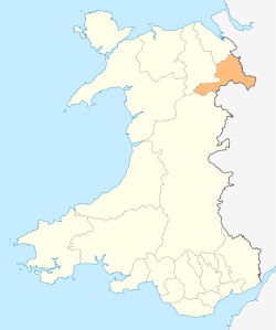
Rossett (Welsh: yr Orsedd, yr Orsedd Goch) is a village and a local government community, the lowest tier of local government, part of Wrexham County Borough in Wales. Rossett is served by the A483 road.
At the time of the 2001 Census, Rossett community (including Rossett itself and the villages of Burton, Burton Green and Lavister) had a total population of 3,336 people.[1]
Geography
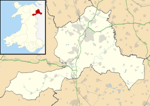
Rossett is geographically located near to the Welsh and English border towns of Wrexham 6.5 miles (10.5 km) and Chester 7.5 miles (12.1 km). The village sits close to the Wales-England border and is built on the banks of the River Alyn which is a tributary of the River Dee one-and-a-half miles downstream.
Rossett's neighbouring villages are Marford, Burton and Holt and Pulford in England.
Community
In terms of amenities, Rossett is well served by schools and village shops. The village has two hotels: Llyndir Hall Hotel and Rossett Hall Hotel, a converted mid eighteenth century house. Local public houses include the Butcher's Arms, the Golden Lion and the Alyn, all located centrally in Rossett. A short walk out of the village center presents the two pubs the Griffin Inn and the Nags Head.
Christ Church, completed in 1892 and replacing an earlier church on the same site, is of Gothic Revival design.[2] The village's war memorial is sited in its churchyard. Other places of worship include the Old Church, the Catholic Church of Christ the King, a Baptist church and a Presbyterian Chapel.
Landmarks
Trevalyn Hall is a Grade II* listed Elizabethan manor house built in 1576. The house and its grounds were owned by the Trevor family for several generations. During the 1980s the building was converted into apartments.[3]
Rossett Mill, is a Grade II* listed watermill built in 1588. Of timber framed construction on a stone base, the mill was extended in 1661 and during the 1820s. The mill is occasionally opened to the public for visiting. The landscape artist J. M. W. Turner sketched the building in 1795.[4]
Marford Mill, opposite Rossett Mill, was first built around 1086 and is mentioned in the Domesday Book. Until the building of Rossett Mill it was the only mill in the area. Marford Mill has an unusual double wheel. The Mill has been the home, since the 1980s, to the British Association for Shooting and Conservation, the UK's largest shooting association.[5]
Cook's Bridge crosses the River Alyn and is Grade II listed. It is a single span stone bridge constructed in the early nineteenth century.[6]
A sacred well, St Peter's well, rises 450 yards from the site of an old chapel which was demolished in the 17th century. The well had a reputation for the cure of sore eyes and sprained limbs.[7]
References
- ↑ 1.0 1.1 2001 Census: Rossett, Office for National Statistics, retrieved 11 November 2008
- ↑ Listed buildings: Christ Church, Rossett Online, retrieved 5 February 2009
- ↑ Listed buildings: Trevalyn Hall, Rossett Online, retrieved 5 February 2009
- ↑ Listed buildings: Rossett Mill, Rossett Online, retrieved 5 February 2009
- ↑ http://basc.org.uk/about-basc/history-of-marford-mill/
- ↑ Listed buildings: Cook's Bridge, Rossett Online, retrieved 5 February 2009
- ↑ http://wellhopper.wordpress.com/2011/08/01/st-peters-well-rossett/
External links
- Rossett Online
- BBC Wales: Rossett
- www.geograph.co.uk: photos of Rossett and surrounding area
- Rossett Community Council
| ||||||||||||||||||||||||||||||||||||