Rosevale, Queensland
| Rosevale Queensland | |||||||||||||
|---|---|---|---|---|---|---|---|---|---|---|---|---|---|
|
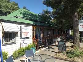
Rosevale Retreat Hotel, 2015 | |||||||||||||
 Rosevale | |||||||||||||
| Coordinates | 27°52′1″S 152°29′23″E / 27.86694°S 152.48972°ECoordinates: 27°52′1″S 152°29′23″E / 27.86694°S 152.48972°E | ||||||||||||
| Population | 268 (2011)[1] | ||||||||||||
| Postcode(s) | 4340 | ||||||||||||
| Elevation | 105 m (344 ft) | ||||||||||||
| LGA(s) | Scenic Rim Region | ||||||||||||
| State electorate(s) | Beaudesert | ||||||||||||
| Federal Division(s) | Wright | ||||||||||||
| |||||||||||||
Rosevale is a small rural town in the Scenic Rim Region, Queensland, Australia.[2] At the 2011 Australia Census the town recorded a population of 268.[1]
The Bremer River passes through the town.
History

Spring fed waterhole, 1954
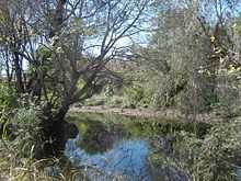
Bremer River, 2011
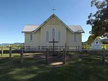
St Paul's Lutheran Church, 2015
The name Rosevale is a corruption of Rossvale, the name of a pastoral run pastoral used first in 1850s by William Ross.[2]
The Historic Rosevale Retreat Hotel, built in 1852 as a homestead, is the state's oldest hotel building. A victuallers license was granted in 1887 to a Matthew Carmody.[3]
Rosevale has previously belonged to the Shire of Mutdapilly, Shire of Moreton and the Shire of Boonah local government areas.
Heritage listings
Rosevale has a number of heritage-listed sites, including:
- Rosewood - Aratula Road: St Patrick's Church and Graveyard [4]
- 572 Rosevale Road: St Paul's Lutheran Church [5]
- 903 Rosevale Road: Rosevale Retreat Hotel [5]
References
- ↑ 1.0 1.1 Australian Bureau of Statistics (31 October 2012). "Rosevale (State Suburb)". 2011 Census QuickStats. Retrieved 12 July 2013.
- ↑ 2.0 2.1 "Rosevale". Place name details. Queensland Government. Retrieved 12 July 2013.
- ↑ "History". Rosevale Retreat Hotel. Retrieved 9 February 2015.
- ↑ "St Patrick's Church and Graveyard (entry 24286)". Queensland Heritage Register. Queensland Heritage Council. Retrieved 2013-07-12.
- ↑ 5.0 5.1 "Local Heritage Register" (PDF). Scenic Rim Regional Council. Retrieved 10 February 2015.
External links
![]() Media related to Rosevale, Queensland at Wikimedia Commons
Media related to Rosevale, Queensland at Wikimedia Commons
| ||||||||||