Rosendale, Missouri
| Rosendale, Missouri | |
|---|---|
| City | |
 | |
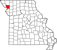
 Location of Rosendale, Missouri | |
| Coordinates: 40°2′30″N 94°49′19″W / 40.04167°N 94.82194°WCoordinates: 40°2′30″N 94°49′19″W / 40.04167°N 94.82194°W | |
| Country | United States |
| State | Missouri |
| County | Andrew |
| Area[1] | |
| • Total | 0.30 sq mi (0.78 km2) |
| • Land | 0.29 sq mi (0.75 km2) |
| • Water | 0.01 sq mi (0.03 km2) |
| Elevation | 912 ft (278 m) |
| Population (2010)[2] | |
| • Total | 143 |
| • Estimate (2012[3]) | 144 |
| • Density | 493.1/sq mi (190.4/km2) |
| Time zone | Central (CST) (UTC-6) |
| • Summer (DST) | CDT (UTC-5) |
| ZIP code | 64483 |
| Area code(s) | 816 |
| FIPS code | 29-63200[4] |
| GNIS feature ID | 0730201[5] |
Rosendale is a city in Andrew County, Missouri, United States. The population was 143 at the 2010 census. Prior to 1881, Rosendale was known as Ogle Mills. It was later named after roses that grew in the area.
Rosendale is part of the St. Joseph, MO–KS Metropolitan Statistical Area.
History
John Gaemlich came from the country of Germany and migrated west up the Missouri River with Joseph Robidouix. John bought the 160 acres (0.65 km2) of section 35 (the town of Rosendale) from Wingate King on September 16, 1856. John was a boot maker and shoe cobbler.
The settlement was first known as Ogles Mill, MO and was later given the name Rosendale in 1869 by Mr. Gaemlich, due partly to the love for the flower and because wild roses grew profusely in the bottom land in and around the village. Gaemlich operated the scales at the stockyards and served as the first mayor of Rosendale in 1881. John Gaemlich died in 1882 at the age of 68.
The first post office was started in 1856 by a man named Benjamin Ogle when the settlement was still known as Ogles Mill.
The Creston Branch of the Burlington Railroad was completed through Rosendale in 1869. Mr. Gaemlich had the town platted in April 1869, which consisted of 40 lots situated on the west half of the southwest quarter of Section 35, Township 61, Range 35, one-half which was donated to the railroad for the purpose of securing a depot. This plat was resurveyed by the company in May, 1870, and as revised showed 310 lots and six streets: Water, Main, Locust, Oak, Sylvan, and Elm. The railroad company retained possession of every alternate lot, which were at once placed upon the market and several of them sold. The most eligible lots were retained by Mr. Gaemlich.
The building of a depot started a short time after trains began running and attracted attention to the village as a shipping point. In 1872 the telegraph was added to the depot.
In 1883 the railroad built a new stockyard and erected a new depot. Four passenger trains passed through Rosendale from Creston, IA, to St. Joseph, MO daily.
In later years the passenger-mail train "The Bug" made one trip daily. Making its last run June 27, 1959. Freight trains, which occasionally include a passenger coach, passed through Rosendale until the swollen 102 took out the railroad bridge south of town June 15, 1967.
The Farmers Sate Bank, organized in 1895, was first called the Rosendale Bank. In 1921, the bank was reported to be in failing condition. On March 29, 1921, W.W. Wells, Pres., George Baum, V.P., Ed Adams, Sec., directors, and stockholders met and organized a new bank called The Farmers State Bank. The Farmers State Bank has always been known as "The Bank of Friendly Service" and would strive to fulfill this motto for many years to come.
The town of Rosendale has a flooding season that lasts about 9 months. The other 3 months the 102 River is frozen. The 102 River doesn't look very big when one drives over top of it on the Rosendale Bridge, but this tiny River can cause some very big damage in a very short time. The town of Rosendale has been hit with numerous small floods since the first flood recorded in 1883, but it has been hit with only 3 floods that were record breaking. The smaller floods would fill up the low lying area and would also cover some of the streets. Yes, the smaller floods would close all roads in and out of the town for a car, but a pickup could still get through. Now when the last 3 big floods came through they engulfed the whole town. There were only small areas, if any, in the whole town that was dry. The only way in or out of the town was by boat. The first record breaking flood came in 1965. There is not much written about this flood, except it was the first flood to cross the road east of the bridge. The 2nd and 3rd record breaking floods both came in 1993. There was only about a week's break between these two massive floods. The first of these two floods was only slightly larger than the 1965 flood. Everyone thought that this would be the biggest flood ever seen for another 28 years. They were wrong. In two weeks after the waters had gone down, another flood came. It was even more massive. This flood broke every record. This massive flood engulfed everything around and covered everything in sight. This flood even ran over the Rosendale Bridge and crossed the road down by the "C" Highway bridge which had never been seen.
Consequently, this is the reason why the school, post office moved out of town, the gas station closed down and why many of the towns people moved out.
Some of the information for this page was taken from the book Pioneer On The 102: Rosendale.
The Town Today
The town of Rosendale as of 1993 had 118 residents still living in the town. Since the recent year of 1996 the High School (North Andrew R-6) has relocated in a new building out of town to the junction of Highway 71 and Highway 48. The school district has consolidated with several small towns, Rosendale, Bolckow, Rea, and Fillmore. The school now inhabits 400 students K-12. A post office has also moved out of town which is now located a half mile east of town. The gas station (Super 48) closed. The Bank (Farmer's State Bank) closed at the beginning of 1997. There is only one store that is still in Rosendale, Beattie's Groceries. One new business has moved into the town of Rosendale that now inhabits the old school building. The name of the business is Riverside Agribusiness. Sadly, the reason for much of the exodus mentioned is the river and its threat of flooding.
Geography
Rosendale is located at 40°2′30″N 94°49′19″W / 40.04167°N 94.82194°W (40.041565, -94.821874),[6] on the east bank of the One Hundred and Two River.
According to the United States Census Bureau, the city has a total area of 0.30 square miles (0.78 km2), of which, 0.29 square miles (0.75 km2) is land and 0.01 square miles (0.03 km2) is water.[1]
Demographics
2010 census
As of the census[2] of 2010, there were 143 people, 50 households, and 38 families residing in the city. The population density was 493.1 inhabitants per square mile (190.4/km2). There were 74 housing units at an average density of 255.2 per square mile (98.5/km2). The racial makeup of the city was 98.6% White, 0.7% Native American, and 0.7% from other races. Hispanic or Latino of any race were 0.7% of the population.
There were 50 households of which 38.0% had children under the age of 18 living with them, 62.0% were married couples living together, 12.0% had a female householder with no husband present, 2.0% had a male householder with no wife present, and 24.0% were non-families. 22.0% of all households were made up of individuals and 2% had someone living alone who was 65 years of age or older. The average household size was 2.86 and the average family size was 3.37.
The median age in the city was 32.8 years. 31.5% of residents were under the age of 18; 8.4% were between the ages of 18 and 24; 23.8% were from 25 to 44; 24.5% were from 45 to 64; and 11.9% were 65 years of age or older. The gender makeup of the city was 54.5% male and 45.5% female.
2000 census
As of the census[4] of 2000, there were 180 people, 69 households, and 50 families residing in the city. The population density was 578.4 people per square mile (224.2/km²). There were 76 housing units at an average density of 244.2 per square mile (94.7/km²). The racial makeup of the city was 99.44% White, and 0.56% from two or more races. Hispanic or Latino of any race were 0.56% of the population.
There were 69 households out of which 37.7% had children under the age of 18 living with them, 52.2% were married couples living together, 15.9% had a female householder with no husband present, and 27.5% were non-families. 18.8% of all households were made up of individuals and 5.8% had someone living alone who was 65 years of age or older. The average household size was 2.61 and the average family size was 3.06.
In the city the population was spread out with 30.0% under the age of 18, 9.4% from 18 to 24, 30.6% from 25 to 44, 18.3% from 45 to 64, and 11.7% who were 65 years of age or older. The median age was 31 years. For every 100 females there were 97.8 males. For every 100 females age 18 and over, there were 103.2 males.
The median income for a household in the city was $26,731, and the median income for a family was $30,313. Males had a median income of $25,179 versus $18,750 for females. The per capita income for the city was $12,847. About 10.2% of families and 11.9% of the population were below the poverty line, including 10.9% of those under the age of eighteen and 20.0% of those sixty five or over.
References
- ↑ 1.0 1.1 "US Gazetteer files 2010". United States Census Bureau. Retrieved 2012-07-08.
- ↑ 2.0 2.1 "American FactFinder". United States Census Bureau. Retrieved 2012-07-08.
- ↑ "Population Estimates". United States Census Bureau. Retrieved 2013-05-30.
- ↑ 4.0 4.1 "American FactFinder". United States Census Bureau. Retrieved 2008-01-31.
- ↑ "US Board on Geographic Names". United States Geological Survey. 2007-10-25. Retrieved 2008-01-31.
- ↑ "US Gazetteer files: 2010, 2000, and 1990". United States Census Bureau. 2011-02-12. Retrieved 2011-04-23.
External links
- Historic maps of Rosendale in the Sanborn Maps of Missouri Collection at the University of Missouri
| |||||||||||||||||||||||||