Roseland, Indiana
| Roseland, Indiana | |
|---|---|
| Town | |
|
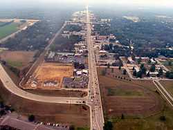
Roseland from the air, looking north | |
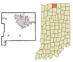 Location of Roseland in the state of Indiana | |
| Coordinates: 41°43′7″N 86°15′6″W / 41.71861°N 86.25167°WCoordinates: 41°43′7″N 86°15′6″W / 41.71861°N 86.25167°W | |
| Country | United States |
| State | Indiana |
| County | St. Joseph |
| Township | Clay |
| Area[1] | |
| • Total | 0.38 sq mi (0.98 km2) |
| • Land | 0.38 sq mi (0.98 km2) |
| • Water | 0 sq mi (0 km2) |
| Elevation | 728 ft (222 m) |
| Population (2010)[2] | |
| • Total | 630 |
| • Estimate (2012[3]) | 628 |
| • Density | 1,657.9/sq mi (640.1/km2) |
| Time zone | Eastern (EST) (UTC-5) |
| • Summer (DST) | EDT (UTC-4) |
| FIPS code | 18-65988[4] |
| GNIS feature ID | 0452756[5] |
| Website | http://www.roselandgov.org/ |
Roseland is a town in Clay Township, St. Joseph County, Indiana, United States. The population was 630 at the 2010 Census. It is part of the South Bend–Mishawaka, IN-MI, Metropolitan Statistical Area.
Roseland is known as "The Gateway Town." It is located at the Notre Dame/South Bend exit of the Indiana Toll Road (Interstate 80/90), making it a good location for many restaurants, hotels and gasoline stations.
Geography
Roseland is located at 41°43′07″N 86°15′06″W / 41.718647°N 86.251622°W.[6]
According to the 2010 census, the town has a total area of 0.38 square miles (0.98 km2), all land.[1]
Demographics
2010 census
As of the census[2] of 2010, there were 630 people, 287 households, and 148 families residing in the town. The population density was 1,657.9 inhabitants per square mile (640.1/km2). There were 348 housing units at an average density of 915.8 per square mile (353.6/km2). The racial makeup of the town was 87.5% White, 2.7% African American, 1.0% Native American, 4.6% Asian, 0.2% Pacific Islander, 1.9% from other races, and 2.2% from two or more races. Hispanic or Latino of any race were 5.1% of the population.
There were 287 households of which 20.6% had children under the age of 18 living with them, 40.8% were married couples living together, 6.6% had a female householder with no husband present, 4.2% had a male householder with no wife present, and 48.4% were non-families. 32.8% of all households were made up of individuals and 9.8% had someone living alone who was 65 years of age or older. The average household size was 2.20 and the average family size was 2.71.
The median age in the town was 35.2 years. 14.3% of residents were under the age of 18; 16.5% were between the ages of 18 and 24; 30% were from 25 to 44; 26.1% were from 45 to 64; and 13.2% were 65 years of age or older. The gender makeup of the town was 48.9% male and 51.1% female.
2000 census
As of the census[4] of 2000, there were 645 people (corrected count), 311 households, and 171 families residing in the town. The population density was 1612.5 people per square mile (645/km²). There were 336 housing units at an average density of 864.7 per square mile (332.6/km²). The racial makeup of the town was 91.60% White, 1.16% African American, 0.61% Native American, 2.16% Asian, 2.93% from other races, and 1.55% from two or more races. Hispanic or Latino of any race were 5.31% of the population.
There were 311 households out of which 20.9% had children under the age of 18 living with them, 43.4% were married couples living together, 8.0% had a female householder with no husband present, and 44.7% were non-families. 37.9% of all households were made up of individuals and 12.9% had someone living alone who was 65 years of age or older. The average household size was 2.06 and the average family size was 2.73.
In the town the population was spread out with 6.4% under the age of 18, 66.4% from 18 to 24, 13.2% from 25 to 44, 7.7% from 45 to 64, and 6.3% who were 65 years of age or older. The median age was 21 years. For every 100 females there were 21.1 males. For every 100 females age 18 and over, there were 18.5 males.
The median income for a household in the town was $33,214, and the median income for a family was $38,750. Males had a median income of $35,000 versus $23,611 for females. The per capita income for the town was $9,450. About 5.1% of families and 5.7% of the population were below the poverty line, including 7.7% of those under age 18 and 3.7% of those age 65 or over.
Government
Roseland was incorporated in 1916. The town has three council members and a clerk treasurer.
Recent residential development
In 2012, construction began on a new University Edge apartment complex in Roseland, expected to open in August 2013. Phase one of the high-end apartment complex will have 144 units — housing for 420 residents — and is being marketed primarily to students at the University of Notre Dame, Saint Mary’s College and other local campuses. The land was cleared and building framing started for the apartment complex, which is along Indiana 933 south of Pendle Road.[7]
Construction of phase two of University Edge, near the east edge of the property, is expected to begin in spring 2014 and be complete by August 2014. If fully occupied, the completed complex will house 560 residents.
A walking/biking path will be constructed between University Edge and nearby University Village, Notre Dame’s married student housing complex. The shuttle bus that runs between the Notre Dame and Saint Mary’s campuses stops regularly at University Village. In 2012, the university proposed a plan that would close existing Douglas Road through campus and create a new four-lane east-west roadway in the fields at the north end of campus. Notre Dame would pay the full cost of the project. If the road-move proposal is approved by St. Joseph County, the new road will include adjacent paved bike/walking paths. A paved path leading to University Edge is included in the plan.
The number of Roseland residents is expected to rise by as much as 67 percent by August 2013.
See also
References
- ↑ 1.0 1.1 "Places: Indiana". 2010 Census Gazetteer Files. United States Census Bureau. Retrieved 2012-04-21.
- ↑ 2.0 2.1 "American FactFinder". United States Census Bureau. Retrieved 2012-12-11.
- ↑ "Population Estimates". United States Census Bureau. Retrieved 2013-06-25.
- ↑ 4.0 4.1 "American FactFinder". United States Census Bureau. Retrieved 2008-01-31.
- ↑ "US Board on Geographic Names". United States Geological Survey. 2007-10-25. Retrieved 2008-01-31.
- ↑ "US Gazetteer files: 2010, 2000, and 1990". United States Census Bureau. 2011-02-12. Retrieved 2011-04-23.
- ↑ "Roseland readies for population boom from student apartments," November 02, 2012, by MARGARET FOSMOE, South Bend Tribune
External links
- Town of Roseland, Indiana website
- Private Roseland website
- The Roseland Saga - South Bend Tribune special archive
- Compendium of Roseland press coverage
- Town of Roseland May Get Help (Indiana Law Blog)
- IN.gov
- IN.gov
- WVPE.org (Celtic Festival)
| |||||||||||||||||||||||||||||||||