Rose Atoll Marine National Monument
| Rose Atoll Marine National Monument | |
|---|---|
|
IUCN category V (protected landscape/seascape) | |
|
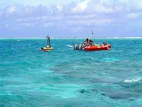
Oceanographers deploy a buoy inside Rose Atoll | |
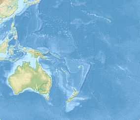
 Map showing the location Rose Atoll in Oceania | |
| Coordinates | 14°32′45″S 168°09′00″W / 14.5458333°S 168.15°WCoordinates: 14°32′45″S 168°09′00″W / 14.5458333°S 168.15°W |
| Area | 8,571,633 acres (3,468,817 ha)[1] |
| Governing body | U.S. Fish and Wildlife Service |
Rose Atoll Marine National Monument is a U.S. national monument in the South Pacific Ocean, covering 8,571,633 acres (13,393.18 sq mi; 34,688.17 km2)[1] and encompassing the Rose Atoll National Wildlife Refuge, which was established in 1973 with 39,066 acres (only 20 acres (81,000 m2) emergent). The monument's marine areas are likely to also be incorporated in the Fagatele Bay National Marine Sanctuary.
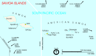
Rose Atoll is a small island about 170 miles (270 km) to the east of Tutuila, the principal island of American Samoa. It is a nesting site for rare species of petrels, shearwaters, and terns; and at the signing of the order establishing the monument, President George W. Bush noted that "the waters surrounding the atoll are the home of many rare species, including giant clams and reef sharks—as well as an unusual abundance of rose-colored corals".[2] The wildlife refuge is managed by the United States Fish and Wildlife Service, and the wider-ranging monument waters are co-managed by the U.S. Fish and Wildlife Service and NOAA.
 President Bush signs paperwork establishing the Rose Atoll Marine National Monument on January 6, 2009. |
 Map of The Samoan Islands showing the location of Rose Atoll
|
References
- ↑ 1.0 1.1 "Annual Report of Lands as of September 30, 2010" (PDF). United States Fish and Wildlife Service. Retrieved 2012-03-18.
- ↑ "Bush Conserves Vast Areas of Pacific Ocean as Monuments". Environment News Service International Daily Newswire. ENS. 6 January 2009. Retrieved 24 November 2010.
External links
- U.S. Fish & Wildlife Service profile
- Refuge Website
- Rose Atoll National Wildlife Refuge Planning Update
- Copy of official map of National Monument designation (PDF)
- White House Press Release on Monument Designation
| ||||||||||||||
