Rolla, Kansas
| Rolla, Kansas | |
|---|---|
| City | |
|
Panorama of Rolla, Kansas (1935) | |
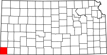
 Location within Morton County and Kansas | |
| Coordinates: 37°7′6″N 101°37′57″W / 37.11833°N 101.63250°WCoordinates: 37°7′6″N 101°37′57″W / 37.11833°N 101.63250°W | |
| Country | United States |
| State | Kansas |
| County | Morton |
| Area[1] | |
| • Total | 0.37 sq mi (0.96 km2) |
| • Land | 0.37 sq mi (0.96 km2) |
| • Water | 0 sq mi (0 km2) |
| Elevation | 3,320 ft (1,012 m) |
| Population (2010)[2] | |
| • Total | 442 |
| • Estimate (2012[3]) | 435 |
| • Density | 1,200/sq mi (460/km2) |
| Time zone | Central (CST) (UTC-6) |
| • Summer (DST) | CDT (UTC-5) |
| ZIP code | 67954 |
| Area code(s) | 620 |
| FIPS code | 20-60900 [4] |
| GNIS feature ID | 0470646 [5] |
Rolla is a city in Morton County, Kansas, United States. As of the 2010 census, the city population was 442.[6]
History
The first post office at Rolla was established in 1907.[7]
Rolla was laid out in 1913.[8] Rolla is a corruption of Raleigh, for Sir Walter Raleigh.[9]
Geography
Rolla is located at 37°7′6″N 101°37′57″W / 37.11833°N 101.63250°W (37.118293, -101.632391).[10] According to the United States Census Bureau, the city has a total area of 0.37 square miles (0.96 km2), all of it land.[1]
Climate
According to the Köppen Climate Classification system, Rolla has a semi-arid climate, abbreviated "BSk" on climate maps.[11]
Demographics
| Historical population | |||
|---|---|---|---|
| Census | Pop. | %± | |
| 1990 | 387 | — | |
| 2000 | 482 | 24.5% | |
| 2010 | 442 | −8.3% | |
| U.S. Decennial Census | |||
2010 census
As of the census[2] of 2010, there were 442 people, 166 households, and 124 families residing in the city. The population density was 1,194.6 inhabitants per square mile (461.2/km2). There were 190 housing units at an average density of 513.5 per square mile (198.3/km2). The racial makeup of the city was 83.3% White, 1.1% African American, 1.6% Native American, 0.5% Asian, 0.9% Pacific Islander, 9.5% from other races, and 3.2% from two or more races. Hispanic or Latino of any race were 24.2% of the population.
There were 166 households of which 39.2% had children under the age of 18 living with them, 57.2% were married couples living together, 11.4% had a female householder with no husband present, 6.0% had a male householder with no wife present, and 25.3% were non-families. 22.9% of all households were made up of individuals and 10.8% had someone living alone who was 65 years of age or older. The average household size was 2.66 and the average family size was 3.11.
The median age in the city was 35.1 years. 30.8% of residents were under the age of 18; 8.2% were between the ages of 18 and 24; 24.4% were from 25 to 44; 26.3% were from 45 to 64; and 10.4% were 65 years of age or older. The gender makeup of the city was 50.7% male and 49.3% female.
2000 census
As of the census[4] of 2000, there were 482 people, 165 households, and 121 families residing in the city. The population density was 1,411.1 people per square mile (547.4/km²). There were 199 housing units at an average density of 582.6 per square mile (226.0/km²). The racial makeup of the city was 81.95% White, 1.87% Native American, 0.41% Asian, 12.45% from other races, and 3.32% from two or more races. Hispanic or Latino of any race were 22.41% of the population.
There were 165 households out of which 41.8% had children under the age of 18 living with them, 63.6% were married couples living together, 6.1% had a female householder with no husband present, and 26.1% were non-families. 24.2% of all households were made up of individuals and 10.9% had someone living alone who was 65 years of age or older. The average household size was 2.92 and the average family size was 3.54.
In the city the population was spread out with 35.7% under the age of 18, 7.1% from 18 to 24, 28.4% from 25 to 44, 17.6% from 45 to 64, and 11.2% who were 65 years of age or older. The median age was 33 years. For every 100 females there were 93.6 males. For every 100 females age 18 and over, there were 105.3 males.
The median income for a household in the city was $38,500, and the median income for a family was $43,750. Males had a median income of $24,886 versus $14,583 for females. The per capita income for the city was $13,211. About 8.8% of families and 10.8% of the population were below the poverty line, including 11.2% of those under age 18 and 5.7% of those age 65 or over.
References
- ↑ 1.0 1.1 "US Gazetteer files 2010". United States Census Bureau. Retrieved 2012-07-06.
- ↑ 2.0 2.1 "American FactFinder". United States Census Bureau. Retrieved 2012-07-06.
- ↑ "Population Estimates". United States Census Bureau. Retrieved 2013-05-29.
- ↑ 4.0 4.1 "American FactFinder". United States Census Bureau. Retrieved 2008-01-31.
- ↑ "US Board on Geographic Names". United States Geological Survey. 2007-10-25. Retrieved 2008-01-31.
- ↑ "2010 City Population and Housing Occupancy Status". U.S. Census Bureau. Retrieved August 31, 2011.
- ↑ "Kansas Post Offices, 1828-1961 (archived)". Kansas Historical Society. Retrieved 16 June 2014.
- ↑ Kansas State Historical Society (1916). Biennial Report of the Board of Directors of the Kansas State Historical Society. Kansas State Printing Plant. p. 248.
- ↑ Malone, Ross (2010). Tales from Missouri and the Heartland. AuthorHouse. p. 16.
- ↑ "US Gazetteer files: 2010, 2000, and 1990". United States Census Bureau. 2011-02-12. Retrieved 2011-04-23.
- ↑ Climate Summary for Rolla, Kansas
External links
| Wikimedia Commons has media related to Rolla, Kansas. |
- City
- Schools
- USD 217, local school district
- Maps
- Rolla City Map, KDOT
| |||||||||||||||||