Roetgen
| Roetgen | ||
|---|---|---|
| ||
 Roetgen | ||
Location of Roetgen within Aachen district 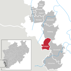
 | ||
| Coordinates: 50°39′N 6°12′E / 50.650°N 6.200°ECoordinates: 50°39′N 6°12′E / 50.650°N 6.200°E | ||
| Country | Germany | |
| State | North Rhine-Westphalia | |
| Admin. region | Köln | |
| District | Aachen | |
| Government | ||
| • Mayor | Manfred Eis (SPD) | |
| Area | ||
| • Total | 39.033 km2 (15.071 sq mi) | |
| Population (2013-12-31)[1] | ||
| • Total | 8,238 | |
| • Density | 210/km2 (550/sq mi) | |
| Time zone | CET/CEST (UTC+1/+2) | |
| Postal codes | 52159 | |
| Dialling codes | 02471 | |
| Vehicle registration | AC | |
| Website | www.roetgen.de | |

Roetgen is a municipality in the district of Aachen, in North Rhine-Westphalia, Germany.
Geography
Roetgen is located approximately 15 km (9 mi) south-east of Aachen, near the border to Belgium. It is attractive for commuters due to its close proximity to Aachen.
History
In World War II Roetgen was the first German town to fall under American control. They marched in on September 12. 1944 at 14.30 PM.
The city was the location of the court martial of Private Eddie Slovik in November 1944.
Division of the municipality
Roetgen consists of three districts:
- Roetgen
- Rott
- Mulartshütte
Mulartshütte is the oldest settlement of the three.
Photos
-

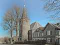
Roetgen, church
-
Roetgen, church
References
- ↑ "Amtliche Bevölkerungszahlen". Landesbetrieb Information und Technik NRW (in German). 4 September 2014.
External links
- Official site (German)
| ||||||||