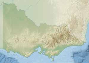
Rocky River (Victoria)
| Rocky | |
| River[1] | |
| Country | Australia |
|---|---|
| State | Victoria |
| Regions | South East Corner (IBRA), East Gippsland |
| Local government area | Shire of East Gippsland |
| Part of | Snowy River catchment |
| Source | Mount Murrungowar |
| - location | near Murrungowar |
| - elevation | 470 m (1,542 ft) |
| Mouth | confluence with the Jack River |
| - location | Brodribb Flora Reserve |
| - elevation | 41 m (135 ft) |
| - coordinates | 37°37′38″S 148°36′31″E / 37.62722°S 148.60861°ECoordinates: 37°37′38″S 148°36′31″E / 37.62722°S 148.60861°E |
| Length | 15 km (9 mi) |
| Nature reserve | Brodribb Flora Reserve |
 Mouth of the Rocky River in Victoria
| |
| [1][2] | |
The Rocky River is a perennial river of the Snowy River catchment, located in the East Gippsland region of the Australian state of Victoria.
Course and features
The Rocky River rises below Mount Murrungowar in a state forestry area west of the locality of Murrungowar, and flows generally southwest before reaching its confluence with the Jack River, within the Brodribb Flora Reserve in the Shire of East Gippsland. The river descends 430 metres (1,410 ft) over its 15-kilometre (9.3 mi) course.[2]
The catchment area of the river is administered by the East Gippsland Catchment Management Authority.
See also
References
- ↑ 1.0 1.1 "Rocky River: 24604". Vicnames. Government of Victoria. 2 May 1966. Retrieved 12 January 2014.
- ↑ 2.0 2.1 "Map of Rocky River, VIC". Bonzle Digital Atlas of Australia. Retrieved 12 January 2014.
External links
- "Snowy River sub-catchment". East Gippsland Catchment Management Authority. Government of Victoria.
- "Snowy River - Catchment Map" (map). East Gippsland Catchment Management Authority. Government of Victoria.
- East Gippsland Catchment Management Authority (2013). East Gippsland regional catchment strategy 2013 -2019 (PDF). Bairnsdale: East Gippsland Catchment Management Authority. ISBN 978-0-9758164-6-2.
| ||||||||||||||||||||||||||||||||||||||||||||||||||||||||||||||||||||||||||||