Rocky Ford, Colorado
| City of Rocky Ford, Colorado | |
|---|---|
| City | |
|
Rocky Ford City Hall | |
 Location in Otero County and the state of Colorado | |
| Coordinates: 38°3′4″N 103°43′17″W / 38.05111°N 103.72139°WCoordinates: 38°3′4″N 103°43′17″W / 38.05111°N 103.72139°W | |
| Country |
|
| State |
|
| County[1] | Otero County[2] |
| Incorporated | August 19, 1887[3] |
| Government | |
| • Type | Statutory City[1] |
| Area | |
| • Total | 1.7 sq mi (4.4 km2) |
| • Land | 1.7 sq mi (4.4 km2) |
| • Water | 0 sq mi (0 km2) |
| Elevation[2] | 4,180 ft (1,274 m) |
| Population (2000) | |
| • Total | 4,286 |
| • Density | 2,521.2/sq mi (974.1/km2) |
| Time zone | Mountain (MST) (UTC-7) |
| • Summer (DST) | MDT (UTC-6) |
| ZIP code[4] | 81067 |
| Area code(s) | 719 |
| FIPS code | 08-65190 |
| GNIS feature ID | 0195481 |
| Website | www.rockyfordcolo.com |

The City of Rocky Ford is a Statutory City located in Otero County, Colorado, United States. The population was 4,286 at the United States Census 2000.
Geography
Rocky Ford is located at 38°3′4″N 103°43′17″W / 38.05111°N 103.72139°W (38.051000, -103.721387).[5]
According to the United States Census Bureau, the city has a total area of 1.7 square miles (4.4 km2), of which, 1.7 square miles (4.4 km2) of it is land and 0.58% is water.
Demographics
As of the census[6] of 2000, there were 4,286 people, 1,655 households, and 1,136 families residing in the city. The population density was 2,521.8 people per square mile (973.4/km²). There were 1,852 housing units at an average density of 1,089.7 per square mile (420.6/km²). The racial makeup of the city was 72.42% White, 0.40% African American, 1.47% Native American, 0.75% Asian, 0.12% Pacific Islander, 21.86% from other races, and 2.99% from two or more races. Hispanic or Latino of any race were 57.14% of the population.
There were 1,655 households out of which 33.0% had children under the age of 18 living with them, 48.1% were married couples living together, 15.5% had a female householder with no husband present, and 31.3% were non-families. 28.0% of all households were made up of individuals and 12.7% had someone living alone who was 65 years of age or older. The average household size was 2.53 and the average family size was 3.07.
In the city the population was spread out with 28.2% under the age of 18, 8.7% from 18 to 24, 23.9% from 25 to 44, 21.6% from 45 to 64, and 17.6% who were 65 years of age or older. The median age was 37 years. For every 100 females there were 95.9 males. For every 100 females age 18 and over, there were 91.2 males.
The median income for a household in the city was $23,359, and the median income for a family was $29,470. Males had a median income of $26,271 versus $17,485 for females. The per capita income for the city was $12,742. About 14.6% of families and 20.3% of the population were below the poverty line, including 28.2% of those under age 18 and 11.6% of those age 65 or over.
Agriculture
Rocky Ford is noted for its cantaloupes and watermelons. Most of the Rocky Mountain region and the United States receives melon seeds from here. Rocky Ford recently gained international attention with U.S. President Barack Obama's public endorsement of their melons.
Gallery
-

Rocky Ford welcome sign
-

Restored railroad depot in Rocky Ford
-

Downtown Rocky Ford on U.S. Highway 50
-
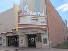
Grand Theatre in Rocky Ford
-

left|thumb|200px|First National Bank of Rocky Ford
-

First Baptist Church in Rocky Ford
-

Community Presbyterian Church in Rocky Ford; pastor Steve L. Culver (2010)
-

First Christian Church in Rocky Ford
-

Christine's Restaurant operates in a former church in Rocky Ford.
See also
- Outline of Colorado
- State of Colorado
- Colorado cities and towns
- Colorado municipalities
- Colorado counties
- Colorado cities and towns
- Arkansas River
- Rocky Ford High School
- Rocky Ford Station
- George W. Swink, town pioneer
References
- ↑ 1.0 1.1 "Active Colorado Municipalities". State of Colorado, Department of Local Affairs. Retrieved 2007-09-01.
- ↑ 2.0 2.1 "US Board on Geographic Names". United States Geological Survey. 2007-10-25. Retrieved 2008-01-31.
- ↑ "Colorado Municipal Incorporations". State of Colorado, Department of Personnel & Administration, Colorado State Archives. 2004-12-01. Retrieved 2007-09-02.
- ↑ "ZIP Code Lookup" (JAVASCRIPT/HTML). United States Postal Service. Retrieved December 26, 2007.
- ↑ "US Gazetteer files: 2010, 2000, and 1990". United States Census Bureau. 2011-02-12. Retrieved 2011-04-23.
- ↑ "American FactFinder". United States Census Bureau. Retrieved 2008-01-31.
External links
| |||||||||||||||||||||||||
