Rochefort-sur-Loire
| Rochefort-sur-Loire | ||
|---|---|---|
|
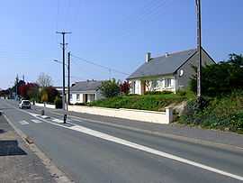
Eastern entry of Rochefort-sur-Loire | ||
| ||
 Rochefort-sur-Loire | ||
|
Location within Pays de la Loire region  Rochefort-sur-Loire | ||
| Coordinates: 47°21′28″N 0°39′17″W / 47.3578°N 0.6547°WCoordinates: 47°21′28″N 0°39′17″W / 47.3578°N 0.6547°W | ||
| Country | France | |
| Region | Pays de la Loire | |
| Department | Maine-et-Loire | |
| Arrondissement | Angers | |
| Canton | Chalonnes-sur-Loire | |
| Intercommunality | Communauté de communes Loire-Layon | |
| Government | ||
| • Mayor (2008–2014) | Roland Bernardeau | |
| Area1 | 27.8 km2 (10.7 sq mi) | |
| Population (2006)2 | 2,128 | |
| • Density | 77/km2 (200/sq mi) | |
| INSEE/Postal code | 49259 / 49190 | |
| Elevation | 12–104 m (39–341 ft) | |
|
1 French Land Register data, which excludes lakes, ponds, glaciers > 1 km² (0.386 sq mi or 247 acres) and river estuaries. 2 Population without double counting: residents of multiple communes (e.g., students and military personnel) only counted once. | ||
.svg.png)
Rochefort-sur-Loire is a commune in the Maine-et-Loire department in western France.
Geography
The commune is traversed by the river Layon.
See also
References
| Wikimedia Commons has media related to Rochefort-sur-Loire. |