Rives, Isère
| Rives | ||
|---|---|---|
|
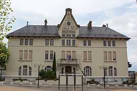
Town hall | ||
| ||
 Rives | ||
|
Location within Rhône-Alpes region  Rives | ||
| Coordinates: 45°21′06″N 5°30′11″E / 45.3517°N 5.5031°ECoordinates: 45°21′06″N 5°30′11″E / 45.3517°N 5.5031°E | ||
| Country | France | |
| Region | Rhône-Alpes | |
| Department | Isère | |
| Arrondissement | Grenoble | |
| Canton | Rives | |
| Intercommunality | Pays Voironnais | |
| Government | ||
| • Mayor (2014–2020) | Alain Dezempte | |
| Area1 | 10.93 km2 (4.22 sq mi) | |
| Population (2011)2 | 6,046 | |
| • Density | 550/km2 (1,400/sq mi) | |
| INSEE/Postal code | 38337 / 38140 | |
| Elevation | 314–469 m (1,030–1,539 ft) | |
|
1 French Land Register data, which excludes lakes, ponds, glaciers > 1 km² (0.386 sq mi or 247 acres) and river estuaries. 2 Population without double counting: residents of multiple communes (e.g., students and military personnel) only counted once. | ||

Rives is a commune in the Isère department in southeastern France.
Population
| Historical population | ||
|---|---|---|
| Year | Pop. | ±% |
| 1793 | 1,429 | — |
| 1806 | 1,715 | +20.0% |
| 1821 | 2,050 | +19.5% |
| 1831 | 2,014 | −1.8% |
| 1841 | 2,270 | +12.7% |
| 1851 | 2,339 | +3.0% |
| 1861 | 2,506 | +7.1% |
| 1872 | 2,543 | +1.5% |
| 1881 | 2,975 | +17.0% |
| 1891 | 3,083 | +3.6% |
| 1901 | 3,110 | +0.9% |
| 1911 | 3,156 | +1.5% |
| 1921 | 3,033 | −3.9% |
| 1931 | 3,139 | +3.5% |
| 1946 | 2,842 | −9.5% |
| 1954 | 3,139 | +10.5% |
| 1962 | 3,902 | +24.3% |
| 1968 | 4,589 | +17.6% |
| 1975 | 5,007 | +9.1% |
| 1982 | 5,115 | +2.2% |
| 1990 | 5,403 | +5.6% |
| 1999 | 5,620 | +4.0% |
| 2006 | 5,745 | +2.2% |
| 2011 | 6,046 | +5.2% |
Access
By road: By motorway (A48) or the Départemental Road, the D1085, between Lyon and Grenoble By train: The TER Lyon Perrache/Saint André le Gaz/Grenoble line. Rives station is a terminus for some TER suburban trains of the Grenoble Metro By plane: Saint Étienne de Saint Geoirs' airport (code GNB) is 15 kilometres away from Rives (20 minutes by car.)
Transport
Pays Voironnais network
- The bus line n°10 goes from the railstation to the down-town (route de la Liampre)
- The bus line J stops at Rives
- Some buses of the line M stops at Rives
Transisère network
- The bus line 7300 (Beaurepaire-Grenoble) stops at the station "Rives le plan".
- Some buses of the line 2900 (Vienne-Grenoble) stops at the station "Rives le plan".
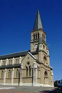
The church of Rives
Personalities
- Napoleon Bonaparte spent a night in Rives, on his return from Elba, in a building that is now a bank. A plaque commemorates the visit.
- Luc Court, motor-car builder was born here in 1862.
- Jérémy Clément, footballer of Paris Saint-Germain was originally from Rives.
- Raphaël Poirée, biathlete was born here.
International relations
- Forlì del Sannio, Italy
- Refojos de Basto, Portugal
See also
References
External links
(All French language)
| Wikimedia Commons has media related to Rives (Isère). |