River Witham |
|
| |
|
| The Grand Sluice at Boston, where the River Witham empties into The Haven, which is tidal below this point |
| Country |
United Kingdom |
| Country within the UK |
England |
| Counties |
Lincolnshire, Leicestershire |
| Cities |
Lincoln |
| Towns |
Grantham, Boston |
|
|
| Tributaries |
| - left |
Grantham Canal, Foston Beck, Ease Drain, Shire Dyke, Fossdyke Navigation, Barlings Eau, Tupholme Beck, Bucknall Beck, Catchwater Drain, The Sewer, Engine Drain |
| - right |
Honington Beck, River Brant, Branston Delph, Middle Drain, Cathole Drain, Nocton Drain, Nocton Bankside Drain, Dunston Bankside Drain, Water Dike, Duns Dike, Metheringham Delph |
|
|
|
|
| Source |
|
| - location |
South Witham, Lincolnshire |
| - elevation |
130 m (427 ft) |
| - coordinates |
52°45′20″N 0°41′27″W / 52.755622°N 0.690858°W / 52.755622; -0.690858 |
| Mouth |
|
| - location |
The Haven, Boston, Lincolnshire |
| - elevation |
0 m (0 ft) |
| - coordinates |
52°57′52″N 0°00′36″W / 52.964541°N 0.010042°W / 52.964541; -0.010042Coordinates: 52°57′52″N 0°00′36″W / 52.964541°N 0.010042°W / 52.964541; -0.010042 |
|
|
| Length |
132 km (82 mi) |
| Basin |
3,817 km2 (1,474 sq mi) [1] |
| Discharge |
for Claypole Mill |
| - average |
1.86 m3/s (66 cu ft/s) [2] |
| - max |
37.61 m3/s (1,328 cu ft/s) [3] |
| colspan="2" style=""text-align: left"" | Discharge elsewhere (average) |
| - Colsterworth |
0.23 m3/s (8 cu ft/s) |
|
|
| Wikimedia Commons: River Witham |
|
|
| Progression : River Witham — The Haven — North Sea |
|
Map showing the course of the Witham and locations along its length
The River Witham is a river almost entirely in the county of Lincolnshire in the east of England. It rises south of Grantham close to South Witham at SK8818, passes Lincoln at SK9771 and at Boston, TF3244, flows into The Haven, a tidal arm of The Wash, near RSPB Frampton Marsh. The name "Witham" seems to be extremely old and of unknown origin.[4] Archaeological and documentary evidence shows the importance of the Witham as a navigation from the Iron Age onwards. From Roman times it was navigable to Lincoln, from where the Fossdyke was constructed to link it to the River Trent. The mouth of the river moved in 1014 following severe flooding, and Boston became important as a port.
From 1142 onwards, sluices were constructed to prevent flooding by the sea, and this culminated in the Great Sluice, which was constructed in 1766. It maintained river levels above Boston, and helped to scour the channel below it. The land through which the lower river runs has been the subject of much land drainage, and many drains are connected to the Witham by flood doors, which block them off if river levels rise rapidly. The river is navigable from Brayford Pool in Lincoln to Boston, with Locks only in Lincoln, at Bardney and at the Grand Sluice. Passage through the Grand Sluice lock is restricted to short periods when the tidal levels are suitable. The river provides access for boaters to the Witham Navigable Drains, to the north of Boston, and to the South Forty-Foot Drain to the south, which was reopened as part of the Fens Waterways Link, a project to link the river to the River Nene near Peterborough. From Brayford Pool, the Fossdyke Navigation still links to the Trent.
History
The name "Witham" seems to be extremely old, apparently predating Anglo-Saxon, Roman, and even Celtic influence.[4] The meaning is not known.[5] Archaeological evidence points to river navigation as far back as the Iron Age. Artefacts such as the Witham Shield[6] and Fiskerton Boat[7] have been recovered[8] and are on display at the British Museum in London or The Collection in Lincoln.[9]
The Witham, which was originally tidal up to Lincoln, was an important navigation in Roman times. Lincoln (Lindum)—the meeting point of Ermine Street, joining London to York, and Fosse Way, leading to Leicester and Bath—was an important Roman fort that became one of only four colonia in Britain. Most important Roman cities were situated near navigable water, which enabled goods to be transported in bulk, but Lincoln did not possess this advantage, and so the Romans constructed the Fossdyke from Lincoln to Torksey on the River Trent, improved the River Witham from Lincoln to The Wash, and built the Car Dyke from Lincoln to the River Cam near Cambridge.[10] The Witham thus gave Lincoln access to the east coast, while the Fossdyke gave access to the Trent and further on to the Humber.
Trading continued throughout the medieval period evidenced by the importance of Torksey, which was then a flourishing town, now only a small village. However, the Fossdyke needed much maintenance to keep it clear of silt. Henry I had overseen the scouring of its channel, and there were inquiries in 1335, 1365 and 1518 to consider the state of the Fossdyke and to compel the inhabitants of the region to maintain it. Lincoln was a centre for the collection of business taxes, but this came at the cost of maintaining the waterways, and having finally decided it was too large a cost, James I presented the Fossdyke to the City of Lincoln.[11]
The Witham originally flowed into The Wash at Bicker Haven, where the port of Drayton was established in the Welland estuary, and it was only as a result of massive flooding in 1014 that it diverted itself to flow into The Haven at Boston. This gave rise to the growth of Boston as a port in the 12th and 13th centuries, exporting wool and salt to the Hanseatic League, though Boston only received its charter in 1545.

Kirkstead Bridge (B1191 road)
The river was affected by silting which restricted trade despite the construction of various sluices and barriers from 1142 onwards, when the first sluice was built below Boston.[12] Other sluices were erected at Boston in 1500 and at Langrick in 1543, but navigation was again difficult on both the river and the Fossdyke by 1660.[13] In 1671 an Act of Parliament was obtained for the improvement of the Navigation.[14] In 1743, John Grundy, Sr. and his son John Grundy, Jr. were commissioned to produce a detailed survey of the river. They produced an engraved map in 1743 and a printed report, running to 48 pages, in the following year. The main recommendation was a 7-mile (11 km) new cut to eliminate the "prodigious meandering course" of the channel above Boston. Although the estimated cost of £16,200 dissuaded the landowners from taking action at the time, the report formed the basis for improvements in the 1760s.[15]
Following meetings of Landowners held in 1752 and 1753, they asked John Grundy Jr, as his father had died in 1748, to re-evaluate his plans from 1744 and consider a plan for a "Grand Sluice" that had been produced by Daniel Coppin in 1745. Grundy suggested that the 1744 cut should be extended by a further 2 miles (3.2 km) into Boston, and that the sluice could then be built on the extension. The landowners moved the location of the sluice nearer to Boston, but otherwise approved his report, although no action was taken. John Grundy was again consulted in 1757, and Langley Edwards of King's Lynn was asked to review the positioning of the sluice in 1760. The landowners then asked John Smeaton to liaise with Grundy and Edwards, and the three engineers produced a joint report in 1761, with estimates of £38,000 for drainage works and £7,400 for improvements to navigation. The report was approved, although a meeting held in January 1762 decided that the new cut should revert to the alignment suggested by Grundy in 1753. The location of the Grand Sluice would be as suggested by Edwards in 1760. Grundy produced another engraved map, and parliamentary approval for the works were obtained in June 1762.[16]
Once the Act of Parliament was obtained, Edwards became the engineer for the project, and drew up the detailed plans, which Grundy and Smeaton checked and altered slightly, after which they had no further involvement with the scheme. Construction was started in April 1763, and the drainage element of the project, which included the sluice, was finished in 1768, having cost £42,000. Work on three locks and other work connected with navigation cost £6,000 and continued until 1771.[16] The Grand Sluice was a major construction which maintained the height of water above Boston to near normal high tide level and had massive flood gates to cope with any tides above this. It was completed in 1766[17] and was effective in scouring the Haven below it, but actually encouraged further silting of the river above it.
The 1762 act created the Witham Drainage General Commissioners, who continued to promote drainage schemes actively,[18] creating a drainage network known as the Witham Navigable Drains that transformed much of northern Lincolnshire from fen to farming land. Today many of these channels are managed by the Witham First, Third and Fourth District Internal Drainage Boards and Upper Witham Internal Drainage Board. These four internal drainage boards reduce the flood risk to the surrounding properties, land and environment.
In 1791, as part of the campaign to promote the construction of the Horncastle Canal, the Commissioners of the River Witham asked the engineer William Jessop to assess the state of the Fossdyke Navigation and the Witham, with particular reference to the problems of navigating through Lincoln, where the channel was restricted by a medieval bridge. He proposed two solutions; the first avoided the route through the city entirely, by utilising the course of the Sincil Dyke to the south, while the second involved lowering the bottom of the channel through the Glory Hole bridge, which was only 18 inches (46 cm) deep at normal water levels. The Commissioners had imposed a toll on all traffic passing under the bridge, but decided that a channel bypassing the city would have grave financial consequences. They opted for improving the existing channel[19] and the work to remove the existing wooded floor, to lower the river bed under the bridge and to underpin its foundations was completed in 1795.[20] The Commissioners dropped the collection of tolls at the bridge, but the amount they received from traffic passing through the locks increased as the volume of traffic grew in response to the easier passage through the bridge.[19]
The Grand Sluice
When completed in 1766, Edwards' Grand Sluice consisted of three channels each 17 feet (5.2 m) wide, fitted with pointed gates on both sides, and a lock adjacent to the north bank, which could be used as an additional flood relief channel if required.[17] The lock was originally very small, but was lengthened to its current 41 by 12 feet (12.5 by 3.7 m)[21] in 1881. The pointed doors on the non-tidal side of the sluice were replaced by steel guillotine gates between 1979 and 1982.[17]
Current navigation
River Witham |
|---|
Legend
|
|
|
|
Fossdyke Navigation |
|
|
|
Brayford Pool |
|
|
|
River Witham |
|
|
|
A57 bridge |
|
|
|
Lincoln High Bridge or Glory Hole |
|
|
|
Sincil Dyke |
|
|
|
A15 Lindum Road bridge |
|
|
|
Stamp End Lock and sluice |
|
|
|
Railway bridge |
|
|
|
South Delph |
|
|
|
Barlings Eau |
|
|
|
Short Ferry Bridge |
|
|
|
Old River Witham |
|
|
|
Witham Bank Side Drain |
|
|
|
Bardney Lock |
|
|
|
Old River Witham |
|
|
|
Bardney Bridge |
|
|
|
Nocton Delph and flood doors |
|
|
|
Catchwater Drain and flood doors |
|
|
|
Kirkstead Bridge |
|
|
|
Timberland Delph and flood doors |
|
|
|
Gibsons Cut, Horncastle Canal |
|
|
|
Billinghay Skirth and flood doors |
|
|
|
A153 Tattershall Bridge |
|
|
|
Horncastle Canal (abandoned) |
|
|
|
and Dogdyke Marina |
|
|
|
Kyme Eau and flood doors |
|
|
|
Langrick Bridge |
|
|
|
Anton's Gowt lock |
|
|
|
Witham Navigable Drains |
|
|
|
|
|
|
|
Railway bridge |
|
|
|
Grand Sluice and sea lock |
|
|
|
A1137 bridge |
|
|
|
(tidal below here) |
|
|
|
A16 bridge |
|
|
|
Railway swing bridge |
|
|
|
Black Sluice pumping station |
|
|
|
South Forty-Foot Drain lock |
|
|
|
Boston Docks |
|
|
|
Maud Foster Drain |
|
|
|
The Haven |
|
Today, commercial traffic, apart from tour boats, has ceased above the port of Boston (The Haven) and only pleasure craft carry on through the lock at the Grand Sluice into the Witham. Although the lock is only 41 feet (12 m) long, it is possible for longer boats to pass through it at certain states of the tide. Unlike many such sea locks, the reverse-facing gates close on every tide, as the normal high tide water level is higher than the level of the river, while at low tides there is insufficient water in the Haven to allow exit from the lock. Passage is therefore restricted to a brief period approximately two hours before or after high water.[21] It is still possible to navigate many of the drains in small vessels, and a new lock, completed in December 2008, provides entry to the South Forty-Foot Drain from below the Grand Sluice so that vessels will be able to reach the Fens without venturing out to the Wash[22] as part of the Fens Waterways Link.
The Witham is navigable from Brayford Wharf in Lincoln to Boston. There are two locks between Boston and Lincoln – one at Bardney and the other in Lincoln itself, the Stamp End Lock which is unusually a guillotine lock.[23] The main obstruction to navigation is the High Bridge or Glory Hole in Lincoln, a medieval structure which is only about 15 feet (4.6 m) wide and 2.6 metres (8.5 ft) high at normal river levels. In times of flood it is unnavigable. The bridge spans the river for 87 feet (27 m), and consists of an arch built in c1160, with extensions added in 1235, 1540 to 1550 and 1762/3. It is the only British bridge which still has secular medieval buildings standing on it, and is believed to be the second oldest masonry arch bridge in the country. It is currently a Scheduled Ancient Monument and a Grade I Listed Building.[20]
There are traffic lights on the short section between Brayford Pool and Stamp End Lock, which are used to indicate the state of the river in times of flood. Green indicates that flows are low or normal, and boats can proceed along this stretch. Red indicates that flows are high and that great care is required. Flashing red indicates that flows are very high and boats must not use the section.[24]
Connecting waterways
There are a number of drains that connect to the River Witham and that are protected by flood doors. These consist of a single pair of mitre gates that are designed to close if the level in the river rises above the level in the drain. Several of these are navigable to the more adventurous boater.[25] The river is also joined by the Kyme Eau, which connects to the Sleaford Navigation on which navigation will eventually be restored to Sleaford. At Antons Gowt, a lock drops down into the Witham Navigable Drains, a system of drainage ditches which are used to prevent flooding of the fens to the north of Boston. Since November 2008 there has been an active campaign by the Billinghay Skirth Regeneration Society to restore navigation on the River Skirth, and the project has won the support of Billinghay and other parish councils, the Inland Waterways Association, the Environment Agency, Lincolnshire County Council and the Lincolnshire Waterways Partnership.[26]
Route

River Witham at Saltersford Bridge 1 mile south of
Grantham. This part of the Witham is home to one of the last viable white clawed crayfish populations in the UK.
[27](Credit:
Mark A. O'Neill)
The source of the River is in South Witham, Lincolnshire,[28] from whence it flows generally north until it reaches Lincoln. the upper waters are important for agricultural water extraction, and also for coarse fish such as roach, common bream and pike; small mammals like Water Voles, and native crayfish.[27]
From near Claypole to Beckingham, a distance of about three miles, the river forms the boundary between Lincolnshire and Nottinghamshire. From North Witham to Long Bennington, the river largely follows the line of the A1, which crosses the river just north of the B6403 junction near Easton.
In Lincoln, the river flows into Brayford Pool and exits along a narrow channel that passes under the mediaeval High Bridge.[23] The bridge not only restricts navigation due to its small size, but the volume of water that can pass through the gap is limited in times of flood. This is alleviated by the Syncil Dyke, which leaves the main channel at Bargate Weir and runs for 1.5 miles (2.4 km) through the industrial areas to the south of the main city centre. It used to rejoin the main channel at Stamp End, but was re-routed into the South Delph, a drainage ditch constructed by John Rennie in the early 19th century that joins the main channel below Bardney lock. The origins of the Sincil Dyke are unknown, but it is known to have been used as a drainage channel in the mid-13th century and is thought to be pre-medieval or even Roman. Parts of it were culverted in 1847 to allow the construction of Lincoln Central railway station.
From Dogdyke near Coningsby to Boston, the north bank of the river was used by a section of the Great Northern Railway from Lincoln to Boston.
A long-distance footpath, the Water Rail Way, follows the course of the river from Lincoln to Boston. The path uses sections of the river towpath and abandoned railway tracks, and has been opened in stages, with the final 2 miles (3.2 km) being completed in September 2008. The path is now part of Route 1 of the National Cycle Network and features a number of sculptures along its length, each commissioned from local artists.[30] They include Lincoln longwool sheep at Stixwould, Lincoln red cows at Washingborough, and Lincoln curly pigs, which became extinct in 1972, at Southrey.[31]
Points of interest
| Point |
Coordinates
(Links to map resources) |
OS Grid Ref |
Notes |
|---|
| Source |
52°45′39″N 0°41′29″W / 52.7608°N 0.6914°W / 52.7608; -0.6914 (Source) |
SK884189 |
|
| South Witham bridge |
52°45′58″N 0°37′39″W / 52.7660°N 0.6275°W / 52.7660; -0.6275 (South Witham bridge) |
SK927195 |
|
| A1 bridge, Colsterworth |
52°49′05″N 0°37′25″W / 52.8181°N 0.6235°W / 52.8181; -0.6235 (A1 bridge, Colsterworth) |
SK928254 |
|
| A52 bridge, Grantham |
52°54′15″N 0°37′54″W / 52.9041°N 0.6317°W / 52.9041; -0.6317 (A52 bridge, Grantham) |
SK921349 |
|
| Railway bridge, Barkston |
52°58′18″N 0°37′51″W / 52.9716°N 0.6309°W / 52.9716; -0.6309 (Railway bridge, Barkston) |
SK920424 |
|
| Long Bennington bridge |
52°58′18″N 0°37′51″W / 52.9716°N 0.6309°W / 52.9716; -0.6309 (Long Bennington bridge) |
SK920424 |
|
| A17 bridge, Beckingham |
53°04′35″N 0°41′48″W / 53.0764°N 0.6967°W / 53.0764; -0.6967 (A17 bridge, Beckingham) |
SK874540 |
|
| Haddington bridge |
53°09′16″N 0°37′40″W / 53.1545°N 0.6278°W / 53.1545; -0.6278 (Haddington bridge) |
SK918628 |
|
| Jn with River Brant |
53°09′46″N 0°34′37″W / 53.1627°N 0.5769°W / 53.1627; -0.5769 (Jn with River Brant) |
SK952637 |
|
| Brayford Pool |
53°13′41″N 0°32′38″W / 53.2281°N 0.5438°W / 53.2281; -0.5438 (Brayford Pool) |
SK973711 |
|
| Stamp End Lock, Lincoln |
53°13′41″N 0°31′47″W / 53.2280°N 0.5296°W / 53.2280; -0.5296 (Stamp End Lock, Lincoln) |
SK982711 |
|
| Bardney Lock |
53°12′59″N 0°20′54″W / 53.2164°N 0.3483°W / 53.2164; -0.3483 (Bardney Lock) |
TF103700 |
|
| Jn with Horncastle Canal |
53°05′00″N 0°11′48″W / 53.0832°N 0.1967°W / 53.0832; -0.1967 (Jn with Horncastle Canal) |
TF208555 |
canal derelict
|
| Jn with Sleaford Navigation |
53°04′10″N 0°11′46″W / 53.0695°N 0.1961°W / 53.0695; -0.1961 (Jn with Sleaford Navigation) |
TF209539 |
|
| Jn with Witham Navigable Drains |
53°00′29″N 0°03′51″W / 53.0081°N 0.0641°W / 53.0081; -0.0641 (Jn with Witham Navigable Drains) |
TF299473 |
|
| Grand Sluice |
52°58′54″N 0°01′50″W / 52.9818°N 0.0306°W / 52.9818; -0.0306 (Grand Sluice) |
TF323445 |
Start of The Haven
|
| Jn with The Wash |
52°55′56″N 0°04′36″E / 52.9322°N 0.0768°E / 52.9322; 0.0768 (Jn with The Wash) |
TF396392 |
|
| Brayford Pool and River Witham, the navigable route from Lincoln to Boston |
|---|
| Brayford Pool: The junction of the navigble Witham with the Fossdyke |
| The medieval High Bridge in Lincoln, whose restricted air draft gives it the name The Glory Hole. |
| The downstream portal of the Glory Hole. |
| Stamp End Lock, the other gauge restriction in Lincoln and the only lock before the tidal sluice. |
| Sustrans signpost on long distance cyclepath next to Witham, once the main railway line |
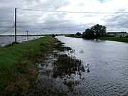
| Flooding at Short Ferry on the old course, July 2007 |
| Moorings on the River Witham by Bardney Lock |
| Both courses of the river at Bardney Lock |
| Bardney sugar factory, once a major user of river water and rail transport. now closed |
| Stixwold Ferry in 1967. Several of the railway stations had these chain ferries provided. |
| Sluice gate for the Kyme Eau, once the junction for the Sleaford canal |
| Langrick Bridge, which replaced a ferry once masted trading vessels no longer operated. |
| The Haven. Tidal waters below the Witham. |
|
Tributaries
The following flow into The Haven:
See also
- Kirkstead Bridge
- Rivers of the United Kingdom
References
- ↑ "WFD Surface Water Classification Status and Objectives 2012 csv files". Environment-agency.gov.uk. Retrieved 7 April 2013.
- ↑ "30001 – Witham at Claypole Mill". The National River Flow Archive. Centre for Ecology & Hydrology. Retrieved 4 April 2013.
- ↑ "Hi Flows UK – AMAX for Claypole". Environment-agency.gov.uk. Retrieved 4 April 2013.
- ↑ 4.0 4.1 Cameron 1998, p. 142; see Old European hydronymy
- ↑ Mills, A.D. (2003). Oxford dictionary of British placenames. Oxford University Press. ISBN 978-0-19-852758-9.
a Celtic or pre-Celtic river-name of uncertain origin
- ↑ "Witham Shield". Retrieved August 2010.
- ↑ Kennedy, Anra (26 March 2002). "Treasures Of The Celtic Causeway – The Fiskerton Log Boat". Culture 24. Department for education. Retrieved 4 May 2013.
- ↑ Field & Pearson 2003
- ↑ "Fiskerton boat". The Collection. Lincolnshire county council. Retrieved 4 May 2013.
- ↑ Boyes & Russell 1977, pp. 254–256
- ↑ Boyes & Russell 1977, pp. 256–257
- ↑ Witham Fourth District Drainage Board: History
- ↑ Boyes & Russell 1977, p. 257
- ↑ Priestley 1831, pp. 684–691
- ↑ Skempton 2002, pp. 277–278
- ↑ 16.0 16.1 Skempton 2002, p. 280
- ↑ 17.0 17.1 17.2 Labrum 1994, p. 66
- ↑ 1st Drainage Board History
- ↑ 19.0 19.1 Boyes & Russell 1977, p. 261
- ↑ 20.0 20.1 Labrum 1994, pp. 60–61
- ↑ 21.0 21.1 Cumberlidge 1998, pp. 104–105
- ↑ Fens Waterways link
- ↑ 23.0 23.1 Nicholson 2006, pp. 63,68
- ↑ Lower & Richardson 2008, pp. 14–15
- ↑ Tuesday Night Club. "2001 Touring log". Retrieved 11 July 2009.
- ↑ Reg Johnson (19 July 2009). River Skirth Regeneration. Lincolnshire Waterways Partnership, Newsletter 19. p. 8.
- ↑ 27.0 27.1 Environment Agency 2004, pp. 13–14
- ↑ Grantham (Map). 1:25 000. Explorer, A1. OSGB. 3 April 2006. p. 247. § Bottesford & Colsterworth. ISBN 9780319238332.
- ↑ Nicola Jones (November 2008). Path Links. Lincolnshire Waterways Partnership, Newsletter 17. pp. 1, 3.
- ↑ Nicola Jones (July 2008). Pigs, Pike, Bikes and the Lady of Shalott. Lincolnshire Waterways Partnership, Newsletter 16. p. 10.
- Bibliography
- Boyes, John; Russell, Ronald (1977). The Canals of Eastern England. David and Charles. ISBN 978-0-7153-7415-3.
- Cameron, Kenneth (1998). A Dictionary of Lincolnshire Place-names. English Placenames Society.
- Cumberlidge, Jane (1998). Inland Waterways of Great Britain (7th ed.). Imray Laurie Norie and Wilson. ISBN 0-85288-355-2.
- Environment Agency (March 2004). The Witham Catchment Abstraction Management Strategy (PDF). Peterborough: Anglian region, Environment Agency.
- Field, Naomi; Pearson, Mike Parker (1 Dec 2003). Fiskerton: An Iron Age Timber Causeway with Iron Age and Roman Votive Offerings. Oxford: Oxbow Books. ISBN 978-1842170649.
- Labrum, E. A. (1994). Civil Engineering Heritage, Eastern and Central England. Thomas Telford. ISBN 0-7277-1970-X.
- Lower, John; Richardson, Christine (2008). Lincolnshire Waterways. Richlow. ISBN 978-0-9552609-5-7.
- Nicholson (2006). Nicholson Waterways Guides (Vol 6). Harper Collins Publishers Ltd. ISBN 0-00-721114-7.
- Priestley, Joseph (1831). "Historical Account of the Navigable Rivers, Canals, and Railways of Great Britain".
- Skempton, Sir Alec et al. (2002). A Biographical Dictionary of Civil Engineers in Great Britain and Ireland: Vol 1: 1500 to 1830. Thomas Telford. ISBN 0-7277-2939-X.
Historical descriptions
- Smeaton, J. (1837), "RIVER WITHAM NAVIGATION", Reports of the late John Smeaton, F. R. S., made on various occasions, in the course of his employment as a civil engineer 1 (2nd ed.), M. Taylor, pp. 18–24, ISBN 978-0-7277-5195-9
- Wheeler, W. H. (1869). "Description of the River Witham and Its Estuary, and of the Various Works Carried Out in Connection Therewith, for the Drainage of the Fens, and the Improvement of the Navigation. (Includes Plates)". Minutes of the Proceedings 28 (1869): 59. doi:10.1680/imotp.1869.23083.
- Wheeler, W. H. (1882). "The Conservancy of Rivers: The Eastern Midland District of England. (Including Appendices and Plate at Back of Volume)". Minutes of the Proceedings 67 (1882): 201. doi:10.1680/imotp.1882.21997.
- Williams, J. E. (1889). "The Witham New Outfall Channel and Improvement Works. (Includes Plate and Appendices)". Minutes of the Proceedings 95 (1889): 78. doi:10.1680/imotp.1889.20832.
- Wheeler, W.H. (1896). "A history of the fens of South Lincolnshire, being a description of the rivers Witham and Welland and their estuary, and an account of the reclamation, drainage, and enclosure of the fens adjacent thereto. 2nd ed., greatly enlarged". doi:10.1680/ahotfosl2e.50358. ISBN 978-0-7277-5035-8.
External links
 Rivers and watercourses of Lincolnshire |
|---|
| | Rivers | |
|---|
|