River Uck
Coordinates: 50°56′28″N 0°03′13″E / 50.941°N 0.0535°E
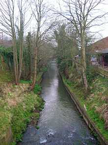
Portions of the River Uck, such as this, were straightened in the past for industrial purposes.
The River Uck is a river in East Sussex, United Kingdom, which drains a catchment starting near Crowborough in the North, Hadlow Down to the East and Laughton Common to the South.[1] It flows through the town of Uckfield and into the river Ouse about 3 miles north of Lewes. The river Uck also has a scenic walk alongside it. The river burst its banks in 2000, flooding much of Uckfield and the surrounding countryside.[2]
The signs indicating the name of the river have been subject to frequent vandalism, resulting in the council fitting specially shaped signs which reduce the ability of vandals to add the letter 'f' to the word 'Uck'.[3][4]
References
- ↑ "SFRA North - Watercourses and Catchment Areas". Wealden District Council.
- ↑ "South hit by severe floods". BBC News. 2000-10-12.
- ↑ Boyle, Ed (2007-12-07). "We'll miss you, Little Dicker". CBS News.
- ↑ Wadsworth, Mark. "River Uck (new sign, 2011)". YPP Mark Wadsworth (blog). Blogspot. Retrieved 24 February 2013.
External links
| Wikimedia Commons has media related to River Uck. |
- Web Camera of the River Uck in Uckfield
- Geographical Association: "Managing Flood Risk - Uckfield Case Study"