River Falls, Wisconsin
| River Falls | |
|---|---|
| City | |
|
River Falls City Hall[1] | |
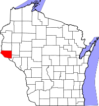
 River Falls Location within the state of Wisconsin | |
| Coordinates: 44°51′31″N 92°37′30″W / 44.85861°N 92.62500°WCoordinates: 44°51′31″N 92°37′30″W / 44.85861°N 92.62500°W | |
| Country | United States |
| State | Wisconsin |
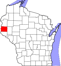
| County | Pierce and St. Croix |
| Government | |
| • Type | Mayor – Council |
| • Mayor | Dan Toland |
| Area[2] | |
| • Total | 6.60 sq mi (17.09 km2) |
| • Land | 6.52 sq mi (16.89 km2) |
| • Water | 0.08 sq mi (0.21 km2) |
| Population (2010)[3] | |
| • Total | 15,000 |
| • Estimate (2012[4]) | 15,182 |
| • Density | 2,300.6/sq mi (888.3/km2) |
| Time zone | Central (CST) (UTC-6) |
| • Summer (DST) | CDT (UTC-5) |
| Area code(s) | 715 & 534 |
| Website | http://www.rfcity.org |

River Falls is a city in Pierce and St. Croix counties in the U.S. state of Wisconsin. It is located mostly within the Town of River Falls in Pierce County; a small portion lies within the Town of Kinnickinnic in St. Croix County. River Falls is the most populous city in Pierce county. The population was 15,000 at the 2010 census, with 11,851 residing in Pierce County, and 3,149 in St. Croix County. It is part of the Minneapolis-St. Paul metropolitan area.
River Falls is the home of the University of Wisconsin–River Falls.
Geography
River Falls is located at 44°51′31″N 92°37′30″W / 44.85861°N 92.62500°W (44.858701, -92.625097).[5]
According to the United States Census Bureau, the city has a total area of 6.60 square miles (17.09 km2), of which, 6.52 square miles (16.89 km2) is land and 0.08 square miles (0.21 km2) is water.[2]
River Falls lies on the banks of the Kinnickinnic River, a class one trout stream. The South Fork of the Kinnickinnic River runs through the city, dividing the campus of the University of Wisconsin-River Falls into two sections.
History
The city's first settlers were Joel Foster and his indentured servant, Dick, in the year 1848.[6] The original village was started as the village of Kinnickinnic in 1854 by brothers Nathaniel N. and Oliver S. Powell who were from St. Lawrence County, New York. At the same time, the township and village was known also as "Greenwood," but this was changed, as another Greenwood, Wisconsin already existed.[7] The present name is for the rapids on the Kinnickinnic River.[8]
Demographics


| Historical population | |||
|---|---|---|---|
| Census | Pop. | %± | |
| 2010 | 15,000 | — | |
| Est. 2012 | 15,182 | 1.2% | |
2010 census
As of the census[3] of 2010, there were 15,000 people, 5,150 households, and 2,812 families residing in the city. The population density was 2,300.6 inhabitants per square mile (888.3/km2). There were 5,449 housing units at an average density of 835.7 per square mile (322.7/km2). The racial makeup of the city was 94.8% White, 1.2% African American, 0.4% Native American, 1.5% Asian, 0.5% from other races, and 1.6% from two or more races. Hispanic or Latino of any race were 1.8% of the population.
There were 5,150 households of which 28.2% had children under the age of 18 living with them, 40.6% were married couples living together, 9.9% had a female householder with no husband present, 4.1% had a male householder with no wife present, and 45.4% were non-families. 27.1% of all households were made up of individuals and 8.4% had someone living alone who was 65 years of age or older. The average household size was 2.42 and the average family size was 2.89.
The median age in the city was 24.2 years. 17.2% of residents were under the age of 18; 34.5% were between the ages of 18 and 24; 23% were from 25 to 44; 17% were from 45 to 64; and 8.2% were 65 years of age or older. The gender makeup of the city was 46.8% male and 53.2% female.
2000 census
As of the census[9] of 2000, there were 12,560 people, 4,269 households, and 2,335 families residing in the city. The population density was 2,524.0 people per square mile (973.8/km²). There were 4,346 housing units at an average density of 873.2 per square mile (336.9/km²). The racial makeup of the city was 96.57% White, 0.53% Black or African American, 0.36% Native American, 1.02% Asian, 0.09% Pacific Islander, 0.32% from other races, and 1.12% from two or more races. Hispanic or Latino of any race were 0.95% of the population.
There were 4,269 households out of which 29.1% had children under the age of 18 living with them, 42.7% were married couples living together, 9.1% had a female householder with no husband present, and 45.3% were non-families. 27.7% of all households were made up of individuals and 9.1% had someone living alone who was 65 years of age or older. The average household size was 2.44 and the average family size was 2.98.
In the city the population was spread out with 17.9% under the age of 18, 35.1% from 18 to 24, 23.8% from 25 to 44, 14.6% from 45 to 64, and 8.6% who were 65 years of age or older. The median age was 24 years. For every 100 females there were 83.5 males. For every 100 females age 18 and over, there were 80.1 males.
The median income for a household in the city was $41,184, and the median income for a family was $60,253. Males had a median income of $36,275 versus $27,345 for females. The per capita income for the city was $17,667. About 4.4% of families and 14.9% of the population were below the poverty line, including 6.6% of those under age 18 and 11.1% of those age 65 or over.
Education
River Falls High School is the area's public high school. It is home to the 2005 and 2007–2013 Marching Band State Champions in AAA division. River Falls is also home to the University of Wisconsin-River Falls.
Recreation
Glen Park is a 41-acre park established in 1898. Overlooking the Kinnickinnic River, the park has playgrounds, a swimming pool, soccer fields, a baseball diamond, basketball courts, horseshoe pits, a gazebo, and several walking trails.[10]
The Glen Park Pool was built in 1937 and renovated for its 75th anniversary in 2012.[11]
Glen Park's Swinging Bridge offers a view of the South Fork Rapids as it enters the Kinnickinnic River. The bridge, a replica of one designed by the Minneapolis Bridge Company and constructed in 1925, is a suspension bridge that spans the South Fork Rapids at the site of the former Cascade Mill and Dam. Below the bridge are fishing and picnic spots.[12]
Another attraction is The Falls Theater, a movie theater.
Notable people
- Aldrich Hazen Ames, former C.I.A. counter-intelligence officer and analyst; convicted in 1994 of spying for the Soviet Union and Russia
- Lynn H. Ashley, Wisconsin State Assembly
- Jule Berndt, Wisconsin State Assembly
- William Berndt, Wisconsin State Senate
- Karyn Bye, Olympic Gold Medal athlete
- Anna Dodge, actress
- Michael P. Early, Wisconsin State Assembly
- Sheila Harsdorf, Wisconsin State Senate
- Nils Pederson Haugen, (1849–1931) U.S. Representative from Wisconsin
- Robert P. Knowles, Wisconsin State Senate
- Warren P. Knowles, Governor of Wisconsin
- Maria Lamb, Olympic athlete and national champion speedskater
- Doug Lloyd, NFL player
- Freeman Lord, Wisconsin State Assembly
- Landon Lueck, reality TV star and professional cyclist
- Mark Neumann, U.S. Representative
- Frank Nye, U.S. Representative from Minnesota
- Francis Paul Prucha, Roman Catholic priest and educator
- Heidi "Frankie" Rayder, fashion model
- Missy Rayder, fashion model
- Dick Ritger, former professional ten-pin bowler and a renowned bowling coach; member of the PBA and USBC Halls of Fame
- David F. Swensen, Chief Investment Officer of the Yale University endowment
- Horace Adolphus Taylor, Wisconsin State Senate
- Kenneth S. White, Wisconsin State Senate
References
- ↑ River Falls City Hall, Frisbie Architects, Accessed July 20, 2009.
- ↑ 2.0 2.1 "US Gazetteer files 2010". United States Census Bureau. Retrieved 2012-11-18.
- ↑ 3.0 3.1 "American FactFinder". United States Census Bureau. Retrieved 2012-11-18.
- ↑ "Population Estimates". United States Census Bureau. Retrieved 2013-06-24.
- ↑ "US Gazetteer files: 2010, 2000, and 1990". United States Census Bureau. 2011-02-12. Retrieved 2011-04-23.
- ↑ River Falls Wisconsin. Piercecountywi.com. Retrieved on 2012-07-07.
- ↑ Easton, August B. History of Saint Croix Valley, p. 485.
- ↑ Chicago and North Western Railway Company (1908). A History of the Origin of the Place Names Connected with the Chicago & North Western and Chicago, St. Paul, Minneapolis & Omaha Railways. p. 189.
- ↑ "American FactFinder". United States Census Bureau. Retrieved 2008-01-31.
- ↑ "Visit Planning - Entertainment & Recreation". rfchamber.com. Retrieved 23 October 2013.
- ↑ "Hospital supports historic park pool". River Falls Journal. 12 June 2012. Retrieved 23 October 2013.
- ↑ Smith, Margaret. "River Falls, Wisconsin- The Swinging Bridge at Glen Park". stcroixheritage.org. Retrieved 23 October 2013.
External links
| Wikimedia Commons has media related to River Falls, Wisconsin. |
| |||||||||||||||||||||||||||||||||
| |||||||||||||||||||||||||||||||||


