River Cover
| River Cover | |
|---|---|
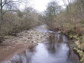 River Cover from St Simons Bridge | |
| Origin |
Great Hunters Sleets nr Woodale 54°11′2″N 2°1′29″W / 54.18389°N 2.02472°W |
| Mouth | 54°16′43″N 1°46′25″W / 54.27861°N 1.77361°W |
| Basin countries | England |
| Length | 14 miles (22 km) |
| Source elevation | 487 metres (1,598 ft) |
| Mouth elevation | 98 metres (322 ft) |
The River Cover is a river in the Yorkshire Dales in North Yorkshire, England. The Yorkshire Dales Rivers Trust has a remit to conserve the ecological condition of the River Cover. The river forms a limestone dale with ancient woodlands.[1]
Course
The source of the river lies in the shake holes that are found between Buckden Pike and Great Whernside that feed many small gills, such as East Stone Gill, West Stone Gill and Downs Gill. Where these conjoined flows meet Hazel Bank Gill is where the river becomes known as the River Cover. It flows in a north-east direction past Woodale, Braidley and Horsehouse. It turns to the north north-east towards Gammersgill before returning north-east between West Scrafton and Carlton, North Yorkshire. Immediately east of Agglethorpe, the river turns east until it joins the River Ure south-east of Middleham.
Ecology
The river is home for Brown trout and Grayling.[2]
Geology
The river runs along a U-shaped glacial valley over Great Scar limestone with Yoredale rock forming the valley sides. It is a gently meandering river with a characteristic stony channel and beaches leading to wooded low banks. The wooded areas extend up into the many gills that join the river.[1]
Lists
Tributaries
|
|
Settlements
|
Crossings
|
Gallery
-
River Cover from St Simons Bridge
-
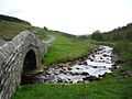
River Cover
-
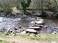
Stepping stones over the River Cover
-
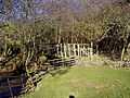
Caygill footbridge over the River Cover
See also
- Coverdale
- Rivers of the United Kingdom
References
- ↑ 1.0 1.1 "Geology". Retrieved 13 October 2011.
- ↑ "Ecology (Fish)". Retrieved 13 October 2011.
Sources
External links
![]() Media related to River Cover at Wikimedia Commons
Media related to River Cover at Wikimedia Commons
| ||||||||||||||||||