Ringelsdorf-Niederabsdorf
| Ringelsdorf-Niederabsdorf | |
|---|---|
 Ringelsdorf-Niederabsdorf Location within Austria | |
| Coordinates: 48°34′N 16°52′E / 48.567°N 16.867°ECoordinates: 48°34′N 16°52′E / 48.567°N 16.867°E | |
| Country | Austria |
| State | Lower Austria |
| District | Gänserndorf |
| Government | |
| • Mayor | Wolfgang Weigert |
| Area | |
| • Total | 32.46 km2 (12.53 sq mi) |
| Elevation | 170 m (560 ft) |
| Population (1 January 2014)[1] | |
| • Total | 1,296 |
| • Density | 40/km2 (100/sq mi) |
| Time zone | CET (UTC+1) |
| • Summer (DST) | CEST (UTC+2) |
| Postal code | 2272 |
| Area code | 02536 |
Ringelsdorf-Niederabsdorf is a town in the district of Gänserndorf in the Austrian state of Lower Austria.
Geography
Ringelsdorf-Niederabsdorf lies in the eastern Weinviertel on the Zaya River, exactly at the meeting of the borders with Slovakia and the Czech Republic. About 15.68 percent of the municipality is forested.
References
External links
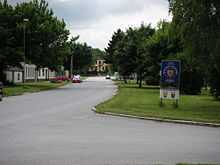
Untere Hauptstrasse in Ringelsdorf
| Wikimedia Commons has media related to Category:Ringelsdorf-Niederabsdorf. |