Richmond County, Georgia
| Richmond County, Georgia | |
|---|---|
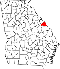 Location in the state of Georgia | |
 Georgia's location in the U.S. | |
| Founded | February 5, 1777[1] |
| Named for | Charles Lennox, 3rd Duke of Richmond |
| Seat | Augusta |
| Largest city | Augusta |
| Area | |
| • Total | 329 sq mi (852 km2) |
| • Land | 324 sq mi (839 km2) |
| • Water | 4.3 sq mi (11 km2), 1.3% |
| Population | |
| • (2010) | 200,549 |
| • Density | 618/sq mi (239/km²) |
| Congressional district | 12th |
| Time zone | Eastern: UTC-5/-4 |
Richmond County is a county located in the U.S. state of Georgia. As of the 2010 census, the population was 200,549.[2] It is one of the original counties of Georgia, created February 5, 1777.
Following an election in 1995, the city of Augusta (the county seat) consolidated governments with Richmond County. The consolidated entity is known as Augusta-Richmond County, or simply Augusta. The cities of Hephzibah and Blythe in southern Richmond County voted to remain separate and not consolidate.
Richmond County is included in the Augusta-Richmond County, GA-SC Metropolitan Statistical Area.
History
The county is named for Charles Lennox, 3rd Duke of Richmond, a British politician and office-holder sympathetic to the cause of the American colonies. Richmond was also a first cousin to King George III.
Richmond County was established in 1777 by the first Constitution of the (newly independent) State of Georgia. As such, it is one of the original counties of the state. It was formed out of a portion of the colonial Parish of St. Paul, after the Revolution disestablished the Church of England in the (former) Royal Province of Georgia.
Geography
According to the U.S. Census Bureau, the county has a total area of 329 square miles (850 km2), of which 324 square miles (840 km2) is land and 4.3 square miles (11 km2) (1.3%) is water.[3]
Major highways
-
.svg.png) Interstate 20
Interstate 20 -
.svg.png) Interstate 520
Interstate 520 -
 U.S. Route 1
 -
 U.S. Route 25
 -
 U.S. Route 25 Business
 -
 U.S. Route 78
 -
 U.S. Route 278
 -
 State Route 4
 -
 State Route 10
 -
 State Route 28
 -
 State Route 56
 -
 State Route 56 Spur
 -
 State Route 88
 -
 State Route 88 Connector
 -
 State Route 104
 -
 State Route 104 Connector
 -
 State Route 121
 -
 State Route 223
 -
 State Route 232
 -
 State Route 383
 -
 State Route 402 (unsigned designation for I-20)
 -
 State Route 415 (unsigned designation for I-520)
 -
 State Route 540 (Fall Line Freeway)
Adjacent counties
- Edgefield County, South Carolina (north)
- Aiken County, South Carolina (northeast)
- Burke County (south)
- Jefferson County (southwest)
- McDuffie County (west)
- Columbia County (northwest)
Demographics
| Historical population | |||
|---|---|---|---|
| Census | Pop. | %± | |
| 1790 | 11,317 | — | |
| 1800 | 5,475 | −51.6% | |
| 1810 | 6,189 | 13.0% | |
| 1820 | 8,608 | 39.1% | |
| 1830 | 11,644 | 35.3% | |
| 1840 | 11,932 | 2.5% | |
| 1850 | 16,246 | 36.2% | |
| 1860 | 21,284 | 31.0% | |
| 1870 | 25,724 | 20.9% | |
| 1880 | 34,665 | 34.8% | |
| 1890 | 45,194 | 30.4% | |
| 1900 | 53,735 | 18.9% | |
| 1910 | 58,886 | 9.6% | |
| 1920 | 63,692 | 8.2% | |
| 1930 | 72,990 | 14.6% | |
| 1940 | 81,863 | 12.2% | |
| 1950 | 108,876 | 33.0% | |
| 1960 | 135,601 | 24.5% | |
| 1970 | 162,437 | 19.8% | |
| 1980 | 181,629 | 11.8% | |
| 1990 | 189,719 | 4.5% | |
| 2000 | 199,775 | 5.3% | |
| 2010 | 200,549 | 0.4% | |
| Est. 2013 | 202,003 | 0.7% | |
As of the census[8] of 2000, there were 199,775 people, 73,920 households, and 49,526 families residing in the county. The population density was 616 people per square mile (238/km²). There were 82,312 housing units at an average density of 254 per square mile (98/km²). The racial makeup of the county was 49.75% Black or African American, 45.55% White, 0.28% Native American, 1.50% Asian, 0.12% Pacific Islander, 1.01% from other races, and 1.78% from two or more races. 2.78% of the population were Hispanic or Latino of any race.
There were 73,920 households out of which 33.60% had children under the age of 18 living with them, 41.80% were married couples living together, 20.80% had a female householder with no husband present, and 33.00% were non-families. 27.70% of all households were made up of individuals and 8.50% had someone living alone who was 65 years of age or older. The average household size was 2.55 and the average family size was 3.13.
In the county the population was spread out with 26.80% under the age of 18, 12.00% from 18 to 24, 29.90% from 25 to 44, 20.50% from 45 to 64, and 10.80% who were 65 years of age or older. The median age was 32 years. For every 100 females there were 93.20 males. For every 100 females age 18 and over, there were 89.80 males.
The median income for a household in the county was $38,004, and the median income for a family was $52,892. Males had a median income of $30,028 versus $23,512 for females. The per capita income for the county was $18,133. About 16.20% of families and 19.60% of the population were below the poverty line, including 27.20% of those under age 18 and 14.10% of those age 65 or over.
Communities
See also
- National Register of Historic Places listings in Richmond County, Georgia
- Richmond County School System
- New Savannah, Georgia
Footnotes
- ↑
- ↑ 2.0 2.1 "State & County QuickFacts". United States Census Bureau. Retrieved June 25, 2014.
- ↑ "US Gazetteer files: 2010, 2000, and 1990". United States Census Bureau. 2011-02-12. Retrieved 2011-04-23.
- ↑ "U.S. Decennial Census". United States Census Bureau. Retrieved June 25, 2014.
- ↑ "Historical Census Browser". University of Virginia Library. Retrieved June 25, 2014.
- ↑ "Population of Counties by Decennial Census: 1900 to 1990". United States Census Bureau. Retrieved June 25, 2014.
- ↑ "Census 2000 PHC-T-4. Ranking Tables for Counties: 1990 and 2000" (PDF). United States Census Bureau. Retrieved June 25, 2014.
- ↑ "American FactFinder". United States Census Bureau. Retrieved 2008-01-31.
Further reading
- A. Ray Rowland (ed.), Historical Markers of Richmond County, Georgia. Augusta, GA: Richmond County Historical Society, 1966.
- Richmond County History. Augusta, GA: Richmond County Historical Society, 1969-date. —Journal, established Winter 1969.
External links
- Official website of Augusta-Richmond County consolidated government
- Documents from Richmond County in the Digital Library of Georgia
- Georgia Department of Transportation map of Richmond County (Note: map uses pre-consolidation city boundaries)
 |
Columbia County | Edgefield County, South Carolina | Aiken County, South Carolina | |
| McDuffie County | |
|||
| ||||
| | ||||
| Jefferson County | Burke County |
| |||||||||||||||||||||||||
| |||||||||||||||||||||||||||||||||||||||