Richibucto Parish, New Brunswick
- This article is about the parish. For the town, consult Richibucto, New Brunswick.
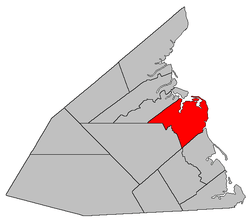
Richibucto is a Canadian parish in Kent County, New Brunswick.[2]
Its population in the 2011 Census was 1,986.
Delineation
Richibucto Parish is defined in the Territorial Division Act as:
- South by Wellington Parish and Weldford Parish, west by Weldford Parish and a line running true south from the forks of the Saint-Charles River to the northern line of Weldford Parish; north by the centre of the Saint-Charles River and of the Northwest Branch and Richibucto, and east by the Gulf of Saint Lawrence, including all the islands in front; except that portion thereof formerly in said Parish of Richibucto, now included in the Parish of Saint-Charles as described below.
Communities
Parish population total does not include incorporated municipalities (in bold):
- Bedec
- Bells Mills
- Cap-de-Richiboucto
- Cap-Lumière
- Côte-Sainte-Anne
- East Galloway
- Galloway
|
- Jardineville
- Peters Mills
- Petit-Chockpish
- Pirogue
- Rexton
- Richibucto
- Richibucto Village Cape
|
|
Demographics
Population
Population trend[3]
| Census |
Population |
Change (%) |
| 2006 |
2,022 |
 1.3% 1.3% |
| 2001 |
1,997 |
 2.3% 2.3% |
| 1996 |
2,045 |
2.8% |
| 1991 |
1,990 |
N/A |
|
Language
Mother tongue language (2006)[4]
| Language |
Population |
Pct (%) |
| French only |
1,250 |
62.19% |
| English only |
705 |
35.07% |
| Other languages |
35 |
1.74% |
| Both English and French |
20 |
1.00% |
|
See also
References
|
|---|
| | Subdivisions | |
|---|
| | Cities | |
|---|
| | Counties | |
|---|
|
-
 Category:New Brunswick Category:New Brunswick
-
 Portal:New Brunswick Portal:New Brunswick
-
 WikiProject:New Brunswick WikiProject:New Brunswick
|
|
Coordinates: 46°37′03″N 64°47′24″W / 46.61750°N 64.79000°W / 46.61750; -64.79000 (Richibucto Parish, New Brunswick)