Richfield, Kansas
| Richfield, Kansas | |
|---|---|
| City | |
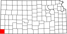
 Location within Morton County and Kansas | |
| Coordinates: 37°15′57″N 101°47′1″W / 37.26583°N 101.78361°WCoordinates: 37°15′57″N 101°47′1″W / 37.26583°N 101.78361°W | |
| Country | United States |
| State | Kansas |
| County | Morton |
| Area[1] | |
| • Total | 1.00 sq mi (2.59 km2) |
| • Land | 1.00 sq mi (2.59 km2) |
| • Water | 0 sq mi (0 km2) |
| Elevation | 3,389 ft (1,033 m) |
| Population (2010)[2] | |
| • Total | 43 |
| • Estimate (2012[3]) | 42 |
| • Density | 43/sq mi (17/km2) |
| Time zone | Central (CST) (UTC-6) |
| • Summer (DST) | CDT (UTC-5) |
| ZIP code | 67953 |
| Area code(s) | 620 |
| FIPS code | 20-59200 [4] |
| GNIS feature ID | 0485068 [5] |
Richfield is a city in Morton County, Kansas, United States. As of the 2010 census, the city population was 43.[6]
History
Richfield was platted in 1885. It was named for the fertility of their land.[7] The town was built up quickly: in less than one year, Richfield had 600 inhabitants, but by 1900 its population had declined to 61.[8] Richfield served as the Morton County seat from 1886 until 1961 when the seat was moved to Elkhart.[9]
Geography
Richfield is located at 37°15′57″N 101°47′1″W / 37.26583°N 101.78361°W (37.265731, -101.783654).[10] According to the United States Census Bureau, the city has a total area of 1.00 square mile (2.59 km2), all of it land.[1]
Climate
According to the Köppen Climate Classification system, Richfield has a semi-arid climate, abbreviated "BSk" on climate maps.[11]
Demographics
| Historical population | |||
|---|---|---|---|
| Census | Pop. | %± | |
| 1990 | 50 | — | |
| 2000 | 48 | −4.0% | |
| 2010 | 43 | −10.4% | |
| U.S. Decennial Census | |||
2010 census
As of the census[2] of 2010, there were 43 people, 20 households, and 15 families residing in the city. The population density was 43.0 inhabitants per square mile (16.6/km2). There were 25 housing units at an average density of 25.0 per square mile (9.7/km2). The racial makeup of the city was 100.0% White.
There were 20 households of which 25.0% had children under the age of 18 living with them, 70.0% were married couples living together, 5.0% had a female householder with no husband present, and 25.0% were non-families. 25.0% of all households were made up of individuals and 10% had someone living alone who was 65 years of age or older. The average household size was 2.15 and the average family size was 2.53.
The median age in the city was 50.5 years. 16.3% of residents were under the age of 18; 7% were between the ages of 18 and 24; 25.6% were from 25 to 44; 18.7% were from 45 to 64; and 32.6% were 65 years of age or older. The gender makeup of the city was 44.2% male and 55.8% female.
2000 census
As of the census[4] of 2000, there were 48 people, 25 households, and 14 families residing in the city. The population density was 48.1 people per square mile (18.5/km²). There were 26 housing units at an average density of 26.1 per square mile (10.0/km²). The racial makeup of the city was 100.00% White.
There were 25 households out of which 20.0% had children under the age of 18 living with them, 52.0% were married couples living together, 4.0% had a female householder with no husband present, and 44.0% were non-families. 40.0% of all households were made up of individuals and 28.0% had someone living alone who was 65 years of age or older. The average household size was 1.92 and the average family size was 2.57.
In the city the population was spread out with 16.7% under the age of 18, 4.2% from 18 to 24, 22.9% from 25 to 44, 33.3% from 45 to 64, and 22.9% who were 65 years of age or older. The median age was 52 years. For every 100 females there were 84.6 males. For every 100 females age 18 and over, there were 81.8 males.
The median income for a household in the city was $37,813, and the median income for a family was $42,500. Males had a median income of $33,750 versus $12,083 for females. The per capita income for the city was $16,974. There were no families and 10.3% of the population living below the poverty line, including no under eighteens and none of those over 64.
References
- ↑ 1.0 1.1 "US Gazetteer files 2010". United States Census Bureau. Retrieved 2012-07-06.
- ↑ 2.0 2.1 "American FactFinder". United States Census Bureau. Retrieved 2012-07-06.
- ↑ "Population Estimates". United States Census Bureau. Retrieved 2013-05-29.
- ↑ 4.0 4.1 "American FactFinder". United States Census Bureau. Retrieved 2008-01-31.
- ↑ "US Board on Geographic Names". United States Geological Survey. 2007-10-25. Retrieved 2008-01-31.
- ↑ "2010 City Population and Housing Occupancy Status". U.S. Census Bureau. Retrieved August 31, 2011.
- ↑ Capace, Nancy (1 June 2000). Encyclopedia of Kansas. North American Book Dist LLC. p. 258. ISBN 978-0-403-09312-0.
- ↑ Blackmar, Frank Wilson (1912). Kansas: A Cyclopedia of State History, Volume 2. Standard Publishing Company. p. 582.
- ↑ Morton County Facts; mtcoks.com
- ↑ "US Gazetteer files: 2010, 2000, and 1990". United States Census Bureau. 2011-02-12. Retrieved 2011-04-23.
- ↑ Climate Summary for Richfield, Kansas
External links
| Wikimedia Commons has media related to Richfield, Kansas. |
- City
- Schools
- USD 217, local school district
- Maps
- Richfield City Map, KDOT
| |||||||||||||||||