Reminderville, Ohio
| Reminderville, Ohio | |
|---|---|
| Village | |
| Motto: "A Great Place to Call Home" | |
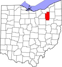
 Location in Summit County and the state of Ohio. | |
| Coordinates: 41°20′18″N 81°24′0″W / 41.33833°N 81.40000°WCoordinates: 41°20′18″N 81°24′0″W / 41.33833°N 81.40000°W | |
| Country | United States |
| State | Ohio |
| County | Summit |
| Government | |
| • Mayor | Sam Alonso |
| Area[1] | |
| • Total | 2.21 sq mi (5.72 km2) |
| • Land | 2.18 sq mi (5.65 km2) |
| • Water | 0.03 sq mi (0.08 km2) |
| Elevation[2] | 1,010 ft (308 m) |
| Population (2010)[3] | |
| • Total | 3,404 |
| • Estimate (2012[4]) | 3,620 |
| • Density | 1,561.5/sq mi (602.9/km2) |
| Time zone | Eastern (EST) (UTC-5) |
| • Summer (DST) | EDT (UTC-4) |
| ZIP code | 44202 |
| Area code(s) | 330 |
| FIPS code | 39-66152[5] |
| GNIS feature ID | 1049116[2] |
| Website | http://www.reminderville.com/ |
Reminderville is a village in Summit County, Ohio, United States. The population was 3,404 at the 2010 census. It is part of the Akron Metropolitan Statistical Area.
Geography
Reminderville is located at 41°20′18″N 81°24′0″W / 41.33833°N 81.40000°W (41.338198, -81.400128).[6]
According to the United States Census Bureau, the village has a total area of 2.21 square miles (5.72 km2), of which 2.18 square miles (5.65 km2) is land and 0.03 square miles (0.08 km2) is water.[1]
Demographics
It is bound on the North by Solon, OH; on the west by Twinsburg, on the east by Aurora, and on the South by Twinsburg & Twinsburg Township; within a few minutes of shopping and freeway access. It is primarily a residential community with its own police and fire departments. 83% of Reminderville is a part of the Twinsburg City School District and the balance is part of Aurora City Schools.
2010 census
As of the census[3] of 2010, there were 3,404 people, 1,399 households, and 963 families residing in the village. The population density was 1,561.5 inhabitants per square mile (602.9/km2). There were 1,497 housing units at an average density of 686.7 per square mile (265.1/km2). The racial makeup of the village was 82.3% White, 9.0% African American, 0.1% Native American, 5.3% Asian, 0.4% from other races, and 2.8% from two or more races. Hispanic or Latino of any race were 1.1% of the population.
There were 1,399 households of which 33.9% had children under the age of 18 living with them, 54.9% were married couples living together, 10.0% had a female householder with no husband present, 3.9% had a male householder with no wife present, and 31.2% were non-families. 27.4% of all households were made up of individuals and 8.8% had someone living alone who was 65 years of age or older. The average household size was 2.43 and the average family size was 2.98.
The median age in the village was 38.3 years. 24.5% of residents were under the age of 18; 5.1% were between the ages of 18 and 24; 31.1% were from 25 to 44; 27.7% were from 45 to 64; and 11.7% were 65 years of age or older. The gender makeup of the village was 48.9% male and 51.1% female.
References
- ↑ 1.0 1.1 "US Gazetteer files 2010". United States Census Bureau. Retrieved 2013-01-06.
- ↑ 2.0 2.1 "US Board on Geographic Names". United States Geological Survey. 2007-10-25. Retrieved 2008-01-31.
- ↑ 3.0 3.1 "American FactFinder". United States Census Bureau. Retrieved 2013-01-06.
- ↑ "Population Estimates". United States Census Bureau. Retrieved 2013-06-17.
- ↑ "American FactFinder". United States Census Bureau. Retrieved 2008-01-31.
- ↑ "US Gazetteer files: 2010, 2000, and 1990". United States Census Bureau. 2011-02-12. Retrieved 2011-04-23.
External links
| |||||||||||||||||||||||||||||||||