Relief, California
| Relief | |
|---|---|
| Unincorporated community | |
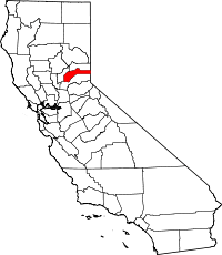
 Relief Location in California | |
| Coordinates: 39°21′41″N 120°51′39″W / 39.36139°N 120.86083°WCoordinates: 39°21′41″N 120°51′39″W / 39.36139°N 120.86083°W | |
| Country |
|
| State |
|
| County | Nevada County |
| Elevation[1] | 3,947 ft (1,203 m) |
Relief (also, Relief Hill and Grizzly Hill)[2] is an unincorporated community in Nevada County, California.[1] Relief is located 3.25 miles (5.2 km) west of Washington,[2] on the South Yuba River, 2.5 miles (4.0 km) above North Bloomfield.[3] It lies at an elevation of 3,947 feet (1,203 m).[1]
History
Relief was a station founded in 1847 by the first group sent to rescue the Donner Party.[2] It was settled about 1853. Mining operations at one time were carried on quite extensively in the vicinity, and in 1858 the town contained over a hundred voters. Subsequently the population declined and the place was nearly deserted. Around 1867, new mines were opened.[3]
Relief has been noted for its unusual place name.[4]
References
- ↑ 1.0 1.1 1.2 U.S. Geological Survey Geographic Names Information System: Relief, California
- ↑ 2.0 2.1 2.2 Durham, David L. (1998). California's Geographic Names: A Gazetteer of Historic and Modern Names of the State. Clovis, Calif.: Word Dancer Press. p. 545. ISBN 1-884995-14-4.
- ↑ 3.0 3.1 Bean's history and directory of Nevada County, California: Containing a complete history of the county, with sketches of the various towns and mining camps ... also, full statistics of mining and all other industrial resources (Public domain ed.). Printed at the Daily Gazette Book and Job Office. 1867. p. 396. Retrieved 3 March 2013.
- ↑ Thompson, George E. (1 July 2009). You Live Where?: Interesting and Unusual Facts about where We Live. iUniverse. p. 12. ISBN 978-1-4401-3421-0.