Reither Spitze
| Reither Spitze | |
|---|---|
|
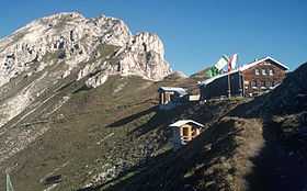
View of the Reither Spitze and Nördlinger Hut from the south | |
| Elevation | 2,374 m above sea level (AA) (7,789 ft) |
| Prominence | 2,374-2,096 m ↓ Ursprungsattel |
| Isolation | 3.7 km → Erlspitze |
| Location | |
 Reither Spitze Tyrol, | |
| Range | Erlspitze Group, Karwendel |
| Coordinates | 47°19′23″N 11°14′10″E / 47.322972°N 11.236125°ECoordinates: 47°19′23″N 11°14′10″E / 47.322972°N 11.236125°E |
| Geology | |
| Type | Dolomite |
| Climbing | |
| Normal route | From the Nördlinger Hut |
The Reither Spitze is a mountain in the Karwendel in the Austrian federal state of Tyrol that, thanks to its location at the southwestern end of the Erlspitze Group, is particularly well known for its great views of the surrounding area from its summit. Its name is derived the village of Reith bei Seefeld, which lies at its southwestern foot.
The Schlossbach, a tributary of the River Inn, rises on the mountainside.
Ascent
The summit of the Reither Spitze may be reached in a 20 minute climb from the Nördlinger Hut to the south.[1] The Nördlinger Hut is an hour's walk from the top station of the cable car on the Härmelekopf; from the Härmelekopf one can also ascend the Reither Spitze directly via the Reither Joch (sure-footedness required). An ascent from Reith bei Seefeld or Seefeld takes about three hours. From the Seefelder Spitze, the Reither Spitze may be reached on an easy path (sure-footedness required) or directly along the connecting arête, a routed graded at UIAA level III difficulty.[2]
Geology
The summit of the Reither Spitze and the arête of the Seefelder Spitze (2,221 m above sea level (AA)) are made of main dolomite rock. This zone of the upper main dolomite is surrounded by a ring-shaped zone of oil-bearing and partly fossil-bearing Seefeld beds. As a result of fish fossils, the oil-bearing slate from this region is also called Ichthyol Slate after the Old Greek word for fish, ichthys (ἰχθύς). These rocks were quarried in various places around the Reither Spitze for the extraction of Ichthyol. The main quarry area was at the foot of the Reither Spitze southeast of Seefeld in the area of the Reither Jochalm.[3][4]
-

The Reither Spitze from Seefeld
-
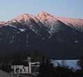
The Härmelekopf and Reither Spitze in winter
-
.JPG)
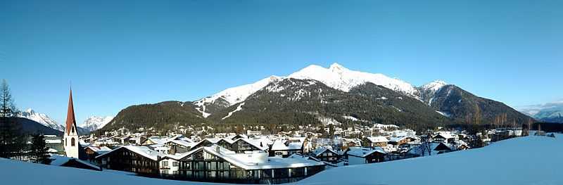
View from the foot of the Hohe Munde
External links
| Wikimedia Commons has media related to Reither Spitze. |
Sources
- ↑ Heinrich Klier, Fritz März: Alpenvereinsführer Karwendelgebirge, Verlag Rudolf Rother, 12th edn., Munich, 1984, ISBN 3-7633-1200-5, p. 136.
- ↑ Heinrich Klier, Fritz März: Alpenvereinsführer Karwendelgebirge, Verlag Rudolf Rother, 11th edn., Munich, 1978, ISBN 3-7633-1208-0, p. 131.
- ↑ Kartierungsbericht der Geologischen Bundesanstalt, as at 14 March 2009 (pdf; 243 kB)
- ↑ Geologische Karte der Republik Österreich 1:50,000, Sheet 117 Zirl, Geologische Bundesanstalt, Vienna, 1992.