Regents Park, New South Wales
Alternate uses: Regents Park (disambiguation)
| Regents Park Sydney, New South Wales | |||||||||||||
|---|---|---|---|---|---|---|---|---|---|---|---|---|---|
|
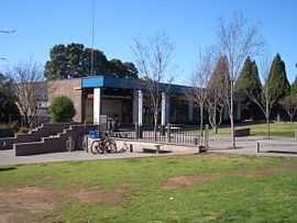
Regents Park Amenity Centre | |||||||||||||
| Coordinates | 33°53′09″S 151°01′42″E / 33.88572°S 151.02833°ECoordinates: 33°53′09″S 151°01′42″E / 33.88572°S 151.02833°E | ||||||||||||
| Population | 4,511 (2011 census)[1] | ||||||||||||
| Postcode(s) | 2143 | ||||||||||||
| Location | 22 km (14 mi) west of Sydney CBD | ||||||||||||
| LGA(s) | Auburn City | ||||||||||||
| State electorate(s) | |||||||||||||
| Federal Division(s) | Blaxland | ||||||||||||
| |||||||||||||
Regents Park is a western suburb of Sydney, in the state of New South Wales, Australia 22 kilometres west of the Sydney central business district, in the local government area of Auburn Council.
History
The suburb took its name from a local property built by Mr Peck and Mr Johnson in 1879, which they had named after Regent's Park, in the north-west of London, United Kingdom.[2]
European settlement
The area was originally part of a land grant to Joseph Hyde Potts and the first subdivision was made in 1880. When the school opened in 1899 it was known as Potts Hill School, but became Sefton Park School in 1907 when this area became known as Sefton Park. In 1929 it was changed to Regent Park School. The railway station opened in 1914 as Regents Park but the site was changed in 1924 when the line connected Lidcombe to Bankstown. The suburb is also notable in the work of Australian poet Peter Skrzynecki, who grew up in Regents Park. Poems such as 'Feliks Skrzynecki' and 'Regents Park' explore the experiences of post war migrants in Australia and their life in the growing suburbs of Sydney's west. The poem '10 Mary Street'is about the Skrzynecki family home which still stands today as a tangible example from some of Skrzynecki's best work.
Transport
Regents Park railway station is on the Bankstown Line of the Sydney Trains network.
Schools
Regents Park Public School (Years K-6), Karningul Public School,Trinity Catholic College (Years 7-8), St Peter Chanel Primary School, Birrong Girls' High School (Years 7-12), Birrong Boys' High School (years 7-12), Regents Park Christian School (K-12).
Local Government Area
The Potts Hill Reservoir (also known locally as 'The Pipelines') is the demarcation line between Auburn and Bankstown Councils. While the majority of the suburb falls within the local government area of Auburn Council, those living south-west of the Potts Hill Reservoir will be registered under Bankstown Council. Regents Park is split between the electorates of Auburn and Bankstown. Federally, it lies in the division of Blaxland.
References
- ↑ Australian Bureau of Statistics (31 October 2012). "Regents Park (State Suburb)". 2011 Census QuickStats. Retrieved 19 April 2015.
- ↑ The Book of Sydney Suburbs, Compiled by Frances Pollen, Angus & Robertson Publishers, 1990, Published in Australia ISBN 0-207-14495-8, page 221
| Wikimedia Commons has media related to Regents Park, New South Wales. |