Red House, New York
| Red House, New York | |
|---|---|
| Town | |
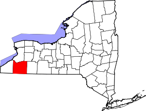
 Red House Location within the state of New York | |
| Coordinates: 42°2′25″N 78°48′19″W / 42.04028°N 78.80528°W | |
| Country | United States |
| State | New York |
| County | Cattaraugus |
| Government | |
| • Type | Town Council |
| • Town Supervisor | Melissa L. Sipko (R) |
| • Town Council |
Members' List
|
| Area | |
| • Total | 55.9 sq mi (144.7 km2) |
| • Land | 55.7 sq mi (144.2 km2) |
| • Water | 0.2 sq mi (0.5 km2) |
| Elevation | 2,215 ft (675 m) |
| Population (2010)[1] | |
| • Total | 38 |
| • Density | 0.8/sq mi (0.3/km2) |
| Time zone | Eastern (EST) (UTC-5) |
| • Summer (DST) | EDT (UTC-4) |
| FIPS code | 36-60950 |
| GNIS feature ID | 0979412 |
| Website |
redhouseny |
Red House (Seneca: joe'hesta) is a town in Cattaraugus County, New York, United States. As of the 2010 census, the town population was 38,[1] making it the least populous town in the state. The town is on the south edge of Cattaraugus County, south of the city of Salamanca.
History
The area that would become the town was first settled by outsiders after 1827. The town of Red House was formed in 1869 from part of the town of Salamanca. Local folklore states that it was named for its famous landmark, the Red House, a Civil War-era domicile remarkable for its strange, dark crimson coloring and reputed by many locals to be haunted.
It was initially occupied by the Frecks family, local landowners of some repute (for whom the hamlet of Frecks is named), whose extended family was torn apart by the ravages of the Civil War, both emotionally and through the loss of several members. As the story goes, when eldest son Johnny Frecks died in the Civil War, his widow began an affair with the next-eldest, James (a relationship said to have been carried on while Johnny was fighting in the war). Exiled by the family for their relationship, the lovers killed themselves, and their ghosts are said to haunt the house. Family patriarch Jonathan Frecks II died shortly after of mysterious causes, after which the family donated a great deal of money to the town and promptly moved to another residence out of the area. Several attempts were made to inhabit the Red House, but no one stayed there for any serious length of time.
Locals have expressed skepticism that the Frecks story has any historical basis. The house was a restaurant and hotel in its last years and, like most others in the town, has since been demolished.[2]
Harvesting trees for lumber and other products was a major early industry.
The reason that Red House is so sparsely populated is due to the fact that the vast majority of the town's land was used for the creation of Allegany State Park, which has no permanent population. Beginning in the 1970s, the state began an eminent domain campaign to buy out the remainder of the town, a campaign that has mostly gone quiet since the late 1990s; the state still has a standing offer to purchase any property that is either abandoned or put up for sale in the town.[3] A small northwest corner remains outside the park's bounds, about half of which is on the Allegany Indian Reservation and much of the rest of which is occupied by Camp Li-Lo-Li, a Christian camp. The few residents remaining in the town are concentrated on a single road, Bay State Road (named after a lumber company from Massachusetts that built and used the road), sandwiched between the reservation and the park.[2][3] Red House can be described as a ghost town.
Geography
According to the United States Census Bureau, the town has a total area of 55.9 square miles (144.7 km2), of which 55.7 square miles (144.2 km2) is land and 0.19 square miles (0.5 km2), or 0.34%, is water.[1]
The south town line is the border of Pennsylvania, and the northwest part of the town borders/includes the Allegany Reservation, defined by the Allegheny River.
Interstate 86 passes through the town, with access from Exit 19. There are also some mostly decommissioned portions of what used to be Route 17 and New York State Route 382.
Adjacent towns and areas
- Salamanca

- Great Valley; Carrollton

- Corydon Township, McKean County, Pennsylvania; Foster Township, McKean County, Pennsylvania

- Coldspring

Demographics
As of the census of 2000, there were 38 people, 14 households, and 9 families residing in the town. The population density was 0.7 people per square mile (0.3/km²). There were 25 housing units at an average density of 0.4 per square mile (0.2/km²). The racial makeup of the town was 97.37% White, and 2.63% Native American.[4]
There were 14 households out of which 42.9% had children under the age of 18 living with them, 71.4% were married couples living together, and 28.6% were non-families. 21.4% of all households were made up of individuals and 21.4% had someone living alone who was 65 years of age or older. The average household size was 2.71 and the average family size was 3.30.[4]
In the town the population was spread out with 26.3% under the age of 18, 7.9% from 18 to 24, 23.7% from 25 to 44, 26.3% from 45 to 64, and 15.8% who were 65 years of age or older. The median age was 42 years. For every 100 females there were 81.0 males. For every 100 females age 18 and over, there were 75.0 males.[4]
The median income for a household in the town was $70,417, and the median income for a family was $71,667. Males had a median income of $36,563 versus $36,250 for females. The per capita income for the town was $18,693. There were no families and 4.8% of the population living below the poverty line, including no under eighteens and none of those over 64.[4]
Communities and locations in Red House
- Allegany Indian Reservation – A Seneca reservation.
- Allegany State Park – Most of the town is within the park.
- Frecks – A former hamlet in the southwest corner of the town, now the center of Allegany State Park's Quaker Area.
- Red House – A hamlet in the western part of the town near the Allegheny River.
- Red House Creek – The site of the first settlement. The name comes from a red-painted house that stood on the bank of the Allegany River.
Notable residents
- George Heron, president of the Seneca Nation in the late 1950s and early 1960s
- Marvin Hubbard, National Football League player[2]
- Tim Horton, National Hockey League player, had a part-time residence in the town.[2]
References
- ↑ 1.0 1.1 1.2 "Geographic Identifiers: 2010 Demographic Profile Data (G001): Red House town, Cattaraugus County, New York". U.S. Census Bureau, American Factfinder. Retrieved October 29, 2014.
- ↑ 2.0 2.1 2.2 2.3 New York's smallest town still holding on. WGRZ-TV. Retrieved September 14, 2014.
- ↑ 3.0 3.1 Chu, Jennifer (February 6, 2004). Portrait of a shrinking town. Living on Earth. Retrieved January 4, 2015.
- ↑ 4.0 4.1 4.2 4.3 "American FactFinder". United States Census Bureau. Retrieved 2008-01-31.
External links
| |||||||||||||||||||||||||||||||||||||
Coordinates: 42°06′44″N 78°48′07″W / 42.11222°N 78.80194°W