Reading, Kansas
| Reading, Kansas | |
|---|---|
| City | |
|
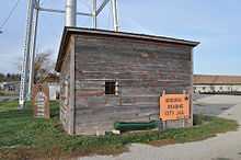
Bank / Post Office / Water Tower in 2009 (prior to tornado) | |
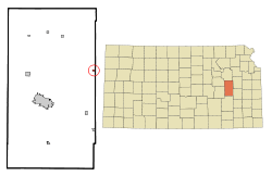 Location of Reading, Kansas | |
| Coordinates: 38°31′9″N 95°57′33″W / 38.51917°N 95.95917°WCoordinates: 38°31′9″N 95°57′33″W / 38.51917°N 95.95917°W | |
| Country | United States |
| State | Kansas |
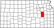
| County | Lyon |
| Platted | 1870 |
| Government[1] | |
| • Type | Mayor/Council |
| • Mayor | Kevin Sorensen |
| • City Clerk | Carol Ann Higgins |
| Area[2] | |
| • Total | 0.20 sq mi (0.52 km2) |
| • Land | 0.20 sq mi (0.52 km2) |
| • Water | 0 sq mi (0 km2) |
| Elevation | 1,099 ft (335 m) |
| Population (2010)[3] | |
| • Total | 231 |
| • Estimate (2012[4]) | 232 |
| • Density | 1,155.0/sq mi (445.9/km2) |
| Time zone | Central (CST) (UTC-6) |
| • Summer (DST) | CDT (UTC-5) |
| ZIP code | 66868 |
| Area code(s) | 620 |
| FIPS code | 20-58600[5] |
| GNIS feature ID | 0479585[6] |
Reading is a city in Lyon County, Kansas, United States. As of the 2010 census, the city population was 231.[7] It is part of the Emporia Micropolitan Statistical Area.
History
For millennia, the land that is currently Kansas was inhabited by Native Americans. In 1803, most of modern Kansas was secured by the United States as part of the Louisiana Purchase. In 1854, the Kansas Territory was organized. In 1861, Kansas became the 34th state.
In 1870, a tract of land on which Reading is now located was owned by McMann & Co of Reading, Pennsylvania. When the Atchison, Topeka and Santa Fe Railway railroad was built through the area, a town company for Reading was organized with James Fagan as president of it. A town site of sixty acres of Section 3, Township 18, Range 13, was laid off and called Reading, after Reading, Pennsylvania, and during the summer of 1870 the town site was laid off.[8]
The first post office in Reading was established in August 1870.[9]
Plymouth was incorporated as a city in September 1890.[10]
In 1996, the Atchison, Topeka and Santa Fe Railway railroad merged with Burlington Northern Railroad and was renamed to the current BNSF Railway. Most locals still refer to this railroad as the "Santa Fe".
May 2011 tornado
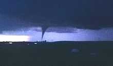
On May 21, 2011 around 9:15PM, an EF3 tornado hit Reading. It was three blocks wide and stayed on the ground for about four miles. The tornado destroyed at least 56 of 110 homes and 14 of 21 businesses. The post office and fire station suffered major damage. One person died and two were hospitalized. Early damage estimates topped $2.2 million.[11][12][13]
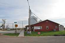
A little more than a year later, the community has pitched in with some help of the Federal Emergency Management Agency.[14] The grain elevator which was destroyed in the tornado has been rebuilt. Houses have been repaired, destroyed trees removed, and once again life in Reading has returned to normal, a quiet place to live.
Geography
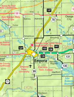
Reading is located at 38°31′09″N 95°57′33″W / 38.519102°N 95.959091°W (38.519102, -95.959091)[15] at the eastern edge of Lyon County. It lies half way between Emporia and Osage City along Highway 170. According to the United States Census Bureau, the city has a total area of 0.20 square miles (0.52 km2), all of it land.[2]
Climate
The climate in this area is characterized by hot, humid summers and generally mild to cool winters. According to the Köppen Climate Classification system, Reading has a humid subtropical climate, abbreviated "Cfa" on climate maps.[16]
Demographics
| Historical population | |||
|---|---|---|---|
| Census | Pop. | %± | |
| 1990 | 264 | — | |
| 2000 | 247 | −6.4% | |
| 2010 | 231 | −6.5% | |
| U.S. Decennial Census | |||
2010 census
As of the census[3] of 2010, there were 231 people, 86 households, and 62 families residing in the city. The population density was 1,155.0 inhabitants per square mile (445.9/km2). There were 103 housing units at an average density of 515.0 per square mile (198.8/km2). The racial makeup of the city was 100.0% White. Hispanic or Latino of any race were 3.9% of the population.
There were 86 households of which 46.5% had children under the age of 18 living with them, 52.3% were married couples living together, 12.8% had a female householder with no husband present, 7.0% had a male householder with no wife present, and 27.9% were non-families. 24.4% of all households were made up of individuals and 8.2% had someone living alone who was 65 years of age or older. The average household size was 2.69 and the average family size was 3.15.
The median age in the city was 32.9 years. 33.8% of residents were under the age of 18; 5.1% were between the ages of 18 and 24; 27.2% were from 25 to 44; 26.4% were from 45 to 64; and 7.4% were 65 years of age or older. The gender makeup of the city was 53.7% male and 46.3% female.
2000 census
As of the census[5] of 2000, there were 247 people, 92 households, and 63 families residing in the city. The population density was 1,185.3 people per square mile (454.1/km2). There were 108 housing units at an average density of 518.3 per square mile (198.6/km2). The racial makeup of the city was 97.98% White, 0.40% African American, and 1.62% from two or more races. Hispanic or Latino of any race were 1.62% of the population.
There were 92 households out of which 39.1% had children under the age of 18 living with them, 53.3% were married couples living together, 7.6% had a female householder with no husband present, and 31.5% were non-families. 26.1% of all households were made up of individuals and 9.8% had someone living alone who was 65 years of age or older. The average household size was 2.68 and the average family size was 3.29.
In the city the population was spread out with 33.2% under the age of 18, 6.5% from 18 to 24, 34.4% from 25 to 44, 16.6% from 45 to 64, and 9.3% who were 65 years of age or older. The median age was 32 years. For every 100 females there were 96.0 males. For every 100 females age 18 and over, there were 108.9 males.
The median income for a household in the city was $25,000, and the median income for a family was $29,500. Males had a median income of $18,750 versus $25,536 for females. The per capita income for the city was $11,673. About 15.6% of families and 13.3% of the population were below the poverty line, including 14.4% of those under the age of eighteen and none of those sixty five or over.
Government
The Reading government consists of a mayor and five council members. The council meets the first Thursday of each month at 7PM.[17]
- City Hall, 413 First Street.
- U.S. Post Office, 404 First Street.
- Kansas Department of Wildlife & Park, 2272 Road 250.
Education
Primary and secondary education
Reading is part of Unified School District 251.[18][19] The city has one school:
- Reading Elementary School, 424 First Street. The school provides a K-6 education.
Notable people
- Jim Barnett, unsuccessful 2006 Republican candidate for governor of Kansas, grew up on a farm near Reading and graduated from Reading High School.
- Robert D. "Bob" Price (1927–2004), U.S. Representative from the Texas Panhandle from 1967 to 1975, was born in Reading.
See also
References
- ↑ http://www.lkm.org/directory/cities.php?ID=151
- ↑ 2.0 2.1 "US Gazetteer files 2010". United States Census Bureau. Retrieved 2012-07-06.
- ↑ 3.0 3.1 "American FactFinder". United States Census Bureau. Retrieved 2012-07-06.
- ↑ "Population Estimates". United States Census Bureau. Retrieved 2013-05-29.
- ↑ 5.0 5.1 "American FactFinder". United States Census Bureau. Retrieved 2008-01-31.
- ↑ "US Board on Geographic Names". United States Geological Survey. 2007-10-25. Retrieved 2008-01-31.
- ↑ "2010 City Population and Housing Occupancy Status". U.S. Census Bureau. Retrieved November 27, 2011.
- ↑ History of the State of Kansas - Reading Early History; William G. Cutler; 1883.
- ↑ "Kansas Post Offices, 1828-1961". Kansas Historical Society. Retrieved 10 June 2014.
- ↑ French, Laura M. (1929). History of Emporia and Lyon County, Kansas. Heritage Books. p. 136.
- ↑ EF3 tornado kills one, causes extensive damage in Lyon County town; The Wichita Eagle; May 22, 2011.
- ↑ Reading reels after devastating storm; The Kansas City Star; May 22, 2011.
- ↑ http://cjonline.com/news/2011-05-23/kansas-officials-inspect-damage-reading
- ↑
- ↑ "US Gazetteer files: 2010, 2000, and 1990". United States Census Bureau. 2011-02-12. Retrieved 2011-04-23.
- ↑ Climate Summary for Reading, Kansas
- ↑ Reading - Directory of Public Officials
- ↑ USD 251
- ↑ Kansas School District Boundary Map
Further reading
- History of the State of Kansas; William G. Cutler; A.T. Andreas Publisher; 1883. (Online HTML eBook)
- Kansas : A Cyclopedia of State History, Embracing Events, Institutions, Industries, Counties, Cities, Towns, Prominent Persons, Etc; 3 Volumes; Frank W. Blackmar; Standard Publishing Co; 944 / 955 / 824 pages; 1912. (Volume1 - Download 54MB PDF eBook),(Volume2 - Download 53MB PDF eBook), (Volume3 - Download 33MB PDF eBook)
External links
| Wikimedia Commons has media related to Reading, Kansas. |
- City
- Schools
- USD 251, local school district
- Historical
- May 2011 Tornado
- Photos of tornado recovery, kansastravel.org
- Kansas officials inspect damage in Reading, The Topeka Capital-Journal
- 45 photos of Reading tornado damage, The Kansas City Star
- 50 photos of Reading tornado damage, The Wichita Eagle
- Numerous photos of Reading tornado damage, Flickr
- Video of Reading tornado seen from a TV tower, KSN
- Maps
- Reading City Map, KDOT
- Lyon County Map, KDOT
| |||||||||||||||||||||
