Rayak (Riyaq)
| Rayak North | |
|---|---|
 | |
 Shown within Lebanon | |
| Location | 500 metres (0.31 mi) north of Rayak, Lebanon |
| Coordinates | 33°51′00″N 36°01′01″E / 33.850°N 36.017°E |
| Type | Surface site |
| History | |
| Material | Alluvial soil |
| Periods | Shepherd Neolithic |
| Site notes | |
| Excavation dates | 1965 |
| Archaeologists | Lorraine Copeland, Frank Skeels |
| Public access | Yes |
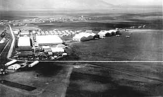
Riyaq (Arabic: رياق), also Rayak, is a Lebanese town in the Beqaa Mohafazat (Governorate), near the city of Zahlé. It has one military airport, an old train station on the former line from Beirut to Damascus, and a hospital. Riyaq Air Base was bombed by the Israeli Air Force during the 2006 Lebanon War. The landing strip was severely damaged as a result.[1]
General information
Altitude: 930 m
Latitude: 33.85
Longitude: 36
Latitude (DMS): 33° 51' 0 N
Longitude (DMS): 36° 0' 0 E
Area: 332 hectares
Location: 176 x 212 Zip Code: 51311
Population: 3,349
Number of Homes: 1,200
Companies: 18
Distances:
From Zahleh 11 km
From Beirut 60 km
Archaeology and history
Rayak North is a Shepherd Neolithic archaeological site located on either side of the main road, 500 metres (0.31 mi) north of Rayak. Flint tools were found there by Lorraine Copeland and Frank Skeels during a survey of 1965. Along with the Shepherd Neolithic series of blade-butts and end-scrapers, another series of large cores and flakes were found that Henri Fleisch considered similar to materials found at Serain and Fleywe that were of a confusing typology judged to be possibly Mousterian, Levalloiso-Mousterian or Heavy Neolithic.[2]
References
- ↑ Lebanon Rapid Environmental Assessment for Greening Recovery, Reconstruction And Reform, United Nations Development Programme report, 2007.
- ↑ L. Copeland; P. Wescombe (1966). Inventory of Stone-Age Sites in Lebanon: North, South and East-Central Lebanon, p. 51 & 52. Impr. Catholique. Retrieved 3 March 2011.
External links
| ||||||
| ||||||
| |||||||||||||
Coordinates: 33°51′04″N 35°59′17″E / 33.851°N 35.988°E