Ravansar
| Ravansar روانسر | |
|---|---|
| city | |
 Ravansar | |
| Coordinates: 34°42′55″N 46°39′12″E / 34.71528°N 46.65333°ECoordinates: 34°42′55″N 46°39′12″E / 34.71528°N 46.65333°E | |
| Country |
|
| Province | Kermanshah |
| County | Ravansar |
| Bakhsh | Central |
| Population (2006) | |
| • Total | 16,383 |
| Time zone | IRST (UTC+3:30) |
| • Summer (DST) | IRDT (UTC+4:30) |
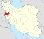
Ravansar (Persian: روانسر; also Romanized as Ravānsar; also known as Rawānsīr)[1] is a city in and the capital of Ravansar County, Kermanshah Province, Iran. At the 2006 census, its population was 16,383, in 3,838 families.[2]
Ravansar is an ancient city in the northwest of Kermanshah Province. Ravansar Spring is a huge karst spring located prominently in the city of Ravansar. The area around Ravansar is karstified, the karst ground water emerges in various springs like homonymous Ravansar Spring, which are very important for the supply of drinking water and as the main source of Qara Su River.
History
The earliest evidence for human occupation in the area dates back to Middle Paleolithic as it is indicated by stone artifacts that have been found at Kuliyan and Jawri caves. There are some archaeological mounds such as Tappa Mousaei (Jewish hill) and Tappa Khanileh.The most importqnt monument in Rawansar is Tagheh Farhad or Dekhmeh Rawansar which is a rock-cut tomb dating back to Achqemenid period and is about 2500 years old.The tomb is located at eastern face of a single rock called Qolla.
Description
It is located in the northwest of Kermanshah where people speak Sorani dialect of Kurdish. The town located at southern end of Shaho Mountain. Its natural landscape and cold water spring (سراب) are very famous. Ravansar is very important karstic area which supply drinking water by large and small springs.
Tourist attractions
Beautiful landscapes and natural ponds such as: Goni-Khani spring and Jawri pond and also the Achaemenid rock tomb of Qoleh and a large archaeological mound called Tappa Mousaeii(Jewish mound) .There are also a number of caves such as Mar Kuliyan and Jawri. The Ravansar and Garab Rivers cross the south and southwestern part of this area. The Hol Awar Mountains are in the north and Mazand is in south east of Ravansar. The presence of rivers, wetlands, mountains, vegetation and wildlife are among the natural and noticeable elements of this zone. Two mosques besides places of pilgrimage such as ‘Weis Qarani’, ‘Sheikh Rasool’, ‘Sheikh Nasra’ and ‘Baba Heiran’ have doubled the attractive of this area.
Northwest of Ravansar is Quri Qale Cave, one of the longest caves in western Asia. First explored in the 1950s, in 1989 it was further opened by an Iranian team. It contains three main chambers, with calcite crystals, stalactites and waterfalls. It is known for its colony of mouse ear bats, and for a number of archaeological finds, including silver plates dating from the late Sassanian period.
References
- ↑ Ravansar can be found at GEOnet Names Server, at this link, by opening the Advanced Search box, entering "-3080921" in the "Unique Feature Id" form, and clicking on "Search Database".
- ↑ "Census of the Islamic Republic of Iran, 1385 (2006)" (Excel). Islamic Republic of Iran. Archived from the original on 2011-11-11.
- Taheri, K (2000). Essays on the Archaeology, Geology, Geography, and Culture of Rawansar Area. Kermanshah: Taq-e Bostan Publications. ISBN 964-5551-79-X.
See also
- Dekhmeh Rawansar
- Khanileh
- Jaff tribe
- Ardalan
- Javanrud
- Paveh
| ||||||||||||||||||||||||||||||||||||||||||||||||||||||||||||||||||||||||||
