Rathkeale
| Rathkeale Ráth Caola | |
|---|---|
| Town | |
|
Rathkeale high street, with the former Central Cinema to right | |
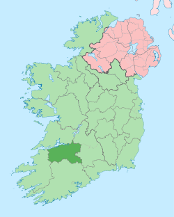
 Rathkeale Location in Ireland | |
| Coordinates: 52°31′00″N 8°56′00″W / 52.516667°N 8.933333°WCoordinates: 52°31′00″N 8°56′00″W / 52.516667°N 8.933333°W | |
| Country | Ireland |
| Province | Munster |
| County | County Limerick |
| Population (2011) | |
| • Urban | 1,550 |
| Irish Grid Reference | R360420 |

Rathkeale (Irish: Ráth Caola, meaning "Caola's ringfort") is a town in west County Limerick, Ireland. It is located 30 km (18 mi) southwest of Limerick city on the N21 road to Tralee, and lies on the River Deel. Rathkeale has a significant Irish Traveller population.
Rathkeale has shopping facilities, a museum and a community college (Coláiste na Trócaire, founded in 1995). The town has a large Roman Catholic parish church, Augustinian Abbey ruins and the Holy Trinity Church of Ireland church.
Places of interest
- On the southwestern edge of the town stands the 15th century tower house of Castle Matrix, formerly a property of an Earl of Desmond, which contains a display of art objects and holds historical records and is one of a series of significant Desmond properties in County Limerick (see also Adare, Askeaton and Newcastle West).
- Within the cemetery of Holy Trinity Church are many gravestones bearing names of Irish Palatine families. These families came from Germany as economic refugees in 1709. Many of their descendants now live in North America. See http://www.irishpalatines.org/about/landmarks.html
- Sean (Jackie) Finn of the IRA during the War of Independence was a native of Rathkeale. His grave located in the local graveyard features an impressive Celtic cross.
- Rathkeale's former railway station on the closed North Kerry railway line from Limerick to Tralee has been converted into the Irish Palatine Museum.
- It is well known from the Channel 4 television show Big Fat Gypsy Weddings.
Transport
Rathkeale railway station opened on 1 January 1867, closed for passenger traffic on 4 February 1963 and finally closed altogether on 2 December 1974.[1] The Great Southern Trail is a greenway rail trail which follows the route of the former Limerick-Tralee railway line between Rathkeale and Abbeyfeale.[2]
See also
References
- ↑ "Rathkeale station" (PDF). Railscot - Irish Railways. Retrieved 2007-11-23.
- ↑ "Home". Great Southern Trail. Retrieved 10 August 2011.
| Wikimedia Commons has media related to Rathkeale. |
External links
| ||||||||||||||||||||||||||
| ||||||||||||||||||||||||||||||||||||||||||||||||||||