Ratekau
| Ratekau | ||
|---|---|---|
| ||
 Ratekau | ||
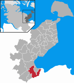
Location of Ratekau within Ostholstein district  | ||
| Coordinates: 53°57′N 10°44′E / 53.950°N 10.733°ECoordinates: 53°57′N 10°44′E / 53.950°N 10.733°E | ||
| Country | Germany | |
| State | Schleswig-Holstein | |
| District | Ostholstein | |
| Government | ||
| • Mayor | Thomas Keller | |
| Area | ||
| • Total | 59.6 km2 (23.0 sq mi) | |
| Population (2013-12-31)[1] | ||
| • Total | 15,132 | |
| • Density | 250/km2 (660/sq mi) | |
| Time zone | CET/CEST (UTC+1/+2) | |
| Postal codes | 23626 | |
| Dialling codes | 04504 (Sereetz: 0451) | |
| Vehicle registration | OH | |
| Website | www.ratekau.de | |
Ratekau is a municipality in the district of Ostholstein, in Schleswig-Holstein, Germany. It is situated approximately 10 km northeast of Lübeck.
It is the place where Blücher surrendered after the Battle of Lübeck in 1806.
The village ist best known for its well preserved fieldstone church St Vicelin of 1156.
References
- ↑ "Statistikamt Nord – Bevölkerung der Gemeinden in Schleswig-Holstein 4. Quartal 2013] (XLS-Datei) (Fortschreibung auf Basis des Zensus 2011)". Statistisches Amt für Hamburg und Schleswig-Holstein (in German). 25 July 2013.
